First Nor’Easter?
With the most recent early season snowfall wrapping up, we turn our eyes to see what’s next.
As discussed at length the northeast is currently in an active weather pattern more typical of early winter than early fall. A deep pool of cold air is getting ready to bed down over the NE in the wake of this latest system. It’s arrival will issue in some honestly chilly temps.
Along southern edge of this cold air a low pressure system will start to slide north east. By thursday morning a low pressure center will be weakeing just off the Carolinas with rain up into maryland. From this point the forecast starts to get a bit tricky.
A few days agot the models showed a more powerful low developeing off the coast and riding north, past the jersey coast and getting picked up by upper level features and shooting off into the Gulf of Maine. Based on this track, and the cold air in place, locations in the Catskills, and even the Poconos above 1500 ft/2000ft would see some snow. With the Catskills even having the potential to see a few inches of snow.
However, as was the case many times last year, these big below average cold air blocks have a tendency to send storms along their southern edge and too far out to sea to affect ski country. As the the week has progressed models have continually trended towards a “suppressed” solution.
My two cents: This bears watching for the simple reason that there are going to be features induced by this coastal storm which the models aren’t picking up on right now. If the storm even comes close to the coast, with the cold temps in place, any moisture thrown back will for sure fall as snow across the higher terrain and at this time of year- even a few measly tenths of an inch of QPF can get the winter feeling we’re all looking for if it falls as white flakes.
I’ll keep you updated!
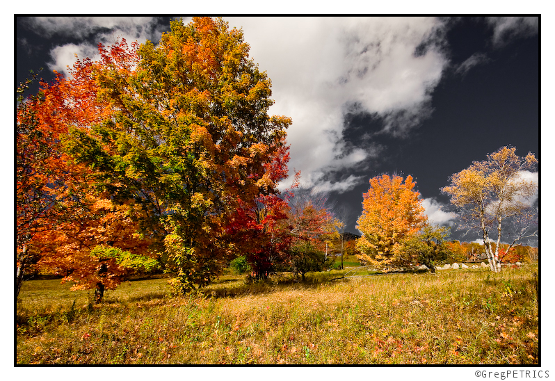
As you can see, the foliage in North-Central Vermont is peak-to-past-peak:

Click for a larger view
Continue reading Foliage Report
Update: Snow Monday Night into Tuesday Morning: Maps
Last week teleconnection data indicated that conditions would be ripe between the 13 and 15th for a storm to develop on the eastern seabord. There was forecasted to be a strong dip in the Northern Branch of the jet stream, allowing cold air to spill into the plains, a Negative NAO blocking and feeding cool air into any developing cyclone and a weakened pacific jet influence.
Come this weekend – we can tick all those factors off.
There was a very large buckle in jet (see coors field last night), there is a negative NAO and weak pacific jet. Ergo, we should expect to see some cyclogensis on the east coast in the near term.
Continue reading Update: Snow Monday Night into Tuesday Morning: Maps
Snow Accumulations Expected Monday Night and Tuesday Across the Higher Elevations of the Adirondacks, Greens, and Whites
The weather pattern for this second week in October is looking more and more like what we might expect around Thanksgiving. A very chilly airmass has been building in Canada over the last week or so and with a –NAO in place, that airmass is taking aim at the Great Lakes region and Northeast U.S. this week. Look for below normal temperatures and with these cold temperatures we have two legit snow threats for the mountains, the first on Monday Night and Tuesday and the second coming late in the week. For this post I’m going to focus on the first event on Monday Night and Tuesday where I expect a 3-6” snowfall above 2,500ft with 1-3” between 1,500-2,500ft in Green Mountains from Sugarbush/MRG northward, and in the northern Whites (Cannon, Bretton Woods, Wildcat). Across the Adirondacks where colder temperatures but less precipitation are expected, look for 2-4” of snow above 2,000ft with a coating to 2” above 1,000ft. This will be both a latitude and elevation dependent storm.
Continue reading Snow Accumulations Expected Monday Night and Tuesday Across the Higher Elevations of the Adirondacks, Greens, and Whites
The BEST East Coast ski movie this year. Our friend Chris Nelson put this together, oh yeah and we’re in it…..
Local Routes from Chris Nelson on Vimeo.
A big thanks to Chris for putting this together, he did great work editing this year, and it’s being well received across the internet:
See here for some folks’ opinions and also check out here.
Chris’s homepage is here he’s got a bunch more footage and some great stills as well, check it out!


