Redesigned Weather Page
We redesigned the weather page, and want your opinions. Please take a look and then send us a comment. We hope you find it useful!
Quick peak ahead to the first cold night!
After sweating my balls off the last few days- honestly I’m down to two now- I figured that you all were interested in a little taste of fall. Well it’s coming.
As the week ends, Bill (the hurricane), will pull off the coast of maine and help to spur a cold front through the north country. Behind that cold front will be some cooler air. Now it will not all come rushing in at once but will seep in over a period of a few days as a cool bubble looks to settle in. Depending on which model you look at the coolest weather will come between monday and friday of next week. Regardless of when it comes I would expect to see a day where temps struggle to reach sixty in the ADK, Greens and Whites. While this isn’t unheard of, ( its actually pretty common in late August) it’s always nice to get a little reminder that fall is on the way and you will not always be sweating into your ass crack on your way to work.
Check out one Model’s output for temps…
SARANAC LAKE
KSLK GFSX MOS GUIDANCE 8/18/2009 1200 UTC
FHR 24 36| 48 60| 72 84| 96 108|120 132|144 156|168
WED 19| THU 20| FRI 21| SAT 22| SUN 23| MON 24| TUE 25|WED CLIMO
N/X 59 80| 43 79| 64 84| 62 72| 51 71| 51 72| 49 66| 46 50 74
TMP 65 68| 54 71| 69 73| 65 62| 57 61| 57 62| 55 58| 52
That’s 58 a for a high at the end of next weekend!…BRRR…
MOUNT WASHINGTON
KMWN GFSX MOS GUIDANCE 8/18/2009 1200 UTC
WED 19| THU 20| FRI 21| SAT 22| SUN 23| MON 24| TUE 25|WED
CLIMO
N/X 52 58| 48 59| 54 63| 54 60| 47 56| 44 49| 38 48| 38 48 66
TMP 54 53| 51 56| 57 59| 56 55| 49 51| 46 43| 41 43| 41
Similarly- 40’s for high on Mount Washington…that’s cool!
Now, another little tidbit is that on any of the above nights, if we can get a clear sky and light winds these areas will see very strong radiational cooling and I would not be surprised to see the first freeze above 3000ft occur within this period.
Going to make a quick edit here…front slowed down quite a bit. Don’t expect those first cold nights until next weekend Thurs/Fri/Sat timeframe…
Warming Up for Cooler Times
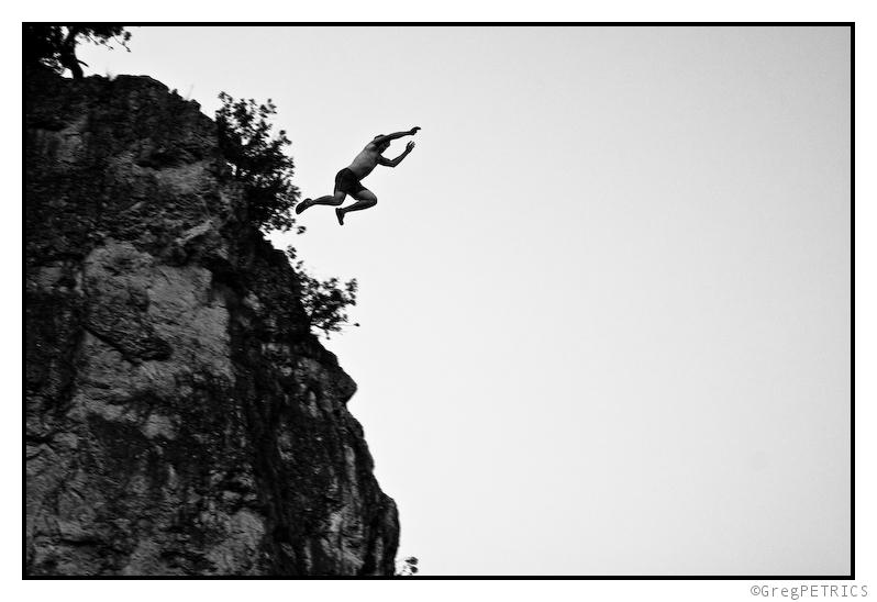
Did some jumping off heights into water recently to get accustomed to that feeling again.
Here’s a shot from near Burlington.

I’ll look for some “WTF shots” in the next few days. I don’t want to put Sam to shame too hard, so I won’t really put much effort into this one.
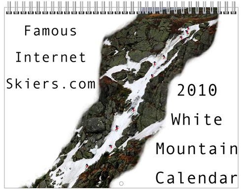
New Calendars are Here!
Just wanted to let everyone know that we got the new calendars in recently and they’re available for sale and quick shipment now. These are DIFFERENT than the old ski season calendars because they run from January 2010 to December 2010. We also have them in a Green Mountain and White Mountain edition. They are printed on premium heavy card stock paper, and feature striking images of action sports in the mountains of VT and NH.
Hopefully this is the hottest day of the summer….

08-09 POV Highlights/Trailer
Well here it is, A highlight reel from the 2008-2009 season. 90 days of skiing and dozens of hours of footage edited down to 4 minutes. It will not only change your life but if you have an incurable disease it will cure it, then infect you with a lust for powder, cliffs, trees, and steeps. I’ll call it a trailer because I am still planning on editing up a longer version with some more in depth footage and lots more integrated photography to be ready in the fall when we all need it the most.
Enjoy!


