January Thaw
The “January Thaw” is coming to stores near you this weekend.
Since December 19 it has been unmitigated winter in the northeast. After a rainy Friday in December, the faceshot machine turned on, VTAH stopped over, the woods opened up, a nor’easter rolled in and and the bottom of the thermometer dropped out and then we had a series of little waves of joy to finish off the party.
Starting Thursday evening however that pattern looks to break. But first we have one more wave of joy. As it stands now a low pressure system will skirt to our north wednesday night. It will push a weak front across the mountains of NY and VT. That front will spark snow across the higher terrain. A few days ago this event wasn’t looking too robust..if it existed at all on the models. However, the latest models are much more interesting. Instead of just a dusting of snow, the higher resolution models are showing something like 2-4″+ of snow. Based on the overall pattern we’ve been in, I support those higher totals particularly up around Jay Peak which has been the real prime spot for these waves of joy.
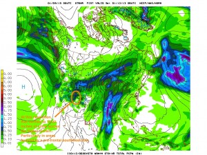
Following that, a ridge will build in to the east coast as the downstream counterpoint to a major trough moving into the west coast. This pattern will center the core of cold air into the intermountain west of the United States. Sorta like this:
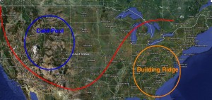
The edge of that cold high will create a frontal zone just along the Ohio valley. From Friday through Wednesday, a number of waves will ripple along that boundary. Given that we’ll be on the “warm” side of this baroclinic zone, we’ll see mostly light rain from these weak lows.
The first of these waves will move in Friday bringing some rain to the Northeast, with a break on Saturday into sunday, and then another wave Sunday-Monday, and a last one Tuesday-Wednesday that likely finishes with snow and a pattern change. None of these waves looks like a major rain maker, but each will induce a few showers, some briefly heavy, over the 5 day period.
Now, following this period, it looks COLD. VERY cold in fact. All major models are showing the development of a cold active pattern with summit temps in the -30c range and steady weak low pressure systems moving through the region. With the AO set to tank and the PNA set to return to a positive phase, this has support from key teleconnections. So don’t despair, winter looks poised for a return shortly.
The flip side of this pattern reversal will be snow out west. As the trough moves into the west it will spark snow across the intermountain west. In Utah the front and the following unstable low looks to produce something in the realm of 1-2 feet of new snow from later afternoon Thursday into Saturday.
Piste and Quiet
Backcountry skiing is so 2012. It’s no longer cool to ski in the backcountry. It’s become overrun and crowded. So much so in fact, that the pistes have become empty. Indeed, this is 2013 bro; the new cool thing to schuss is piste. Now that everyone has gone into the woods, they all forgot that there is snow on the trails too!
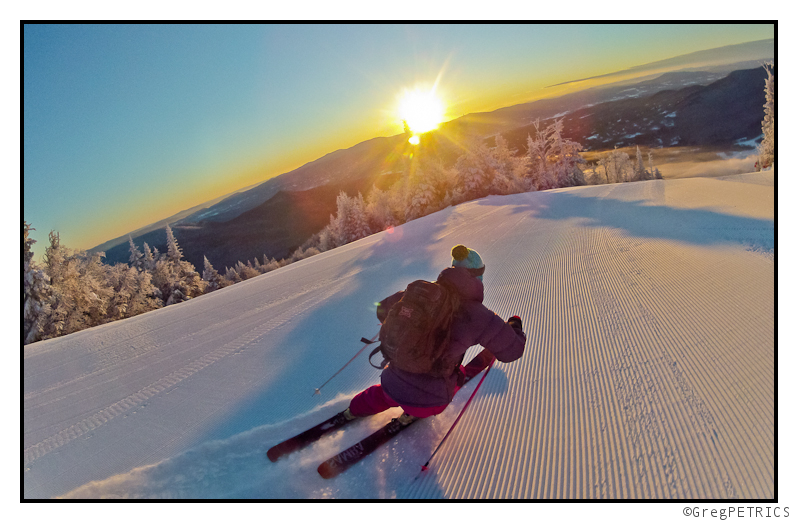
And who says there’s no adventure on the piste? Sometimes the run will just drop off into the abyss! (or is that the “a-piste”?)
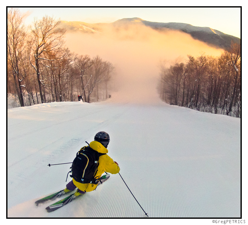
Also, unlike the backcountry, the pistes have magnificent views from top to bottom!
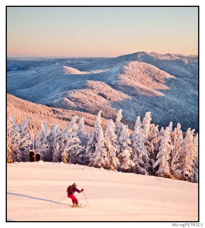
And finally, who says there’s no powder snow on the piste? That’s so false it’s funny! Not only is there powder snow, but they have special machines that MAKE THE POWDER SNOW! And when the temp is in the negative teens the machines make the snow so fast your tracks are covered before you even make them!
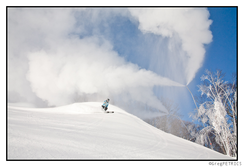
OK OK. I realize that last sentance didn’t make any sense, but whatever; in 2013 the piste is cool again. GIT SUM!
Little waves of joy to begin the New Year
What a stretch it has been! 2012 has certainly closed with a bang in the Northeast….err…rather a “POW!” Since it rained on 12/19 it hasn’t stopped snowing! High five.
As we roll into 2013 it looks like that snowy pattern will continue.
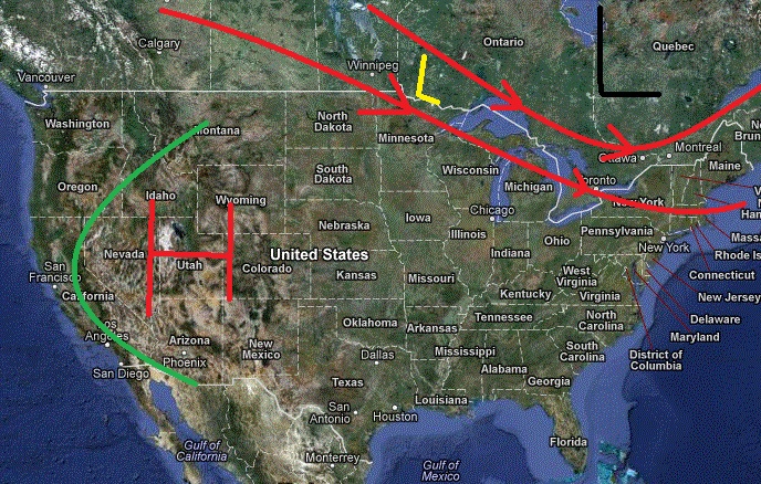
The overall pattern across the country is pretty clear right now:
Large scale high pressure out west (red H) is driving energy up into Canada. (green line is flow around high) To our north a quasi stationary vortex has set up over N/E Canada. That’s pumping cold air from the north into our region. Combined these two features create a flow that directs energy from central canada right through our region. (Marked as red lines with arrows, representative L is in yellow)
Given the source region (Canada) for these lows, and the limited interaction with southern moisture the waves tend to be rather weak and moisture starved.
They do however tend to be pretty cold. With the base we have down, that’s perfect.
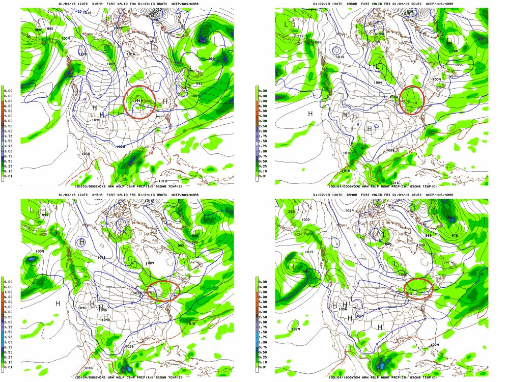
The first of these events will unfold thursday into friday morning. All the major models agree that a weak low will move over the Great Lakes during the day on thursday, pick up some moisture, and roll into the ADK and VT Thursday night. Here is an annotated NAM view to give you an idea of the path. (See how it follows the above pattern pretty much spot on?)
Snow should break out around midnight and run through late morning Friday. With temps in the teens this wave should produce 2-6 inches of fluffy cold snow across the ADK, and Greens. It will have less of an impact downstream from the greens (in NH and Maine). One, the storm moisture will be squeeze out by then, and two because the low looks to track north of NH and Maine, limiting the best dynamics there.
The next event will be a cold front dropping in from the north later in the day Friday into Saturday. Just to our north, a low pressure system will develop (and some VERY cold air) will rotate around in a broad cyclonic flow. The cold front associated with this low will drop into our region. As it does it will spark snow showers across the Mtns. Again we’re talking limited strength and moisture but there are certainly enough dynamics to support 2-4 more inches of snow. Again, this may impact NY and VT more than NH and Maine. As of Thursday AM, the best snow looks to fall from around Sutton down south thru Jay and those mtns ’round there.
Lastly, it seems some warm air advection snows could develop on sunday. As a cold high pressure departs our region and another high builds in to our west, the flow of air will turn southwesterly. That will bring some warmer, moisture air into the forecast area. The warm air will rise over the cold air and cool, losing it’s moisture as snow in the process. This looks to be the lightest of all the events. I’d say a trace to 2 inches are possible from this event. Though these WAA snows can be sneaky.
Entering next week I think we see the pattern relax, though only after another cold front crosses the region (1-3″) on tuesday. Major models all show a ridge of high pressure developing across the N/E mid-next week. This will bring temps above normal for a few days in advance of a potentially strong storm for that weekend.
The flip side to this active pattern out east, is clear, high pressure out west. Nothing complicated here. Big dome of high pressure is going to move into the intermountain west. Inversions will become pretty narsty by next week. So climb out of the cold, smoggy, valleys and enjoy some brilliant January sun. By day 10, it will break and we’ll get back to the pows.
TR: Schuss Forest; Schuss!!
When the blackout dates arrive for season-pass holders, that can only mean one thing: it’s time to schuss forest (if it’s ready). Looking to avoid some crowds, and check out some new zones we have had our eye on for a few years, we grabbed our GPS, and headed off into the woods. All involved were happy to schwack their way into some new territory and hopefully schuss forest; schuss!
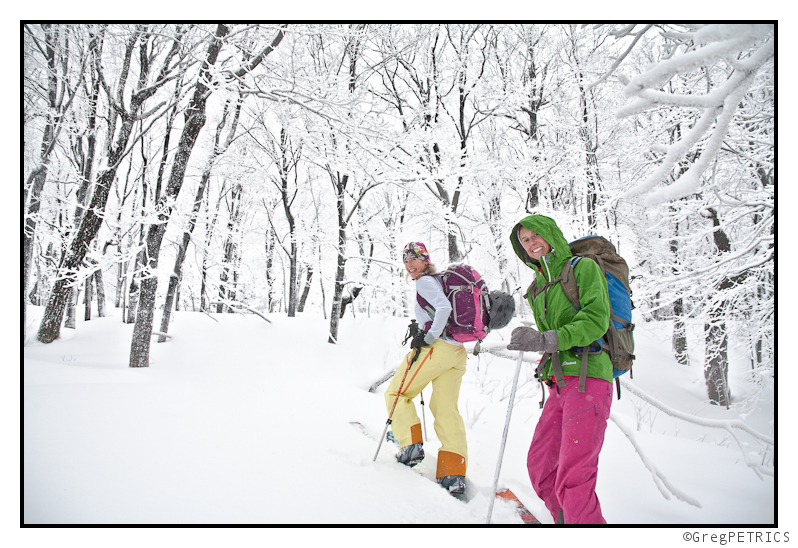
Click the picture or here to read Schuss Forest; Schuss!!
It Gonna Snow (and keep snowing…and keep snowing…Friday Update)
Well that was nice….looks like more is on the way
Tomorrow, a wave of low pressure is going to develop to our southeast. It will move up the coast and stay to our southeast. It isn’t going to be as potent as the previous storm though. As the upper trough swings through on saturday it should push some light precip into the region. 2-4 inch type stuff beginning later saturday afternoon.
Then in the wake of the system- well as part of the system rotating into nova scotia – a nothwest flow will develop at the same time cold upper air moves in. This will spark orographic precip along the Spine and the Northern ADK. The flow looks blocked a bit and its possible the best snow will be confined to the western slopes of the spine. However with any northwest wind wind transport will move a bunch of that snow up and over the spine anywhere lacking trees.
Overall I think we’re looking at weekend totals in the ADK and VT in the 4-8 range (of pretty fluffy snow).
So yea…it’s going to keep snowing.
Long term it’s looking cold and active.
Nice!!
End Update
Here is the forecast:
SNOW.
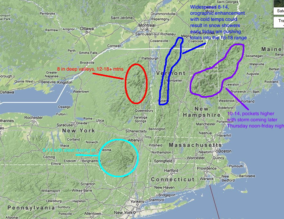
Totals thru Friday 12/28/12
In the meantime, why not enjoy some FIS stoke from the nights before Christmas
THURSDAY 10:00 AM UPDATE
First- I’d like to note that I’ve bolded the dates for which this map applies. Some of you- esp. those along the eastern side of the Spine of VT might think this storm is a little juuuxt. It’s not your time yet.
Currently the storm center is to our southeast with a center of low pressure right around Montauk point (a PRIMO Location). That is giving our winds a strong easterly component right now. With that east wind, areas on the east side of the Spine will see less then perfect snow conditions. Areas west of the spine on the other hand will see GREAT snow making conditions. Also, given the location of the low, the prime dynamics (locations of deformation zones/confluence of the triple jet structure/frontogenesis…yada yada yada) for heavy synoptic snow will be over the ADK. Another 10-14 inches+ are possible in the High Peaks over the next 24hrs with storm totals of 18-30 inches likely.
Now the tricky part comes along the Green Spine. At some point this afternoon the winds will shift around to the North and then Northwest. At the same time significantly colder air will move in aloft. This combined with lingering low level moisture should spart robust upslope snow showers. If the numbers are to be believed we’ll see upwards of 6-8 inches of pretty fluffy champlain dust once the winds shift around. So depending on how that segment of the storm plays out, the Spine could do VERY WELL. Nothing beats an chasing down a pint of dense storm snow with a shot of 4% fluff. Still watching this closely however. Some model skew-ts show a slight capping inversion which may inhibit the orographic uplift.
So yea…that’s the update for now. I’ll try to take a closer look at the Whites and Maine later. Though based on how this is going I think a widespread 10-18 is a reasonable forecast.


