Wasatch Weather: March Madness Begins Sunday
Actually it doesn’t. But old man Ullr (PRAISE!) doesn’t care. He’s ready now for the drama, the excitement, the passion and the heartbreak that only March can bring. So what’s he to do? How about conjur up a doozy of storm for the Wasatch. That’s what.
Starting sunday and exploding monday night into tuesday, night a deep cold northern pacific storm will swing into the beehive state and take dead aim at the Wasatch. With plenty of moisture, extremely favorable conditions for orographic enhancement and sufficient duration, this looks like it’s going to be a very impressive storm.
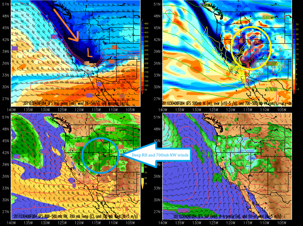
Below, we see the cold 500 mb outline of the system as it dives S/E out of the Pacific N/W coast heading towards Utah. 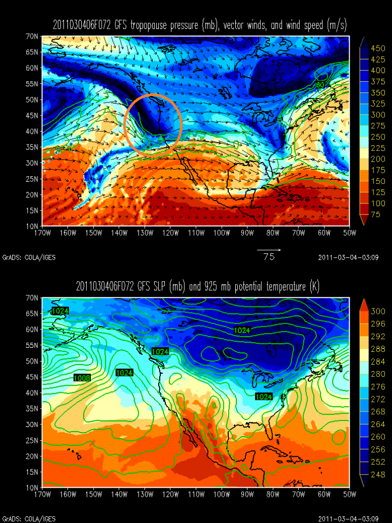
Zooming in as the storm rounds into the beehive state shows just how dead -on this will be.
In the upper left you see the track of the storm and location at the given hour. In the upper right I’ve circled the strong model predicted upward motion. Bottom left shows saturation at 700mb (wasatch elevation) and NW winds. VERY KEY.
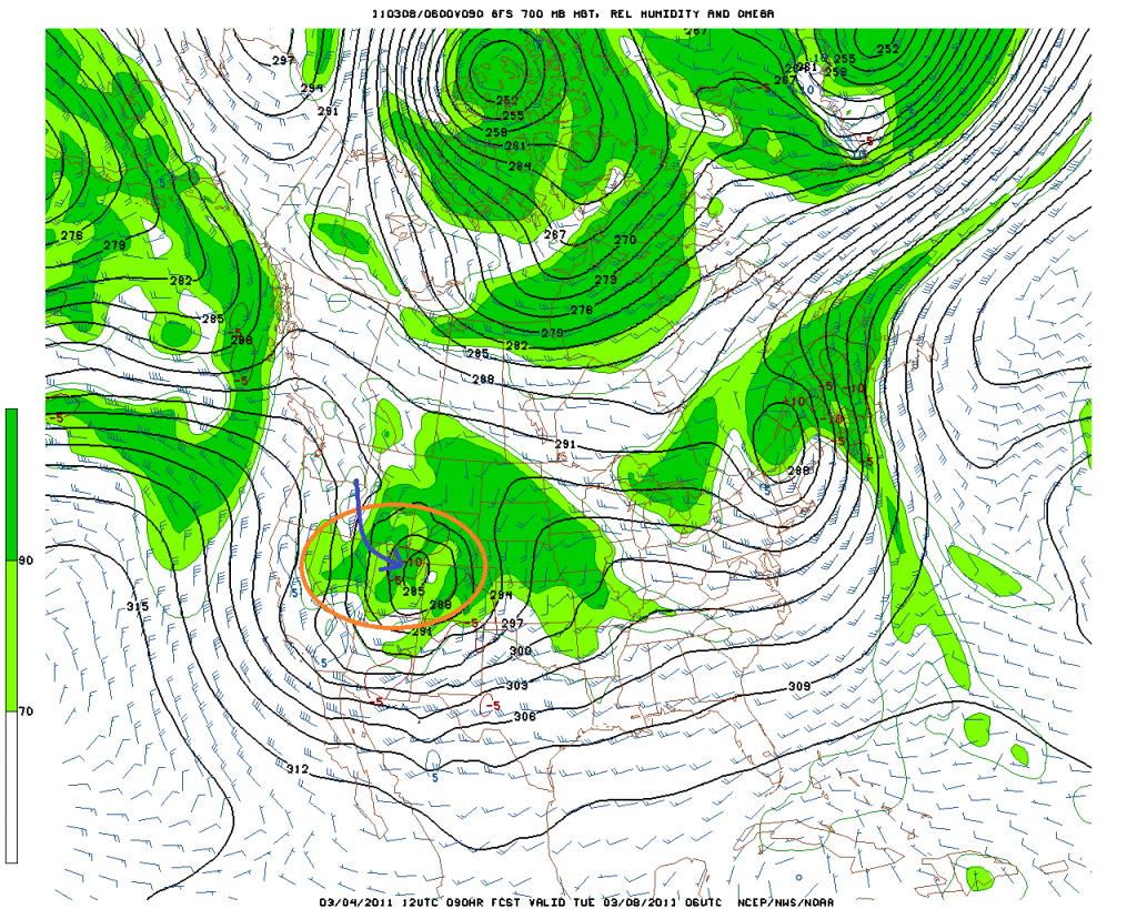
Moving on, lets look some more at the 700mb heights and moisture:
I’ve drawn in the winds in blue to underscore the fact that I think a substantial element of the forecasted heavy snow will be the result of orographic enhancement. To achieve that, we need NW winds to run smack dab ino the 3-4k vertical relief of the Wasatch and funnel up the box canyons.
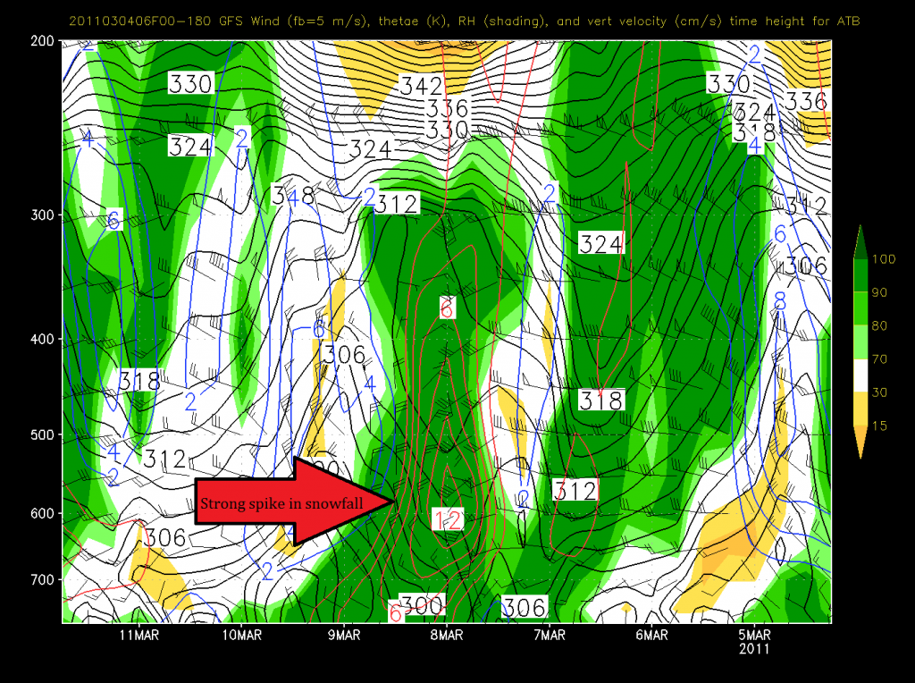
Looking at the time-height series to get a sense of the vertical motion does nothing to un-excite me.
GFS:
Red circles indicate predicted speed of upward motion. Here the max upward motion occurs with the passage of the storms cold front (look at thewind shift) and remains robust for 12 hours afterwards due to orographic lift. Awesome.
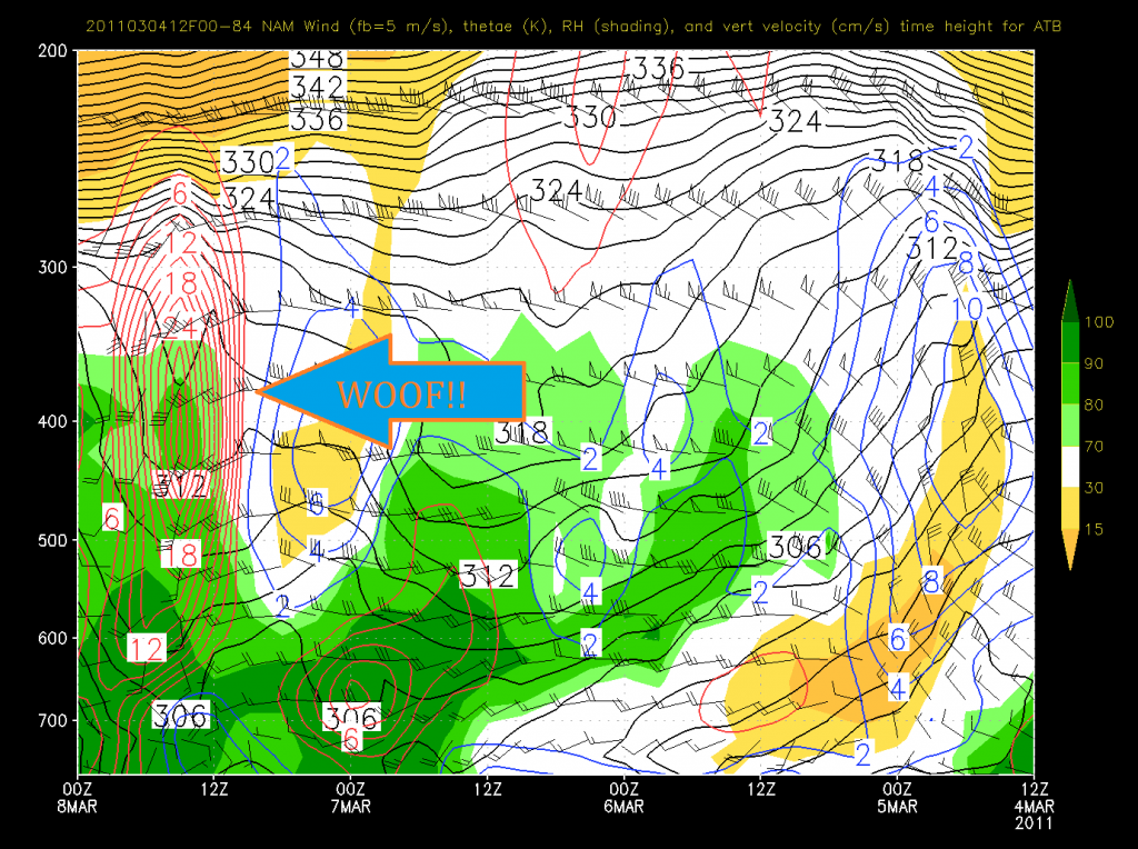
NAM:
Now that’s just absurd. That much high altitude lift is not going to happen. Regardless, the NAM is clearly saying- Wax that fatties….something big is coming.
Now what does this add up too?
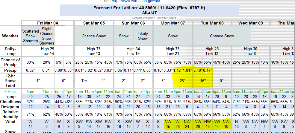
The NWS computer basically blew it’s load this morning answer this question:
Crazy right? Well yes. But only a little bit. Given how this storm is coming in I’d not be surprised if the high cottonwoods saw 36 inches in 24-36 hours. That’s very doable with the winds, moisture and storm track.
Video: The Elusive Powder Kiwi
![]()
Here in the PNW part of the world it has been dumping. It just refuses to stop snowing. There has been 4-8 feet of snow in this system so far and there is snow forecasted through Saturday. The cooler temps we have been having lately have really allowed us to take advantage of the La Nina moisture. Our friend James is visiting from New Zealand, he nailed the timing as his first day here was the first day of the storm. If it keeps snowing like this INS will probably have to track him down and deport him to get him to go home.
TR: Cold Town, Winter in the City
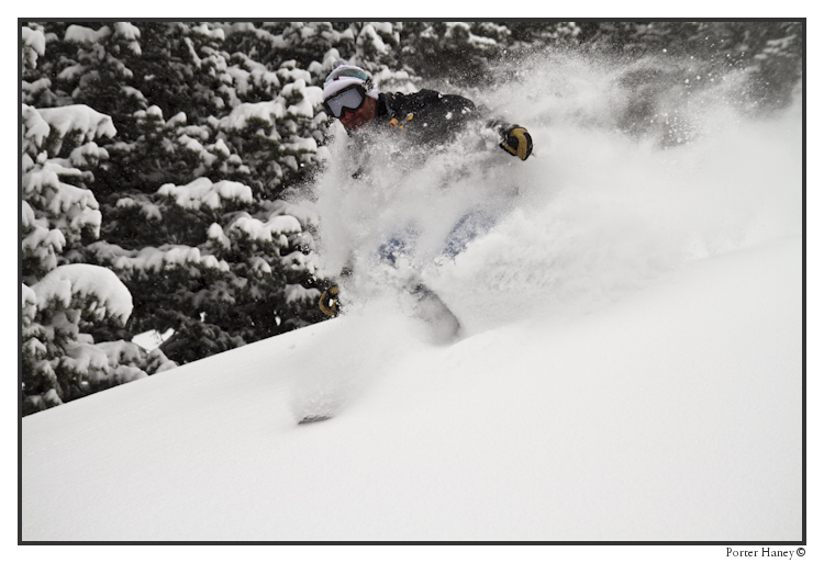
Utah, Vermont, and everywhere in between was slated to get POW’d upon this weekend. L_H had it nailed in the forecast – Utah was replete with waist, to chest, to face deep powder.
Click the image, or CLICK HERE to read more.
That’s More Like It! Part 1: High Elevation
For one and a half months, skiing on the east coast has felt–well–not a whole lot like skiing on the east coast. Every day was low hanging fruit as winter weather went uninterrupted for over 45 days. Objectives we’ve had our eye on for a while finally were ready. Storied ski descents we’ve pined for finally got hit. That’s over now. Now we’re back to the usual. Now we’re back to east coast skiing. As I posted about last week, we had a vicious crust, and a little dust. This past weekend we still had a vicious crust (in places at least), but A LOT more dust. East-Coast skiers that some of us are, we went out to see what we could find. We figured we might as well go get that dust right when the sun comes up! Why not?
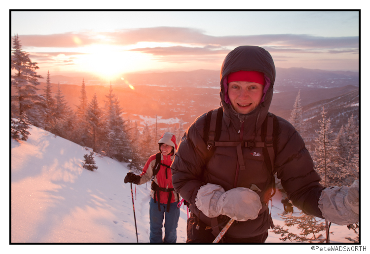
Once we got to the summit, yours truly headed out to find a perch to get some photos from.
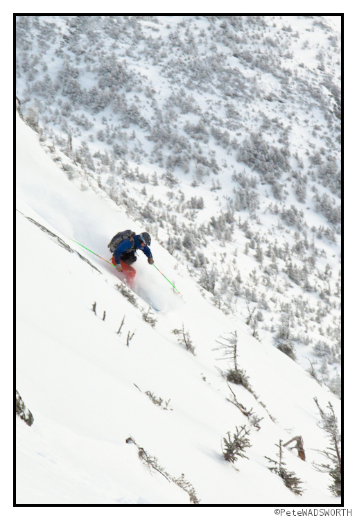
I enjoyed watching my friends make some turns down the untracked dust collector! As Bill demonstrates, the dust was very deep this weekend! Go Bill! Too bad both my fingers (I’ve only got two) and my battery froze after this shot!
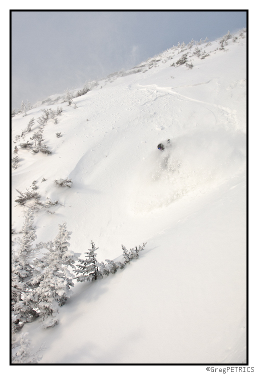
After blowing on batteries and fingers for a few seconds I got the camera back to life. I can’t say the same for my fingers. I shouted up to friend of FIS, Pete Wadsworth, to descend. Pete enjoyed a few turns, and simultaneously broke a long running tradition of painful days in the backcountry the two of us have going, and we finally enjoyed some type-1 fun. At least I think we did. I had fun! He did mention something about frostbite… ;)
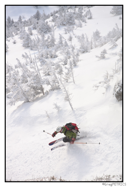
If he didn’t have any fun in the previous picture, I’m pretty sure he was enjoying himself here:
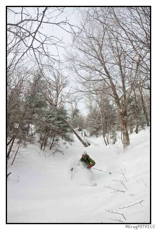
Careful out there though folks… a weather warm-up followed by a freeze followed by a heavy falling of snow spells: avalanche. Well it doesn’t actually spell it. Duh. You know what I mean though.
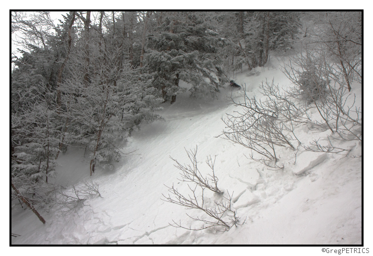
Check back later for Part 2: Low Elevation. Thanks for reading FIS! Pick up some avalanche supplies to be ready for spring shred!
Wasatch Weather: Another Major Storm on the Way (UPDATED…Possible WTF))
2/26/11 – HOLY SH*T update
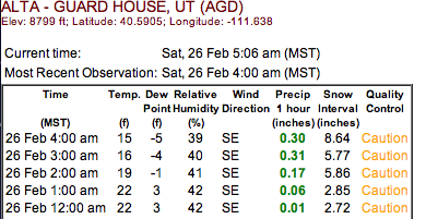
Look…either the collins plot is messed up or something seriously magical just went down up at Alta.
What am I talking about? Well look at these precip totals for the last two hours:
.6 inches of precip in the last 2 hours? Wozers. That’s impressive. Somebody needs to go find out if this is true.
2/25/11 UPDATE
With all the talk about the bus taking us to pow town in the east, we can’t lose sight of the fact that the Cottonwoods are already there! Snow should be breaking out early this morning as the trough digs into the west. Once it breaks out it will remain steady throughout the day with total daytime accumulations (i.e. from now until 5pm UT time) reaching a foot. Overnight the snow will continue as a cold front moves through. Another 12 inches are likely from 5pm UT time until lift start saturday morning. A secondary wave will push into the region tomorrow spiking snowfall again and putting out another 6-8 inches. Storm totals of 24-36 inches look reasonable in the high cottonwoods. Yay.
Original post:
Last week we discussed how a distinct pattern change was going to bring substantial snows back to the Wasatch. I’d say it did – to the tune of roughly 50 inches in four days. Awesome. Here’s the thing about pattern changes in UT- when the hose turns on- it doesn’t turn right off. So as we head into the later half of this week and weekend, we’re under the gun for another major storm system.
Essentially, a deep and cold Canadian storm will drop out of the Pacific Northwest, dig deep around the coast, and swing inland over the Great Basin. As it does it will first bring heavy snows on a sw flow then as it swings in and punches a cold front through snowfall rates will spike. In it’s wake, a sustained period of moist unstable nw flow will prevail keeping the snowfall going.
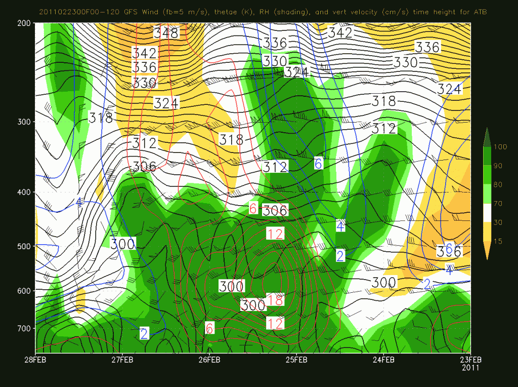
So what does this mean…well first- look at the big ass sustained period of upward motion in a saturated environment:
That’s good for snows for sure and overall we should expect to see 20-30 inches plus in the high Cottonwoods.


