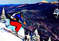
SPAM #14: Carnival Ride
With Part I of our Winter Carnival–the Unconventional Terrain Event–in the books, and Part II coming soon, here’s a quick SPAM entry from the ski mountaineering descent Ben and I made. As detailed in the TR, as we approached the rap station, we had to cross a snowfield hanging above ice cliff in almost every direction. We debated the option of simply sidestepping down in order to minimize risk, but Ben decided he wanted to snag a few carnival ride turns in this improbable location. Here are two of them. This is probably one of the simplest SPAM entries I’ve done, but I think it works.
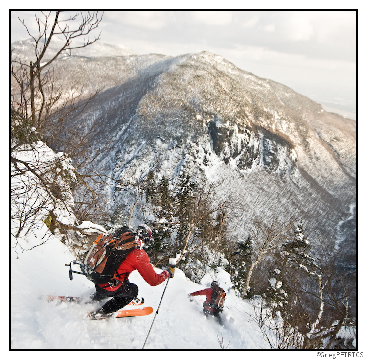
As a special bonus, here’s a second SPAM shot. Again, this isn’t that complex of a SPAM, but it is a stitch of several photos. The location is the top of the snow gully in the TR, just after we got off rappel and were preparing to ski. Although the pictures from the TR I think do a good job of depicting the steepness, none of them were quite able to capture just how “inside” the mountain we were at this point. To try to get a sense of the surroundings, I took several photos from low to high capturing over 180 ° of vertical field of view. I then aligned and stitched them together using Hugin. I think the result is spooky.
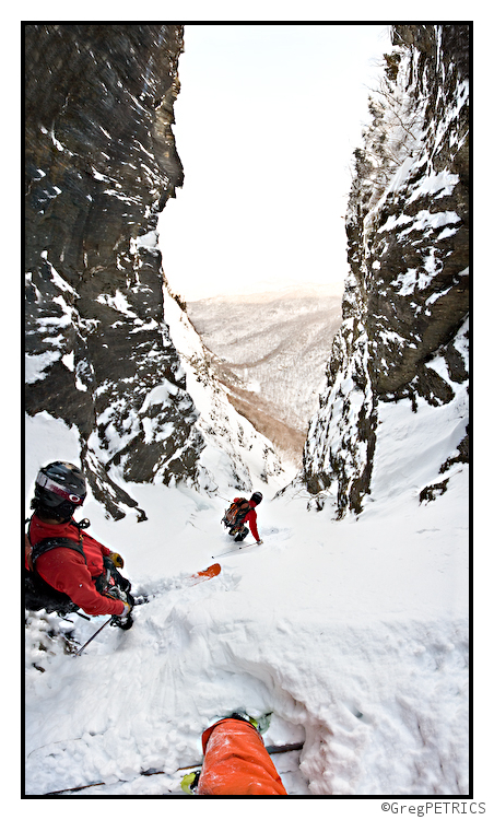
Thanks for checking out the SPAM Series of FIS. If you haven’t done so already, may we suggest you check out the full TR?

TR: The (Other) Winter Carnival — Part I
After last Wednesday’s storm, Ben and I happily noticed that a certain line high in a mountain pass of Vermont which we had had our eye on for several years was receiving copious wind loading, and might almost be ready to go. Tracing its way down off the ridge, from high to low the line includes all the types of skiing that Vermont has to offer: a dense “bushwhacky” orienteering challenge; several tongues of snow hanging precipitously above sheer ice cliffs; a rappel over a chaussy mixed climbing route; ski chuting ice flows pinned between rock walls barely wide enough to fit ones shoulders through; thrilling powder turns hanging between mandatory technical ski maneuvers; a 15 foot mandatory boulder huck to an “eagle-eye” landing adjacent to a cliff wall; wide open alpine powder skiing; and finally a perfectly nestled window in the forest in which to make a few glorious turns. Want more? There’s a full Trip Report on the other side of this picture:
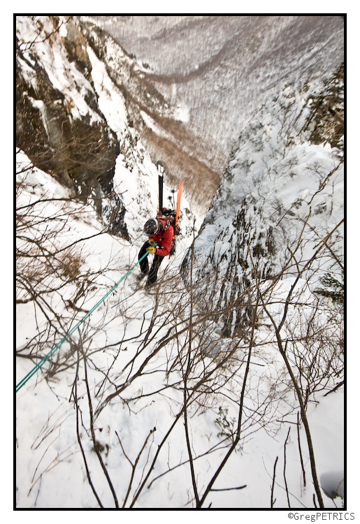
Click the picture or here to read The (Other) Winter Carnival — Part I
Quick Update: Strip of 7-10 inches likely across much of Vermont.
I tweeted about this storm a few days ago. I wrote then :@FISWX I’m sniffing out ANOTHER storm for the wknd. Track issues but confidence is up that strip of 8-10 possible thru NY and VT sat to sun.” While I mentioned that the models were having a hard time with the system as it was originating from the gulf, I warned you all to stay tuned. Well this is why.
At this time many of the american models have come into some agreement. As per my earlier thinking this storm should bring solid 7-11 inches of heavier snow (thermal profiles suggest as such) across much of vermont. Northern New Hampshire will see similar totals. ADKs will see 5-10 inches of snow from this system.
Utah: Winter Returns on a NW Flow
I know it has been a tough month for LCC. A sloppy rainy once in 30 year storm over MLK day turned parts of LCC into the Adirondacks. And since there isn’t an edge grinder within 900 miles of Alta, the locals weren’t happy. However, after 36 inches of mixed density snow in the last two weeks, if you tucked the wha-mbulance away in the garage you could find some mighty decent skiing.
And it should only get better. Beginning this weekend, a high pressure off the coast, and digging troughs in the central US will conspire to funnel a moisture stream right down into Utah from the NW. Yay. Lets go in depth.
First, a high pressure parked off the Cali coast will drift to the west. This will move the mean flow of air around the high westward as well. At the same time a long wave trough will deepen in the central states. This will create a conveyor belt of air between these two systems that will ride down from the NW right over the Wasatch. (Good). shortwave impulses of energy of moderate intensity will round the high and dive s/e on this conveyor belt of air. A steady stream of moisture off the ocean should also be established with this pattern. (Good). Essentially then, these shortwaves will work to spike atm dynamics in a moist environment and spark steady snowfall for the next 5 days.
With this pattern established we can take a look at the time/height maps showing air saturation and upward vertical motion. Why is this important? Well because studies have shown that for little cottonwood canyon, storm duration and upward vertical motion are possibly the most vital elements in getting big dumps. (and here you thought it was taco bell).
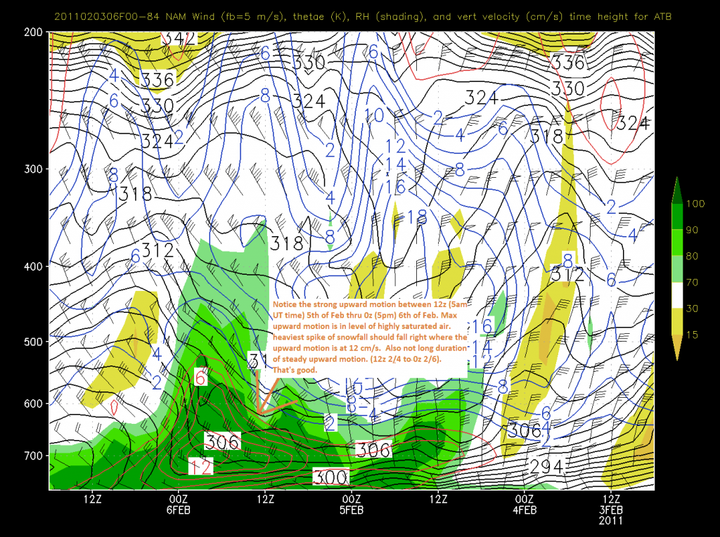
Looking at the NAM (which runs through the first 75% of the event). P.S. the last sentence of the annotation should say “NOTE the long duration…”:
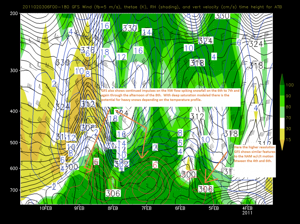
Now turning to the GFS we see a markedly similar solution not just for the first event but also for the second and third wave:
I’ve annotated both to focus on the upward motion. Ideally you want to see the max upward motion occurring within air that is at least 90% saturated. Here both models clearly depict this. That’s good.
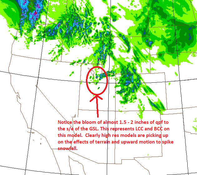
Looking at some models to ground our sense of how much precip is possible, we see the high res models really picking up significant moisture in the NW flow favored terrain. This is for the period ending early sunday am.
For snow growth, recent studies have show that temps in the minus teens Celsius with winds in the high teens to low 20s are key for development of dendrites. Looking at the temp profiles I see some degree of variation early on and then with the later waves, good cold snow growth temps.
NWS/SLC noted the possibility for rime, and I’ll mention graupel since they are both possible. Rime forms when super cooled droplets of air freeze on surfaces. Supercooling is often a result of very fast cooling via upward motion. Graupel is achieved through as similar process. Snow falls through this layer of super cooled water and rime accumulates on the flakes until they take on that ball shape. (And here Dwyer, you thought it was the result of magic snow elves pooing). With the upward motion and saturation predicted it’s very like at some period rime and/or graupel will exist. It happens. Nothing is perfect.
Now lets talk totals.
For the first wave ending sunday the high cottonwoods should see decent totals….something like 6-12 is a good 25-75% call right now. Adding the next few waves I think the high cottonwoods could see 2-2.5 feet by the wed. of next week. Not bad. Not bad at all.
Here’s the caveat however. Yea…there’s always a catch. There is going to be wavering about whether the shortwaves dive s/e through the great basin or more west into the Grand Tetons. For this system to play out they need to dive S/E. I’m pretty confident they will but if for some reason this doesn’t pan out, that will be the reason why. Stay tuned.
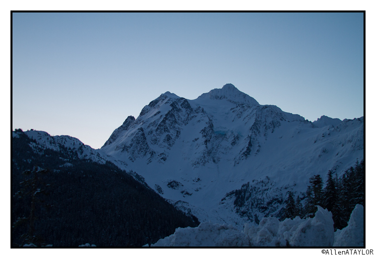
Shuksan: Anatomy of a Bail
I had the chance to engage in my first true Bail in a long time on tuesday. I left the Baker parking lot at 7 am with the goal of skiing the North Face of Mt. Shuksan. I was going solo, I was happy with the stability and really wanted to take advantage of a good weather window.


