Summer Series: July 30 to August 1
As the calendar turns to August, I start looking ahead to next winter. As G so wonderfully put it, the “turn” is a moment in the year when every skier should get excited. At the turn, I start to dream about powder sloughing off the thighs of my ski pants as I drop my knee and float into the apex of the turn. I start to think about the awesomeness that is the combo of a warm fire and cold beer after a day spent out in the snow. But most of all, I start thinking about the feeling of perking up in my chair and leaning into my computer, full with anticipation, as a weather model starts to whisper in my ear rumors of a storm.
While I’m going to put out a more in-depth winter prediction sometime in late August, I figure I’d share a few thoughts and considerations right now in honor of G’s article.
First and foremost you are not going to have a repeat of last years blockbuster I-95 winter. Just cross that off right now. The ENSO state is no longer in the El-Nino phase. In fact, in a very short period it flopped to a moderate Nina phase. Only a few times in the last century has the ENSO state flipped so rapidly. Most notably was in the spring of 1998. However that event isn’t a perfect analog because of the clear differences in the location of the SST anomaly. Where the core anomaly is located (referred to sometimes as west or east based) matters in what type of event we are going to see. Also, the PDO regime is now different than it was in 1998 and the 1998-99 winter. Regardless that still remains an analog year. (You should, before you proceed, read my take on analogs)
As mentioned the developing Nina appears at this point to be west based (lots of debate on where this is going). Some recent west based nina years are 07-08, 99-00, 88-89 and 75-76. Again, there are differences but these years have to be considered.
We have also seen a smokin’ hot summer. Similarly hot summers on the east coast were: 1994, 1993, 1995, 1999 and 1988.
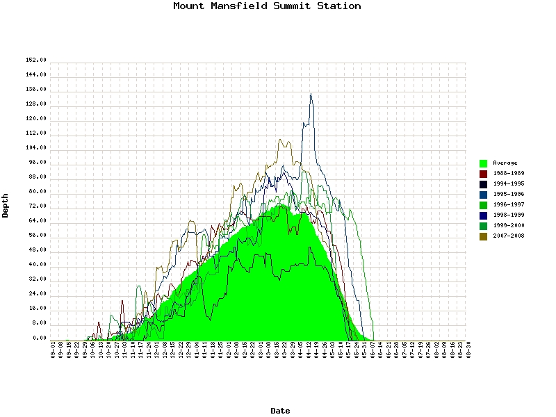
With the overlap of all these, at this point its wise to look at the winters of 88-89, 94-95, 95-96, 96-97, 98-99, 99-00 and 07-8.
At Mt. Mansfield it appears that overall these winters have been good.
While there are noticeable exceptions, the trend is for above average snowfall. Importantly, if you look at the data for these winters outside of the North Country, the story is different. Average to below average snowfall was the rule and few of these winters are remembered that fondly towards the coast (95-96 being an exception).
What makes for this difference? I have a theory that I’m working on but basically, it adds the following factors up: warm great lakes, northerly storm track, and not a lot of blocking.
So what to make of the up coming winter from all this? Right now I’d say look for slightly above average snowfall along the northern greens with intrusions of warm air and messy systems. Lake effect could be pronounced.
Anywho, on to the weather for the weekend.
Continue reading Summer Series: July 30 to August 1
TR: The Turn
A lot of folks focus on the summer solstice as the turning point from summer to winter. They say: “the days are now getting shorter” or “we’ve made the turn away from the sun.” As any bona fide ski addict knows however, the solstice is hardly a turning point, since by all rights, you should still be skiing. Indeed, the depths of despair of the ski addict persists for at least a few more weeks as summer continues to grind on with hotter and hotter days, and sticky/buggy trails. The Turn doesn’t occur for skiers and riders until about today.–the meteorological solstice. It is the day that we’ve finally hit (on average) the hottest day of the year; it is the day on which it is least likely to snow, it is the day the thermometer takes a turn and starts heading down again. As owners of this year’s Famous Internet Skiers calendar know, today is the day when it is now safe to sanely look forward to the turns you will make next season. For us, we think this is the perfect time to look back at the season that came before, and recount all the turns that are worthy of remembrance.
Click the picture or here to read The Turn
The High Life
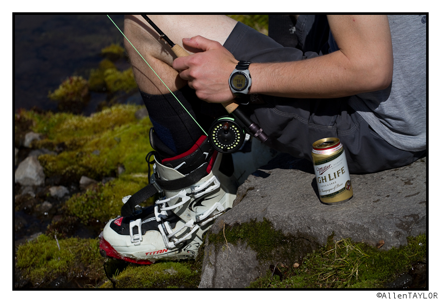
Allen, Chester, and I spent the afternoon in the mountains yesterday. This one picture says it all:
(UPDATED) Summer Series: Weekend of July 23-25
Well that was wild. Yesterday I wrote the greens were under the gun for some severe storms- and boy did some pop up. If you look at the SPC severe weather reports from yesterday you get a sense of just how darn active yesterday was:
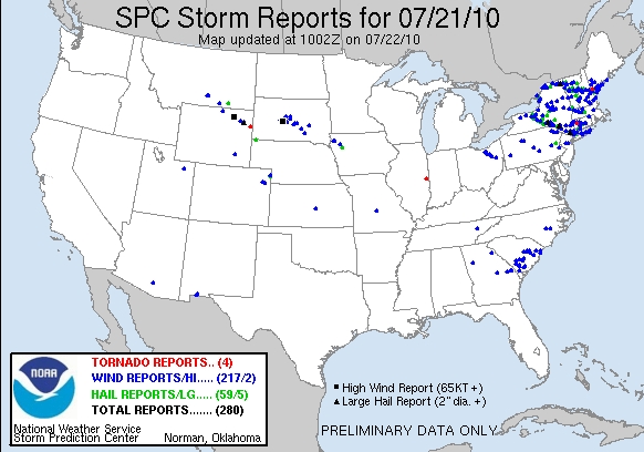
There was hail, winds in excess of 70 miles per hour and several severe thunderstorms with Doppler indicated rotation. Nasty all over. While we talk about the dangers of cold and winter weather, nothing is more dangerous to the outdoor enthusiast than a severe thunderstorm and its powerful cloud to ground lightning. They are not to be taken lightly. I’ve been caught out during one and would not wish to repeat the experience! Gotta be careful and heed these warnings.
As for the coming weekend, I don’t see a repeat of yesterday despite there being the chance for another round of t-storms.
Continue reading (UPDATED) Summer Series: Weekend of July 23-25
Severe Weather Warning: North Country under the gun
Going to make this short and sweet: Be careful. A broad upper trough of cooler air is moving through the North Country today. Along with surface heating and relatively high dewpoints this will combine to set the table for some serious thunderstorms. Supercell development is very possible.
SPC (the storm prediction center and the best t-storm forecasters in the world) place the north country- ADKS and Greens in the “moderate risk” category for severe weather (hail,high winds and tornados). This is substantial for our area. With the production of what is likely a tornado in Malone, NY (right now unconfirmed but Tornado warning is in effect) the atmosphere is showing it’s teeth. More is highly posssible and we have to take the NWS risk seriously.
Watch the radar and stay safe.


