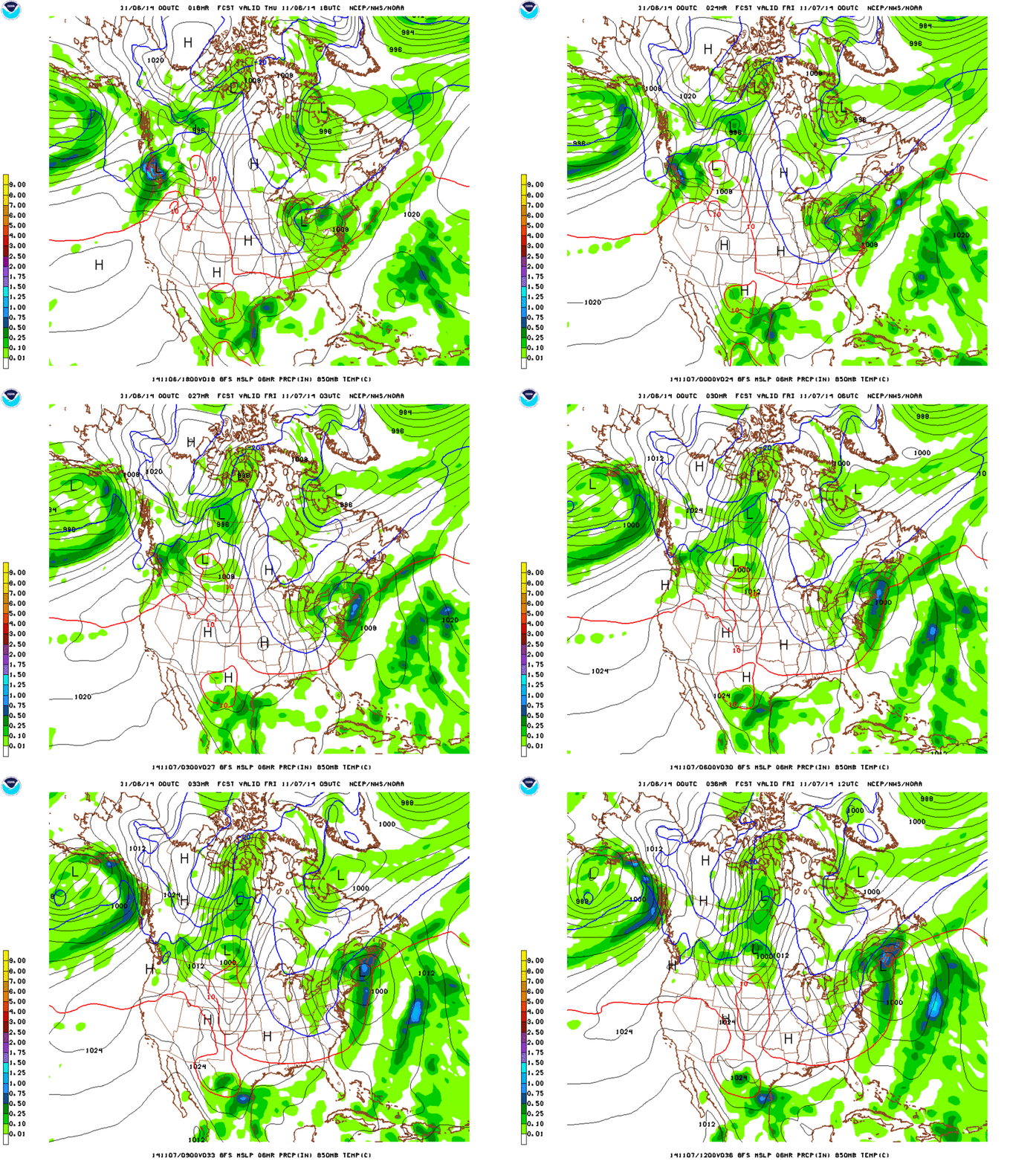
As I type this a storm system is dropping out of the great lakes and moving east. The primary center of the low will move into Pennsylvania and then swing through NJ and strengthen upon interaction with the coastal baroclinic zone.
This is a similar to the track low pressure took last weekend.The difference is that as the low pressure center digs southeast it will a) not go into the Carolinas and b) will redevelop along the coast further north and west. The system will then track just offshore of Connecticut, Mass and Maine.
Here, lookie:
As the system rolls through, it will bring precip to the higher elevations (and maybe even lower elevations briefly). First, tonight warm air advection on south winds will bring a steady rain that will change over to snow above 2500 feet by early nighttime. Winds will be from the south as the system is to our southwest and south. Then as we move towards daybreak on Friday the system will bring precipitation on North and Northwest winds as it moves northeast to our east. Temps will fall Friday as the system pulls out. There will be a period of calm between the departing system and the advection of some cold moist air behind the system later friday. This air could spark some additional upslope accumulations.
Overall the models are fairly moist with this system.
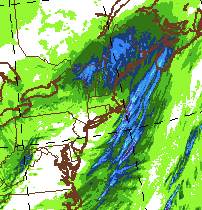
12 hour totals by tomorrow AM:
However temps will be marginal and some snow that falls will be consumed by unfrozen wet ground. That said it is highly likely that elevations above 2500 feet will see 3-7″ of dense wet snow from this system with the potential for several more inches up orographic precipitation Friday into Saturday. (Of course this makes perfect sense since I’m out of town Friday into Saturday…… FML)
So there you go. Let’s get started.
10 Comments
Leave a Reply
|
|||
| Home |


Skrilla Gorilla
wrote on November 6th, 2014 at 6:35 amSkrilla Gorilla
wrote on November 6th, 2014 at 6:54 amSorry for the inconvenience, but we no longer advertise for evo, and are still in the process of converting some of our older links.
We recommend looking for similar offerings from the merchants listed below:
800-Ski-Shop.com
Backcountry.com
CampSaver.com
Eastern Mountain Sports
GearX.com
Liftopia.com
MasseysOutfitters.com
theflipflopper.com
*Affiliates: you can log into your account at AvantLink to help control the behavior of inactive merchant links like this – go to the “Merchants” page and view the “My Inactive Merchants” listing.
Greg
wrote on November 6th, 2014 at 7:55 amShows you how much we care about keeping the monetization part of this site up to date #wedothisbecausewelikeit
bushman
wrote on November 6th, 2014 at 7:32 amyup going to hike up. 3-7 is good; more is better but will take it for this early, 2 runs to recall muscles from May
Greg
wrote on November 6th, 2014 at 7:53 amWould love to meet up if you’ll be in Stowe early. Enjoy!
bushman
wrote on November 7th, 2014 at 8:22 amGreg, thanks for the invite. Cannot make it to Stowe this WE but maybe later. NWS reports light snow this AM at JPeak so I expect it’s same at Stowe
Peter
wrote on November 6th, 2014 at 9:05 am2 laps = 2 naps
mtl_ripper
wrote on November 6th, 2014 at 10:17 amYES OH YES, the dreams awaken
Peter
wrote on November 9th, 2014 at 6:18 pmHow much is going to fall at Magic? What about Loon?