LH Peek at the Week: Early Spring Storm followed by cold
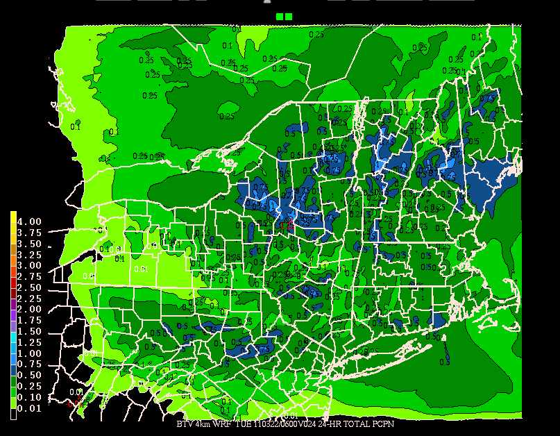
Spring will start with a snow storm. Throughout today, northern stream energy will swing into the Northeast. With below freezing temps this storm will bring snow over the next 24 hours. High resolution modeling indicates that the High Peaks and the Green Spine could see up to an inch of liquid by early tuesday morning.
With the temperature profile in place I’d estimate this works out to 6-12 inches of wet spring snow.
In the wake of this system we’ll see below average temps for the next few days. N and NW winds will keep highs in the low to mid 30s. Snow showers will be likely through at least wednesday am as well. Sun will break out again midweek and then we’ll look for some other energy working into the region come late week.
3 Comments
Leave a Reply
|
|||
| Home |


monkfish
wrote on March 21st, 2011 at 8:59 amI for one refuse to thank you for your hard work until the season is over.
Peter
wrote on March 21st, 2011 at 9:45 amomg. my legs are absolutely shredded from this past week.
I can’t believe I don’t want this storm to come right now.
oh, ok, that feeling has passed now, it’s ok. BRING IT ON!
jj
wrote on March 21st, 2011 at 5:10 pmLooking quiet out there…did this storm fizzle?