Potential Xmas weekend Nor’Easter (X-mas Eve Update)
Welcome to winter. Now let’s get down to business and discuss the possiblity of a strong Christmas Weekend Nor’Easter that could bring widespread snow to the northeast and set up fantastic conditions for the all important holiday week.
before we get into the details, let me say one thing. By now I hope you all realize I’m not a hype master. Personally I think driving traffic by screaming “it’s gonna snow” as loudly as I can is pretty lame. Any fool can grab one model run 5 days in advance, look at some insane qpf output and predict “several feet of snow” and be right once and awhile. However that’s not me. You don’t read this mess from my ADHD mind for B.S. Hype. You read it for unusual and sometimes accurate assesments of the weather. So with that in mind lets dive in.
(Note: Here’s how we are going to to do this as I’ll have to post significant model runs each day from here until at least the weekend. Below will be the latest thoughts with the older thoughts running from latest to oldest down at the bottom. So check back often to read the latest juice).
December 24th Analysis:
Over the last 36 hours the various numerical weather models have generally converged on a few simple facts.
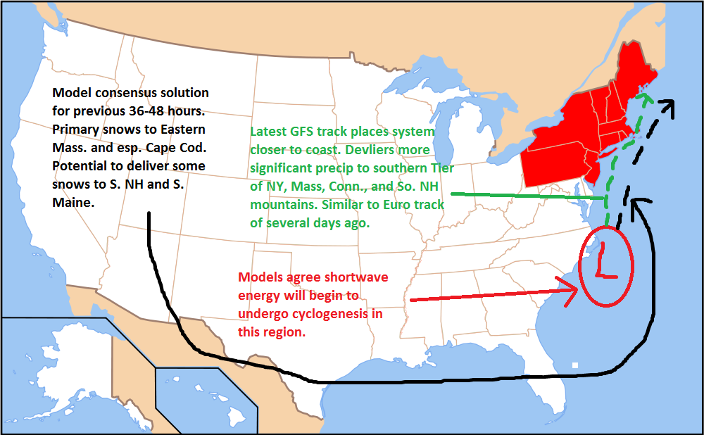
First the is strong model agreement that short wave energy ejecting from the west will interact with a stationary front off the coast of the Carolinas. Because I’ve seen this country’s test scores in Geography, I’ve drawn you a map. ![]()
Now as you can see there are two competing track solutions. First we’ll start with the black dotted line. This was the general model consensus up till this morning. The storm would develop, and track in generally a straight line from the coast of Carolinas to the tip of Cape Cod. A ton of data would support this conclusion including the water temperatures under this path, the location of the primary baroclinic zone and strength of NW winds over the Northeast. This track would bring little to no snow to the I-95 corridor, graze the delmarva and deliver significant snows to Eastern Mass. I have generally favored this track since the beginning as you can see below. However…I’ve always been worried that the models are phasing this system too slowly and not allowing for the shortwave to dig a trough as deeply as climo this time of year suggests. The Euro of the early week WAS more progressive with the shortwave and dug the trough much more deeply. As a consequence it had a much more west based solution. However as we have seen it moved back towards the east during the week.
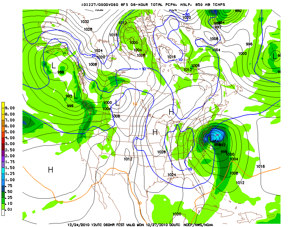
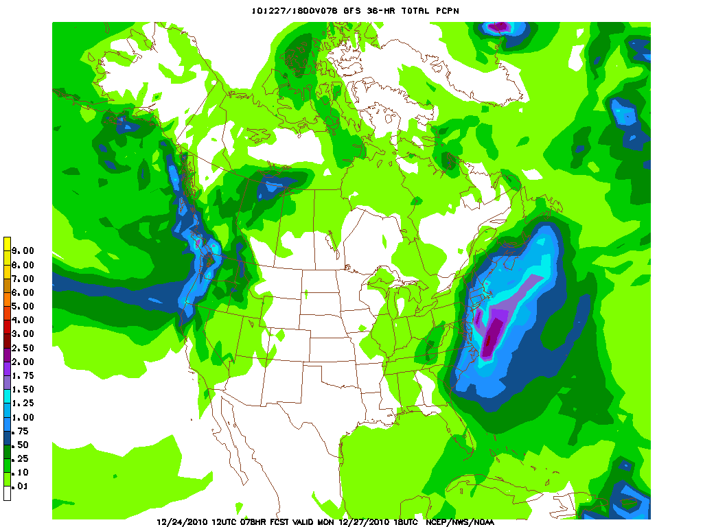
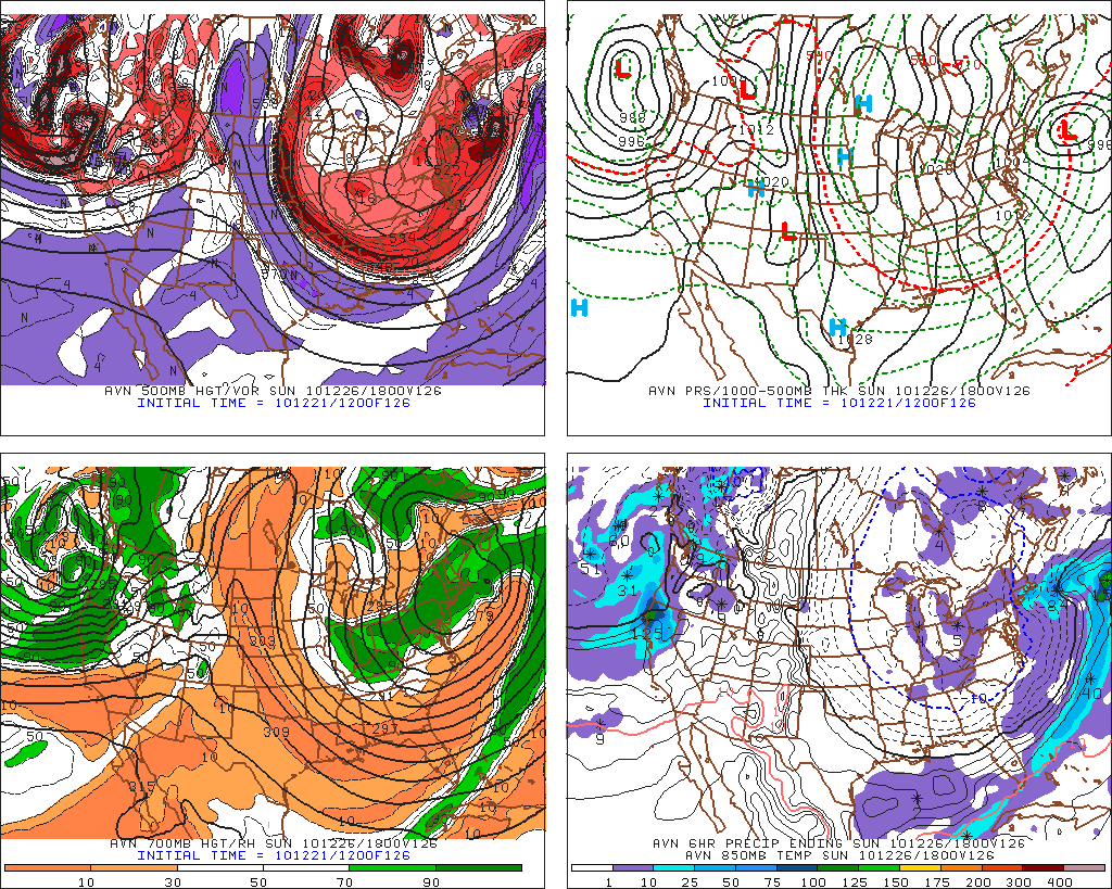
So when the 12x GFS came out with this:
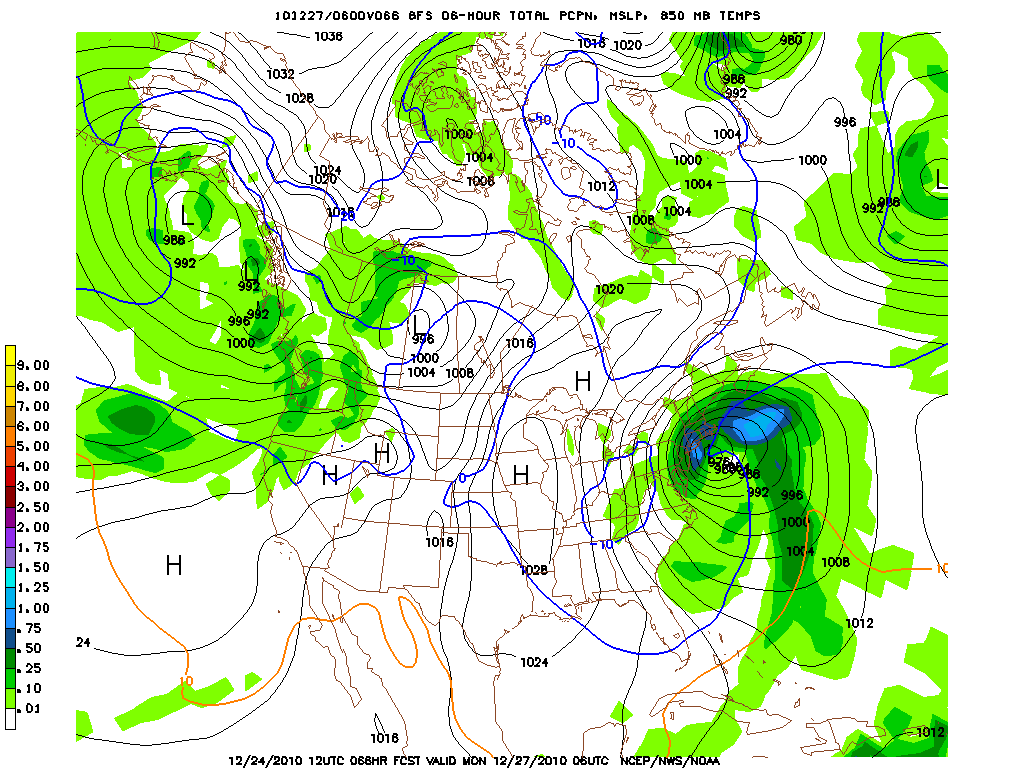
and then this:
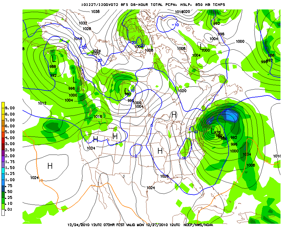
Followed by this:
I had to pause and really think about where this is headed. As you can see in the MS Paint Mona Lisa above, (outlined in Green) this latest GFS track is west and brings upwards of 8-10 inches of snow as far north as the Berkshires, Southern VT, and Central NH. Not to mention heavy snows in NJ, the Southern Tier of NY, Long Island, Conn, Mass. and RI. Strangely it looks REALLY similar to the Euro’s solution from Monday/Tues. So hum. What do to.
Well let me make a few points. First I I think if you live in the Boston area you should expect snow and wintery precip in spades come sunday night into Monday. If you live in Southern NH, and are planning to ski in the NH area you should really pay attention because even if the GFS is too far west I believe it’s onto something which the Euro was on a few days ago. Say it’s even 1/10 right, then NH – at least the southern half- will be looking a very nice xmas present.
Lastly- If you are thinking of skiing in say Southern VT and the Berkshires you need to watch this closely starting Saturday night. We may not know what this system will do until the shortwave actually emerges off the coast and starts to deepen. Serious Butterfly Affect stuff affects these storms, so sometimes waiting and being prepared is the best course of action. Do I think you need to wax up the phatties though? Not likely. However, I’m going to say that if you get 4-7 inches of snow in the Berkshires north up to Magic I will not be surprised at this point.
I’ll post an update tomorrow afternoon, and Sunday afternoon. Then we’ll be in a nowcast and I’ll keep you current with twitter, FISWX and this rambling slightly incoherent post.
Happy Holidays.
December 22 Analysis:
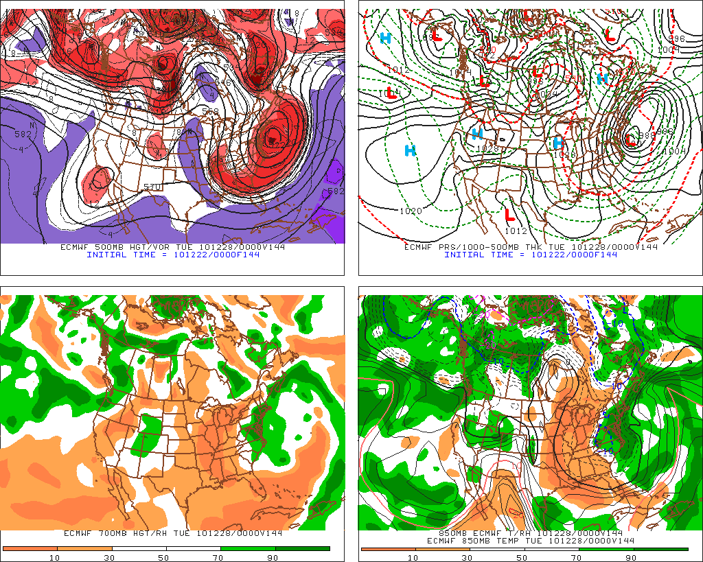
I appears to me that the Euro Phases the storm WEST of it’s position yesterday but then follows the GFS’s solution from yesterday and moves it out to sea before really delivering a blow to interior portions of NY, VT and NH.
Phasing/developing:
Now storm begins to move eastward with northern extent of precip shield having trouble working into Catskills, Berks to say the least. Similar to some some of the larger mid-atlantic systems we saw last year. Of course those occured in a completely different pattern so um…yea…not sure I really buy this solution.
So does anything change in my position since yesterday? Not really. I still think this isn’t going to be a major event for the ski world. I’d love to be wrong but I don’t get the right juju from this. I think the GFS has generally modeled this pattern well over the last three weeks and until it shows me it’s lost that I have to side with it.
December 21 Analysis:
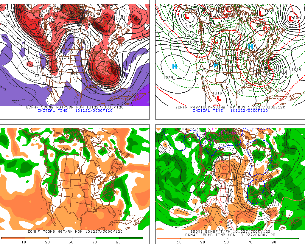
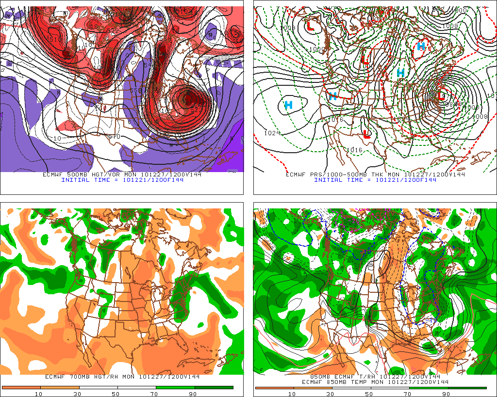
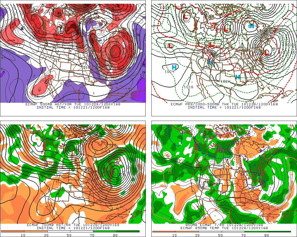
Well lets get right to it and start with the Euro since that’s the model that’s driving this train of discussion right now.
Developing….Classic northern stream trough digging deep into the south. (check). Shortwave appearing off Carolinas coast while mean location of max upper level divergence hangs back towards the west just slightly (check). Tap of low level moisture from Gulf along warm converor belt (check). Backside arctic type air (check).
Cyclogensis has occured as the storm moved into the baroclinic zone off the Carolinas. Storm is in the beginnings of the occlused phase and prob. reaching max power. Snows inland. Catskills, Mass. So. Vt. hammered.
I’m not sure much needs to be explained beyond “bombs away“:
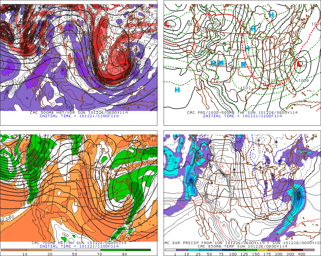
Turing to the Candian model (CMC) we see a surprising amount of support:
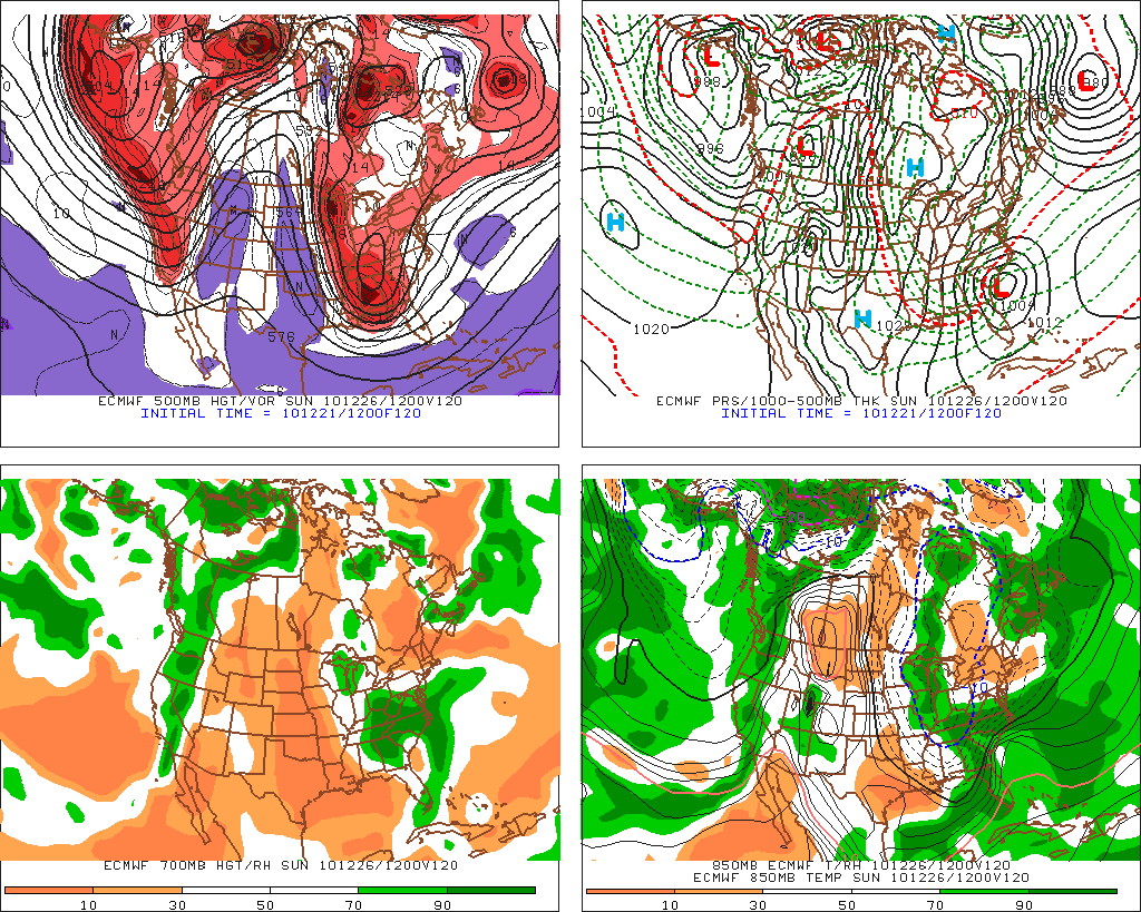
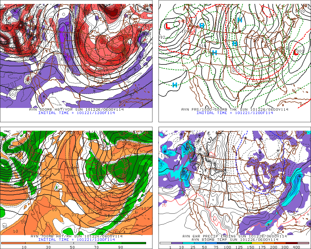
The GFS.
As with several systems of late the GFS pushes the wave OTS (Out to Sea) and says the storm is definitely DTF (thanks Pauly D.)
See (or Sea):
Fully developed. Just tickling Cape Cod. Coootchy Cootchy Coo.
So…where does that leave us? Well it leaves me thinking the GFS is right. Why? Because the Euro and the CMC have both been consistently too far west with coastal systems this year. They are displaying a bias to phase systems and digging troughs too much. This directs the low’s pathto the west more than it should. As a result both models come BACK east towards the GFS solution. We’ll watch this to see if it plays out over the next 4 days.
17 Comments
Leave a Reply
|
|||
| Home |






Evan
wrote on December 22nd, 2010 at 10:18 amSooo, what you’re saying is maybe we get snow??
Harvey44
wrote on December 22nd, 2010 at 10:28 amI’m no expert, but I’m thinking you are right… snow on the fishes. BUT of course I refuse to give up dreaming. Will be following along closely LH. Thanks.
Evan
wrote on December 22nd, 2010 at 10:38 amCan we rename noreasters as noroutsosears or perhaps notsonoreasters.
laseranimal
wrote on December 22nd, 2010 at 11:30 amcan we move the mountains out to sea cause that would be rad having to add lifejackets to your BC ski gear
Rcamp
wrote on December 22nd, 2010 at 12:07 pmGreat read and very informative as always. It looks like the latest GFS is trending towards the Euro, right? Sure hope is it can keep moving west for a hit.
Lionel Hutz
wrote on December 22nd, 2010 at 1:44 pmThe 12z GFS did trend eastward. Still doesn’t push any meaninful precip into ski country.
Maineiac
wrote on December 22nd, 2010 at 1:41 pmLionel, I know that your forecasts are primarily geared to the ADKs, Greens and Whites, but there are a few places to ski in Maine too! Thanks for putting the time into this, your discussions are better than watching the news or schmeather.com because you say what you think and why. I’ve wanted to know the why to everything since I was 2.
Lionel Hutz
wrote on December 22nd, 2010 at 1:46 pmI know there are places to ski in Maine. It’s just hard to get a handle on where exactly there are!
When it comes to this storm in particular I’d really say Maine’s not in a better position than anywhere else.
My gut says at this point – snows up to about NYC then storm’s eastward progression and sharp cutoff for QPF shield prevent snowfall from making impact in ski country.
But…as I have said many times in the post. Let just follow the progression and take some notes.
Doremite
wrote on December 22nd, 2010 at 2:31 pmWait, yesterday you said 6-10″ on high east facing slope of Green by Thursday morning but now looking like won’t move eastward enough to make that happen? Seems like you’ve draw back a bit from what was discussed yesterday but above note you haven’t really changed your position on this storm. Am I getting storms confused and, most importantly should I even hope for 6″+ to fall on northern greens (read Jay) today/tonight?
Lionel Hutz
wrote on December 22nd, 2010 at 2:45 pmSon I have no idea what the heck you are saying.
6-10 East facing slopes for greens was a storm currently in existance. That post was here:http://www.famousinternetskiers.com/pre-holiday-snows-eastern-flow-snows-over-next-48-hours/
And yea…for the POST XMAS STORM WHICH THE BASIS FOR THIS POST I haven’t really changed by thinking.
Put the egg nog down.
Doremite
wrote on December 22nd, 2010 at 2:36 pmWell, obviously I can hope for whatever I want but if I do am I just playing myself (with intentionally withheld)
Doremite
wrote on December 22nd, 2010 at 2:55 pmI was thrown off by the “December 22 Analysis” which I read literally rather than your analysis of xmas as of 12/22…. that and the egg nog. So northern greens may actually still see some action today/tonight. NWS clearly still going 2-4″ish but as you noted, LH, not elevation-centric. Sorry for confusion.
webfoot
wrote on December 22nd, 2010 at 3:49 pmAs always, thanks for this. Should I be doing my “thingy” dance for the poconos?
Chris
wrote on December 22nd, 2010 at 5:44 pmNearly s6 inches so far up on Camels Hump today! Still coming down!
Les
wrote on December 23rd, 2010 at 9:13 amEuro and GFS agreeing on a big storm now? But will it reach into the mountains, or just cause traffic hell on i-95? Lionel?!!
Les
wrote on December 25th, 2010 at 10:05 amRight on LH! Keep up the great work!