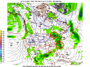
Well, earlier in the week I wrote that a dual low system would affect Northern NY, VT and NH on friday. And that’s still true. Looking at the system it’s fairly clear that we’ll see a broad area of low pressure move up just to the west of the Appalachian spine, as it does, it will spawn another low to develop just along coastal NJ. By friday morning all the major models agree the we’ll have two weak lows, one just over by the Great Lakes, and another over by Long Island.

Given the structure of the system, there will be plenty of low level warm air. Below 2000ft This isn’t going to be snow (or very much snow). Temps at 850mb will warm above 0c up to about the southern ADK and southern VT. North of that in the ADK and Greens and NH mountains, 850s will stay around -3c leading to the idea that upper elevations (say 2000ft plus) will see all snow out of this system.
Now this is a fairly moisture starved system so I wouldn’t expect a TON of snow from the passage of the lows on friday. However some of the higher resolution models disagree and give the summits of the Spine – centered on Kmart-a rather robust .5 to .75 inches of liquid. With the temps forecasted that’s a good 6-9 inch snowfall. Seems a bit wet to me. I think a 3-5 inch snowfall above 2000 ft is the proper call up and down the spine. A few pockets in central VT could tip over the six inch mark of the air remains a touch colder than modeled. ADk prob. in the same 3-5 range with the Whites reaching 3-5 as well.
Following the passage of the northern low, a moderately strong cold front will sweep in from the northwest. Now models are not robust on this at all. However this year the pattern has been for these cold fronts that bring -10c to -12c air into the the ADK and VT to spark snow showers that result in the 2-4 inch snowfalls regardless of what is modeled. So look out for snow showers across the higher terrain on saturday with 2-4 inches possible, and maybe a touch more up by Jay and over on the rockpile by early saturday morning.
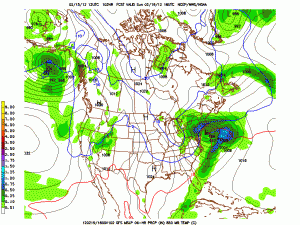
The next part of the story is the development of a potentially strong low pressure system that could impact the northeast on monday. Up until yesterday there really wasn’t much to say other than energy ejecting out of the west, would amplify in the low midwest and move through the mid-atlantic and out to sea. It would not phase with a northern stream shortwave diving out of the great lakes, and we wouldn’t really care. Then yesterday’s 12z GFS showed this:

This was a deviation from the previous solutions so of course the question became, what did the overnight run show?
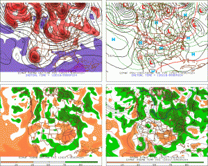
Well for one, they all show a developed low pressure system off the N.E. coast. (That’s good) However they have clearly reverted to the more suppressed solutions that were previously the operational GFS solution. (That’s bad). Right now, my take is to follow the pattern of the winter: suppressed storms. I feel like this wants to go out to sea. I’ll watch it closely but that’s my best guess right now.
8 Comments
Leave a Reply
|
|||
| Home |


Porter Haney
wrote on February 16th, 2012 at 9:42 amThe 12z GFS also shows pow in UTAH. And yes I always finish my sentences by screaming.
Phineas
wrote on February 16th, 2012 at 9:43 amhuge bummer
Peter
wrote on February 16th, 2012 at 10:43 amthanks for the detailed write up. We will search and destroy all micro-pow we can find.
scott
wrote on February 16th, 2012 at 11:24 amLionel, if the high peaks of Central VT can get 4-6″ out of this, I’ll vote for you for President, not just BTV bachelor of the year.
Between the damage from TS Irene and then this awful Winter, I’m not sure what more can go wrong in Central VT(OK, a cold spring after the lifts close). At this point, several inches of cement would feel like manna from heaven.
scott
wrote on February 16th, 2012 at 11:25 amI meant 4 – 6″, not 4 – 6′. Spinal Tap moment for you right there.
Big Wave Dave
wrote on February 17th, 2012 at 10:42 amBRICK!
Seriouslu Lionel, what gives? no personal responsibility of course :) (my other favorite weatherman Matt Noyes of NECN was way off too)
but in all seriousness… besides it sucking… why has this winter been so difficult to predict?
cliffy
wrote on February 19th, 2012 at 9:17 pmBrick – no way….maybe a 3 pointer that only went for 2 cause of a toe on the line. West side of Mansfield had 4-6″ new over the weekend above 2500′ – below that was tolerable at best. Here is pic of Mansfield from just N of Fair Haven looking more like something in the presi’s. There was a lot less white showing on Thursday.
http://www.pbase.com/chieftaffy/image/141615900
cliffy
wrote on February 21st, 2012 at 6:22 pmVs. 9 days earlier
http://www.pbase.com/chieftaffy/image/141658809
I think somebody fell asleep at the stake – thats a little more than 2″