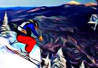
Rinse and Repeat? Don’t Think So. But Snows First!
Like the storm we just had? Well good because it’s little brother may on the way.
THURS PM UPDATE:
Looks like we have some heavy snows falling at elevation right now! Come on ULLR! Likely 6-7 already above 3000 ft with more on the way over the next few hours. Keep it up!!!
As I’ve always said- sometimes the weather does what it wants to do. Right now it wants to snow at elevation!
UPDATE:
Sadly I don’t think this one is going to work out.
After a few (3-6) inches of snow overnight and thru thursday am, cold air will get scoured out. As I discussed below, a second wave will develop along the draped cold front, somewhere down in PA. It will however slide NW instead of N or NE. This will rotate the system in such a way to bring warmth and rain on friday to the North Country. Had it stayed less rotated it would have sucked cold air down into the hills and repeated the sun-mon pattern. So tonight thru sat am looks wet. How wet? Not sure. Maybe .75 to 1.75 inches of rain are possible. Given the DEEP snowpack this will cause some serious flooding problems. Be careful.
ORIGINAL POST:
As the week progresses a shockingly similar pattern to this weekend looks to develop. A primary storm will head into the Great lakes pushing a weak ridge out into the east coast. As the warm front from the primary low passes over entrenched cold air in NY and NE isentropic lift will lead to moderate snows beginning late wednesday night and then continuing on thru early friday am.
By that time, the cold will possibly get scoured out allowing rain to move in. I say possibly because some data shows upper elevations remaining supportive of mixed frozen precip. If it does get scoured out there would be a period of about 18 hours where a cold rain could fall. At that time, a wave of low pressure will develop in Virginia- just like it did on sunday.
Clearly there are model discrepancies at this point about what happens next. Some models track this low thru NY state proper and bring rain to much of the region. Others track it right along the eastern edge of the Green spine bringing snows to NY and upper elevation VT. Personally, I lean towards the latter. I think for the low to track so sharply NW (from VA, thru PHL and then back into western NY) doesn’t match with the pattern we’ve had so far this winter. I think, looking at recent guidance and trends, that this low tracks towards the eastern side of VT.
I’ll keep you updated!
9 Comments
Leave a Reply
|
|||
| Home |


Harvey44
wrote on March 8th, 2011 at 11:11 amLionel … as the lone wolf of hope out there we will be watching LH/FISWX closely. Anything on timing? When do you see the changeover happening?
billski
wrote on March 8th, 2011 at 11:38 amPlease, please, please. Fixed schedule only gets me up there by Friday AM.
Building my Ullr pyre now.
webfoot
wrote on March 8th, 2011 at 11:42 am“Lonewolf of hope” amen. Pokes are pretty much destroyed and was planning to head north this weekend. LH, your insight very much appreciated. NOAA just giving me the valley floor predictions. (Well, the tools may be there to assess otherwise but thats beyond me.) Thanks in advance for tracking this one.
PS. My sons and I were at Jay Peak reading your “Pow town” work. Lottsa fun that Friday.
Doremite
wrote on March 8th, 2011 at 1:27 pmThanks LH. Missing the post event action due to work obligations but was really hoping for a packed pow paradise in the NEK this weekend. Stoke of new snow quickly turning into anxiety about a wet Friday burying all this goodness in carbonite. Will follow your juju in hopes of seeing dropping temps and rising snow totals. Keep those wanting to be in the know in the know.
billski
wrote on March 8th, 2011 at 3:01 pmWhat is the typical temperature delta between valley and summit?
I know, it depends on everything (and hopefully no temperature inversion)
5 degrees?
thanks.
Big Wave Dave
wrote on March 8th, 2011 at 4:07 pmwho cares if it rains friday its supposed to be in the 40’s saturday and snow for a day and a half before, its march in new england, quit yer whinin’ and go ski some slop, there is sure enough out there!
Dave
wrote on March 8th, 2011 at 4:08 pmI am driving up from Connecitcut on Thursday night to ski Jay Peak on Thursday and Friday. I just read that the trough will take on a negative tilt.
Will that be enough to keep the precipition mostly snow at Jay? The National Weather Service is calling for 45 mph southeast downsloping winds on Friday.
Any updates will be appreciated!
powhounddd
wrote on March 8th, 2011 at 5:44 pmSurf the slop!
tdub
wrote on March 10th, 2011 at 8:40 pmLH, I appreciate your guidance, even when it’s bad news. I decided to hit K for the week and got a nice little bonus pow morn, that sht was velvety goodness! . I’ve really grown to depend on your more focused north country reports to supplement the ‘bigger picture’ more mainstream reports, and i’ve been able to read between the weather lines as it were. thanks man. keep it up, a tip of the chapeau sir. :)