Before we get to the weather I want to thank my Flyers for a great season. As I sit here this morning they are waking up for the first time in eight months without a game to look forward to. Gotta be tough to lose game six of the Finals in overtime at home after fighting so hard all year and coming back from 0-3 down to the Bruins (not to mention 0-3 in period 1 of game 7). Way to go…now stop cavorting with each others wives (Google it) and win the cup next year. Anyway…I guess I should get to the weather….that is unless you want to talk Phillies baseball.
| Jump to: | Synopsis | Friday | Saturday | Sunday | Extended |
SYNOPSIS:
Similar to last weekend, Friday looks to be the nicest day of the weekend. Come Saturday, a low pressure system moving NE from the Great Lakes will push a warm front into the north country. As the front slows and drapes across the NE showers with a few rumbles or thunder will break out on saturday. Models diverge on how fast this clears with some recent data indicating that by sunday early afternoon we’re dry with broken clouds.
| Jump to: | Synopsis | Friday | Saturday | Sunday | Extended |
FRIDAY:
Friday is looking like the best day of the weekend- at least for the North Country and NH. Behind a departing system a surface ridge will build in on Friday. Sunshine with broken clouds (less south, more north) will make for a very pleasant day.
Primary Concerns: Lingering clouds trapping moisture.
Best Location: Really the entire NE looks to have a nice Friday.
Best Activity: There isn’t much that you can’t do tomorrow. I’d be careful with hiking though because recent rains may have led to some mud pockets. Though with the soil moisture still so below average I suspect mud will be low.
Recreational Forecast:
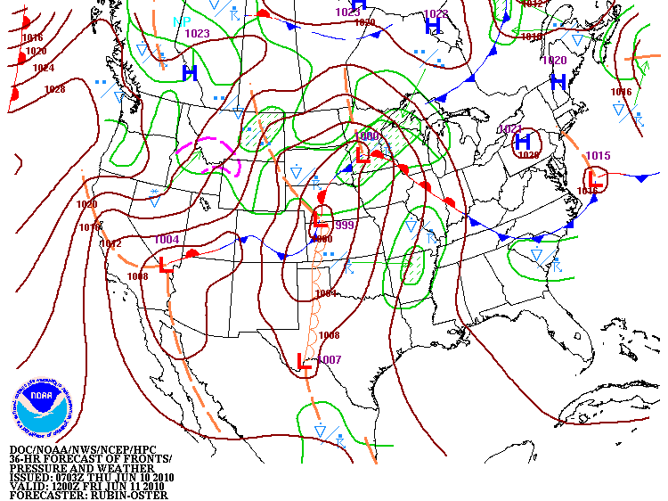
As Friday breaks a surface ridge should build into the northeast. Looking at the HPC expected fronts map below-
you can see the primary High s/w of the NE with a weaker surface high over NH/VT. Given the location of these highs, surface dewpoints should be fairly low as the prevailing flow will be strong out of the NW.
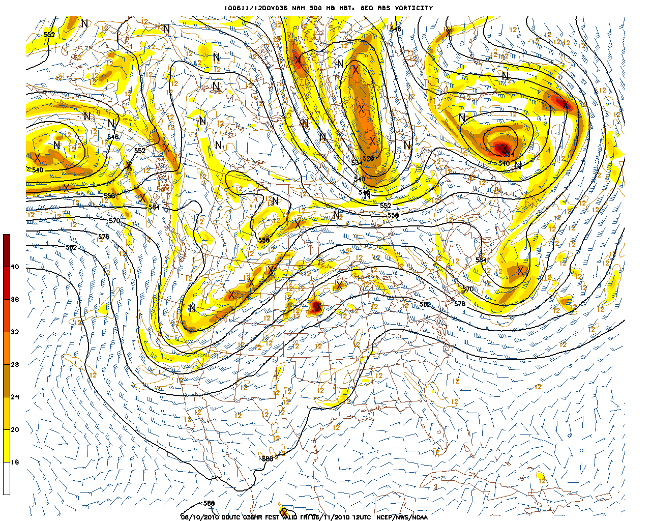
Well modeled by the NAM here:
The SREF fxt below may even be a little high for 2m dewpoints.
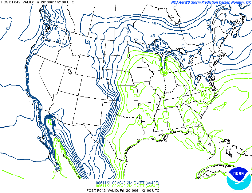
Though I wouldn’t rule out a damp feeling morning given the recent rains, potential for morning fog and some lingering clouds.
Regardless this all should burn off my the later afternoon.
Cloud models show a weakening of the clouds by early afternoon with a clear evening to follow. By 1 pm both models show fairly light cloud cover:
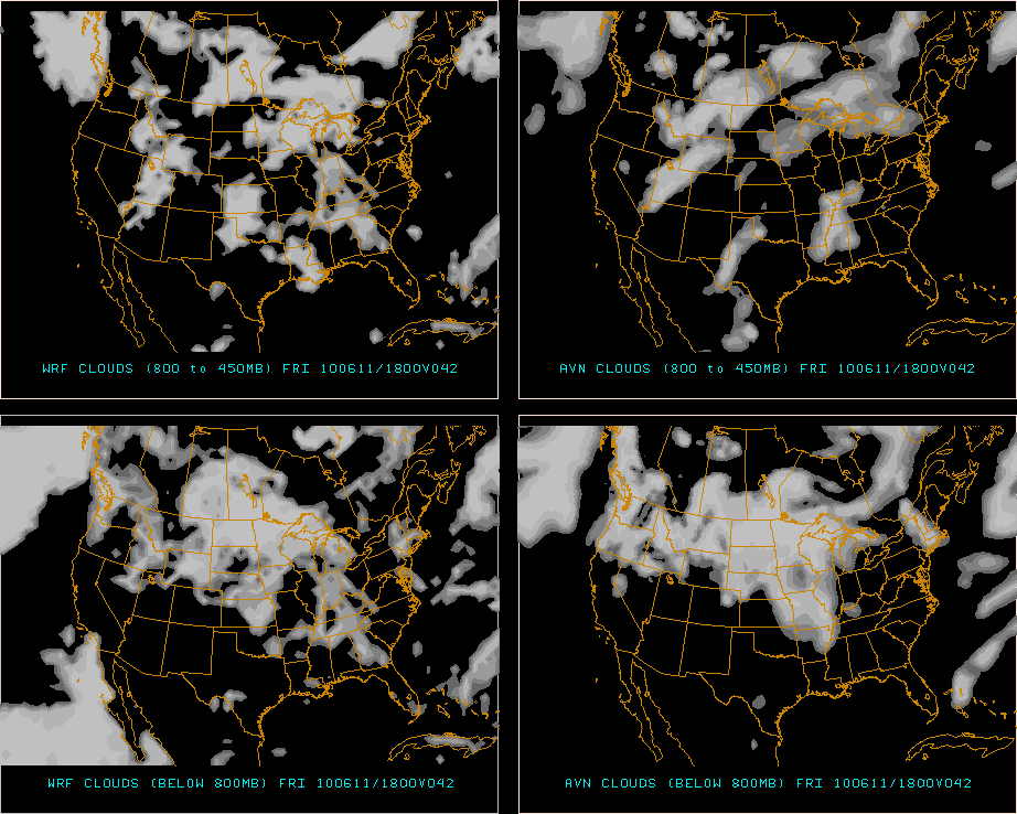
Make sure to check our Satallite feed to see if/when the cloud cover is breaking up.
Given the NW flow I’d suspect Friday’s temps to range from between the upper 70’s in the Catskills to the low 70’s in the north country. Higher terrain will be in the mid to upper 60’s. Winds are modeled across the higher terrain to be in the 10-15 mph range as per BUFKIT. But I’d caution that there could be some unexpected gustiness that the models aren’t picking up. If that surface low doesn’t move out fast enough the gradient could tighten between the surface high and the low leading to some winds over the 20 mph range across the higher terrain. While this isn’t something that should prevent you from doing anything…maybe at least packing a layer would be helpful. (Which you should be doing anyway because that’s smart).
| Jump to: | Synopsis | Friday | Saturday | Sunday | Extended |
SATURDAY:
Sat will start out tranquil but an approaching system will drive a warm front into the area. Increasing humidity, instability and moisture should conspire to produce wide ranging showers in the afternoon with a few heavier pockets across the higher terrain of NY, VT and NH. Latest data is hinting at some higher Cape values and elevated lifted index values giving us at least the chance for some T-storms in the afternoon.
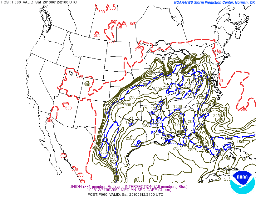
Primary Concern: The primary concern is for rain breaking out in the midday hours. A growing concern is for the chance for T-storms mixed into the system Sat. afternoon. Right now the highest areas of instability are to the south of the Catskills as this is where the most surface heating will occur. As you can see below an area of elevated CAPE values is showing up in South western NY state:
Similarly lifted index values are rising in the same general area:
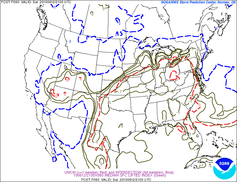
Now these values have risen in the past few models so it’s something to watch. While the highest area of concern is to the SW right now, if we get the warm front to push a little further north than expected you could begin to see instability increase in the North Country and across New England.
Best Areas: I’m going to say the further East you are- NH, Eastern VT…the better your saturday will be. As it will take some time for the system to move east by the time the showers get to you it’s possible that you could have gotten a full day activity in.
Best Activity:
Going to depend on where you are. Southern areas – I’d say just about anything is in play so long as you watch out for a few afternoon showers and rumbles of thunder. North- not really sure. Could prob. get some good climbing in early in the day but I’d stay close to some cover at least. A hike could be nice but if you don’t want to pack the rain gear it’s prob. worth skipping. East. Go for it but watch the skis in the afternoon as some rain could work into the area by 2-3 pm. (MTW will see it first by the way…so be aware of that).
RECREATIONAL FORECAST:
As mentioned above, a Low pressure center working out of the Great Lakes Midwest will push a warm front up into the North East on saturday.
By Saturday morning HPC and the models are in general agreement with the orientation of the major players.
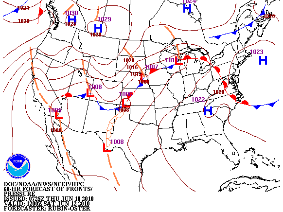
HPC clearly shows the warm front draped across western PA and SW NY.
The NAM is a little more progressive with the front and brings it all the way up into NY state and VT/NE by the same time. 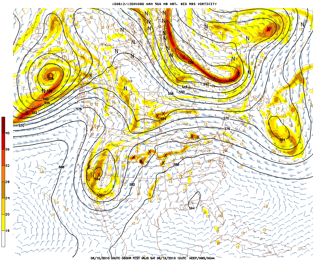
Increased upper level humidity
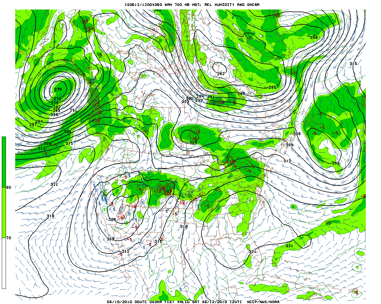
will provide plenty of moisture for future systems as well.
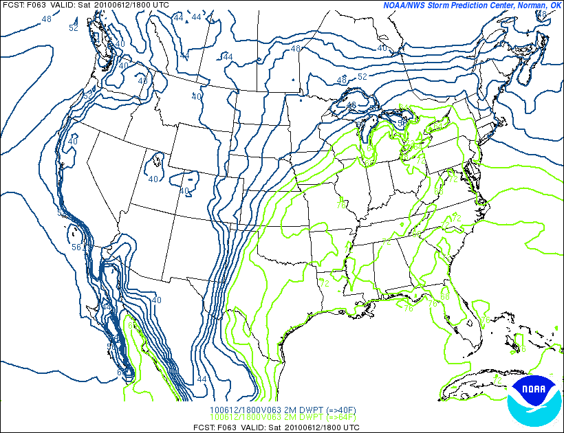
Down at the surface, the warm front will move some much wetter air into the region as well. Spiking dpts into the mid 60s across much of NY by early afternoon.
With cloud cover in place
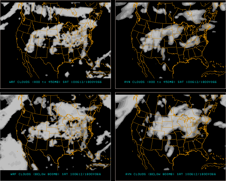
regardless of how much rain we get Sat. isn’t going to be the best day to be outside in the North country.
As for the rain all the models indicate that Sat will feature periods of rain esp. in the afternoon in the North Country. While amounts are a little varied, the heaviest amounts look to approach .5 inch in a band of enhanced precip which will extend across the Southern ADK and on into VT. This would correspond to the general location of the warm front. Should the front move north the heaviest precip axis would similarly move. Besides checking the radard the cams on the right of dashboard are a good way to follow the precip and the cloud ceiling.
South of that band- in the Catskills the precip should remain light and spotty with instability based showers being more likely. In the evening/really later afternoon the precip begins to concentrate on the eastern side of the Greens. VT and NH should see some solid precip as Saturday turns to Sunday.
| Jump to: | Synopsis | Friday | Saturday | Sunday | Extended |
SUNDAY:
Sunday should feature a clearing system with nice weather building in later in the day. How soon that happens is up in the air right now. Models haven’t been consistent at all in how they want to handle Sunday. Right now I’m tempted to go with a damp morning – primarily to the east with clearing from west to east by early afternoon.
SATURDAY AM UPDATE:
Sunday will still feature clearing but with upper air instability lagging behind the system and moving through the cool moist atmosphere on sunday, showers should be expected in the afternoon. The way it looks right now, sunday morning should be pretty dry- though with the rain on sat. and the cool temps it might feel wet down at the surface in the morning. As we move into the afternoon however I’d expect some shower activity to develop from the catskills north and all the way east into VT and NH by the end of the day. T-storms would be possible down in the PA hills while mainly just showers in the northern mountains.
Primary Concern: Showers developing in the afternoon are stronger than advertised.
Best Areas:
RECREATIONAL FORECAST:
As above, sunday will start out dry. Now with today’s rain and cool temps and light winds the surface might not dry out. So don’t go running through the grass, get soaked and come complaining to me. By dry I mean not raining. As we move into the late morning some sun could poke through. In the afternoon some disturbances will move through the atmosphere. With high RH values and a generally rain supporting atmosphere I think these disturbances will set off some wide ranging shower activity. I’d say that from 1 to 4 you have the highest chances of seeing a shower. While the activity will be rather widespread I see amounts being pretty low with only a few pockets – mainly in the Southern ADK/ALB region east to VT-of heavier rain. Regardless I don’t see sunday as wash out right now and say that if you want to get outside – do so. Just watch the radar and check back with me for updates!
| Jump to: | Synopsis | Friday | Saturday | Sunday | Extended |
Extended outlook
More divergence for the Mon. Tues period. Looks like however a weak L will move across NY state from west – east spreading clouds at the very least a shower across the North East.
Again I’m going to reserve the right to update here as I don’t think there is a good handle on what the extended period will look like. We need to see how fast that system clears on Sunday before we see what Monday could bring.
3 Comments
Leave a Reply
|
|||
| Home |





Porter Haney
wrote on June 10th, 2010 at 4:40 pmLooks like cold and rainy in Utah!
Anonymous
wrote on June 11th, 2010 at 6:48 amre: best activity on saturday… i’ll definitely be watching my SKIS in the afternoon…. SCHRALPIN’ ZE SNOW!
Hailey
wrote on June 15th, 2010 at 9:41 amre: best activity on saturday… i’ll definitely be watching my SKIS in the afternoon…. SCHRALPIN’ ZE SNOW!