Welcome to summer and the new Summer Series here on FIS. Read on for our inaugural Summer Series Weekend Outlook. As you know I’m obsessed with winter weather. And while I love nothing more than nailing a winter storm weeks in advance or live updating an exploding monster I certainly don’t go crawl into a hole for six months out of the year (though my April billables certainly suggest I did spend a fair amount of time in some hole like encampment). In fact, just like the rest of the FIS – as you’ll see- I enjoy summer.
Nothing beats a hot sunny day at the beach, a warm sunny hike, a good late evening bar-b-q, a cold beer at a baseball game or changing your boxers twice a day because you sweat right through them sittin in traffic.
So in honor of summer and all the awesome summer activities we came up with this weekend outlook. My goal is to roll this out each Thursday afternoon so that you all can have time to plan your adventures. I’ll take it day by day and highlight the primary concerns, and the significant weather factors that come into play for the myriad of summer activities. So hopefully you kids like it. If you don’t…well go read accuweather and try to find out what “clouds and sun, with showers at times. Some showers could be heavy. .01 to .25 inches of precip possible with locally higher amounts” means.
| Jump to: | Synopsis | Friday | Saturday | Sunday | Extended |
SYNOPSIS:
Before we get into the daily specifics I’d like to just paint an overall picture. Currently a large bubble of hot (and I do mean HOT- it was 80 degrees when I went running this morning at 5:54) is being squeezed from the NE by a cold front. People call this a backdoor cold front but that’s stupid and cliché. The front is being pushed by a very very large 500mb vortex spinning in the Canadian Maritimes. Seen sitting and spinning very clearly here.
The effect of this advancing cold front is primarily going to be the setting off of some pretty strong T-storms across the southern Tier of NY State and down into PA and the DC area as the front clears. Cape, lifted index, and omega values are all fairly high from the Catskills down through the poc-a-hos over the next 24 hours. Smartly the SPC has put these areas in the slight risk category for severe thunderstorms. Hail is possible along with strong gusts of wind. After that front clears by Friday the weekend is setting up cooler and generally pretty nice. Though not without its potential pitfalls.
| Jump to: | Synopsis | Friday | Saturday | Sunday | Extended |
FRIDAY:
Primary Concerns: Lingering Convective T-storms in Southern New York
As the front drives south it will slow. Convection will be present in PA but lingering convection – esp. in the morning and early afternoon could appear in the Catskills and areas south. The Storm Prediction Center generally agrees though I’d expand their “Slight Category”
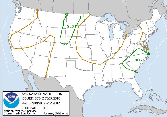
Best Location: Anywhere north of the Catskills and East of the Hudson. The ADK though with a large soil moisture anomaly might be the best for Friday if you want to take a walk in the woods. Soil Moisture is down considerably ytd 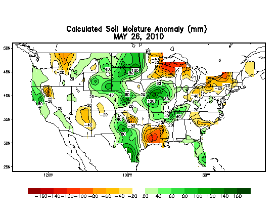 and with the primary storms passing s/e I don’t see that changing for Friday.
Best Activity: All are in play Friday.
Recreational Forecast:
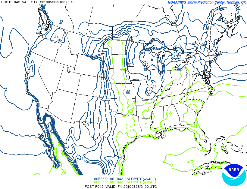
As we enter the afternoon hours on Friday, the weather looks to set up nicely for outdoor activities.
With low dew points
and temps reaching up into the mid-70s
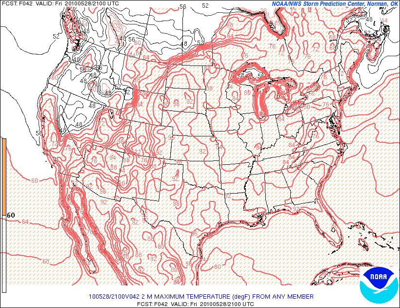
just about any activity should be in play. Also, I think sun will predominate. By the afternoon, the majority of the clouds will be to the south.
| Jump to: | Synopsis | Friday | Saturday | Sunday | Extended |
SATURDAY:
Primary Concern: Weak Upper level disturbance setting off some rain showers across the southern ADK, and Green spine as maritime air interacts with cool westerly flow. As I’ll get into below this is the primary issue with Saturday but it’s really not well supported by all the available data. However I kind of support it. With the large vortex interjecting maritime air into the mountains, and winds out of the west there is a chance for some upward forcing. With a weak disturbance moving through the atmosphere I think that a period of light showers and clouds can’t be ruled out. So just plan accordingly. Not talking wash out…just one of those…where did that come from rain showers.
Best Areas: Just about all are equal though I’d suspect some of the forcing might be greatest along the southern greens so showers might be heaviest there.
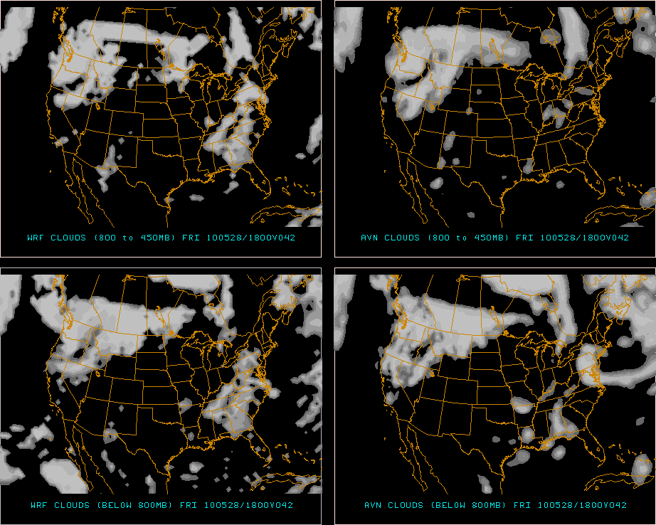
Best Activity: Things under 3000ft. I believe that clouds will be more extensive on Saturday afternoon than are being forecast right now.
High res models are starting to pick up on this. 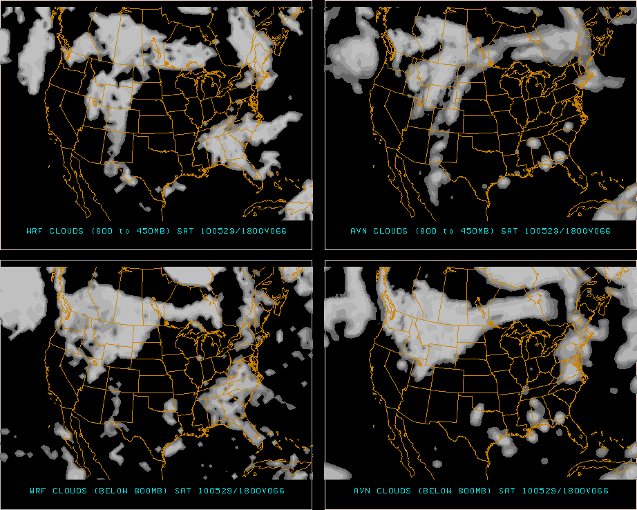 and with high chances for the lowest Condensation level (where clouds begin) to be around 1000m being pretty high:
 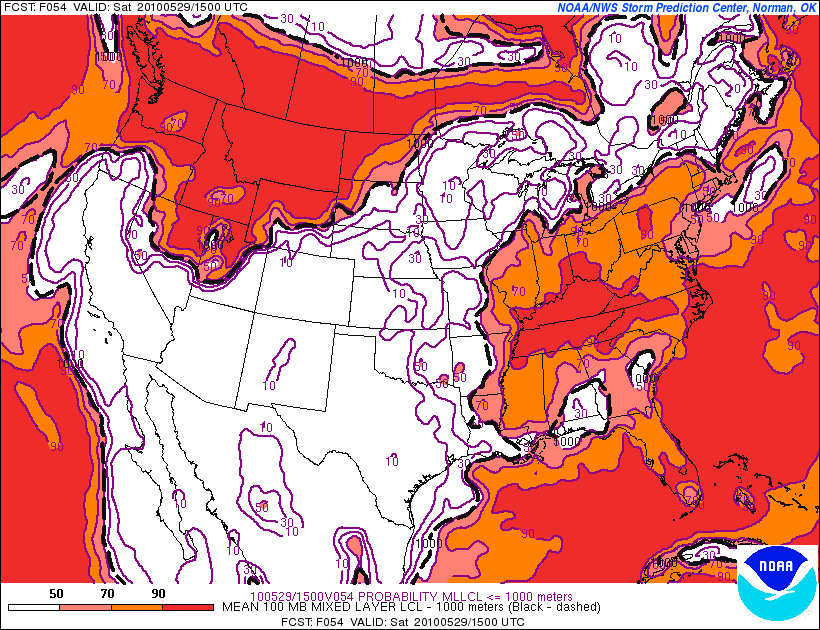 I’d try to stay lower down. Not that some sun will not poke through. For sure. Esp. in the AM. But by the afternoon I thin some lower clouds will have moved in.
RECREATIONAL FORECAST:
Saturday should start out benign. Sun in the morning with low dew points and cool temps. As we enter the afternoon hours, clouds will build (see above) and temps will stay 3-5 degrees cooler than Friday. Highs should reach into the lower 70’s.
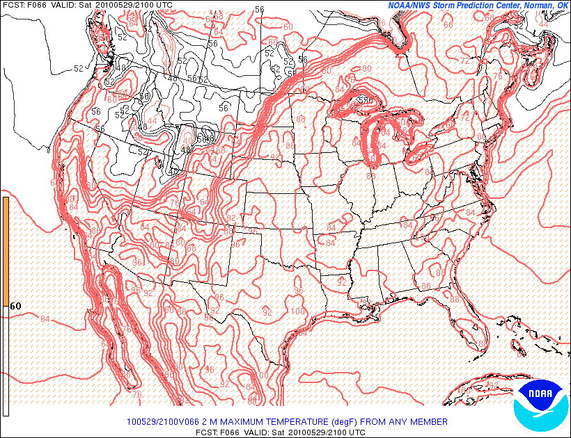
However, as we enter the afternoon, as mentioned above, a weak disturbance will move through. The NAM has been most aggressive with this and you can clearly see the weak trough and the higher RH values here.
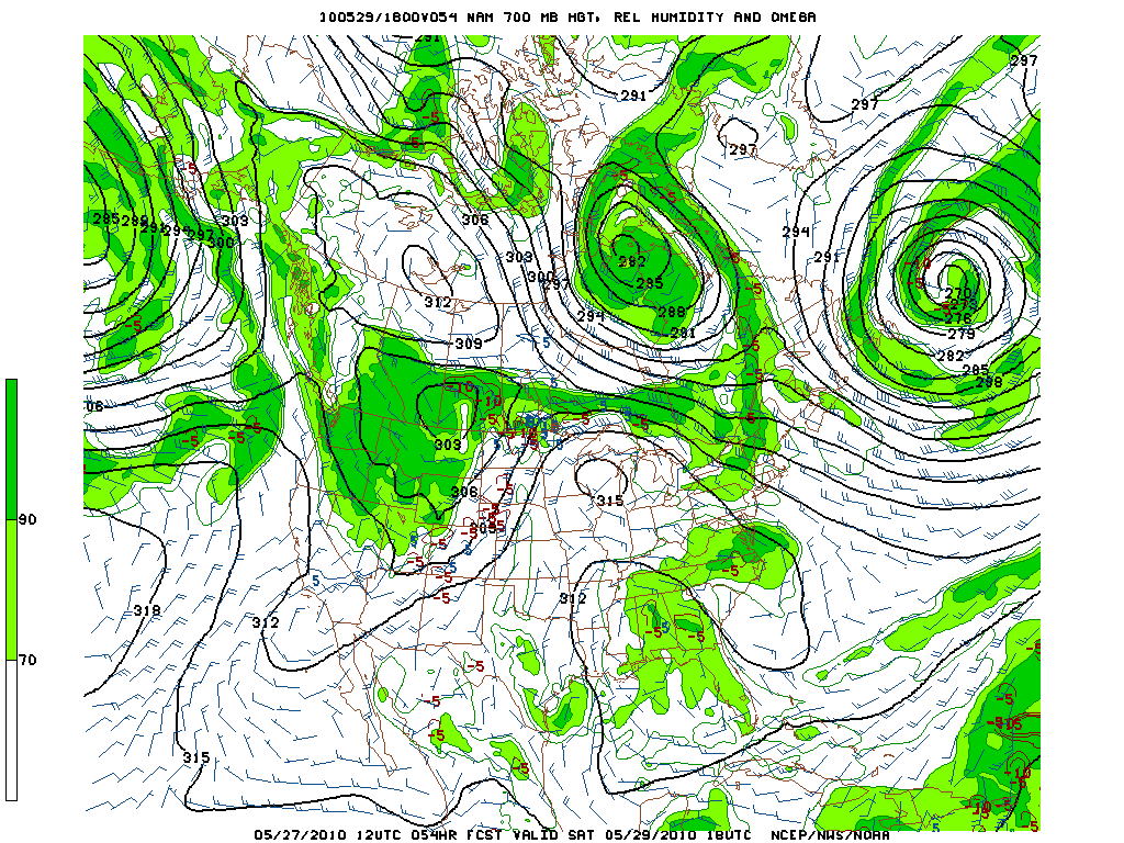
I think this makes sense. The maritime air, the post frontal eddies in the atmosphere, the mountains, the forecasted sun. All adds up to a random widespread shower breakout midday. The SREF’s have hinted at this as well. Note the small “blooms” of precip over the southern Greens and Catskills and Berkshires. 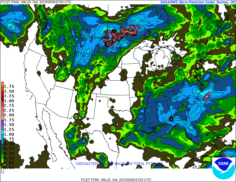
So all in all I’d give Saturday a mixed rating. Not going to be a total winner but if you are willing to deal with some brief showers midday and lower broken clouds you could have fun out there.
| Jump to: | Synopsis | Friday | Saturday | Sunday | Extended |
SUNDAY:
Primary Concern: System working north of the border could move south or at the very least send a significant chunk of junk south through n. NY and n. VT. Previous model runs places this system, which is running on along a warm front smack in the middle of the ADK. However this has moved north with time and now is sitting over Montreal. If that front sags south the ADK and northern greens could see rain and maybe a weak embedded T-storm.
Best Areas: After a few days of messy weather I’d say the Catskills are looking just peachy on Sunday. Convection has cleared, the threat or rain is to the north and sun a warm temps should prevail. Light winds and moderate dew point would be the only drawbacks. (Skeeters are starting to come out and a little breeze goes a long way).
RECREATIONAL FORECAST:
As mentioned, a system will be working to the north of the border. Rain will spread south from this system to just north of the border and should the system sag a bit this rain could work its way into the ADK. Will it? The trend has been the other way and given the strength of the warm air to the south I don’t think it will. I think Sunday will be mainly dry in these areas. But this is the weather we are talking about!
Though given the proximity of the system to the north, clouds will enter the picture in the north country. 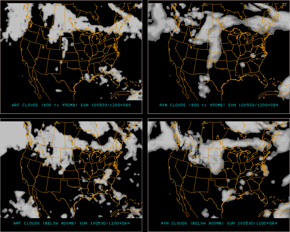
As mentioned, however, the clouds should stay clear of the southern Greens and Catskills. With the sun in place and warm front to the north temps should exceed seasonal averages.
SREF is spitting out low to mid 80s and I tend to agree.
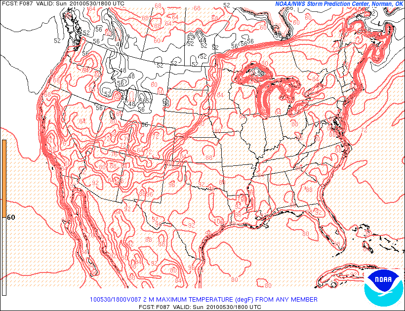
With a dpt approaching 60F it could feel a little sticky if the RH values start to get up there.
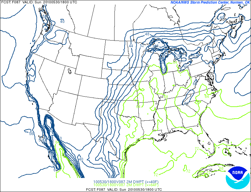 While this isn’t stick to the car levels it will be noticeable while exercising outdoors. So maybe a little extra water would be a good idea.
| Jump to: | Synopsis | Friday | Saturday | Sunday | Extended |
Extended outlook
Memorial Day: Front starts to push through the area and bring another round of T-storms and showers later in the day. Overnight some could be pretty heavy across the NE. Still a ways off but Monday afternoon looks so-so at this point.
So if you made it this far…get out there, have some fun and tell me what it was like. Email me, post a comment, tweet me back, txt me a message. I want to hear from you all. Where were the bugs, where was the mud, where did you go!
Until next week!
3 Comments
Leave a Reply
|
|||
| Home |




Ben
wrote on May 27th, 2010 at 3:20 pmThanks AJ! Sounds like Friday is the day to hit the local crags before the humidity climbs up! Slick rock sucks for climbing…
Anonymous
wrote on May 27th, 2010 at 9:53 pmloving this new format Lionel… holy sheet! great job. very much looking forward to using this tool all summer long
Greg
wrote on May 28th, 2010 at 6:13 ami’m bringing sweaty back… ….
…. ….YEAH!