The week before xmas and I’ve run out of witty Xmas related word play (UPDATED: 12/26)
There is a lot to address this morning and I’m sure all of you are busying wrapping presents, baking cookies, decking the halls and keeping those maids a milkin’ from getting out of pocket (’cause you know pimpin’ ain’t easy), so I’ll get right to it.
12/26 Update
Good morning! Hopefully everybody had a good safe Christmas. With the current storm we’re looking at the following:
– Sleet for the higher terrain of the ADK. It should mainly be sleet there and not too much freezing rain. Def. could see some rain mix in but based on radar returns up there it’s not really all that impressive. There is also a cooler pocket of air that could force some of the precip to change to snow for a period of time.
– Further east into VT i’d expect more rain as VT is on the wrong side of a developing surface wave.
– Sunday should be a quieter day
– As the primary low in the central part of the country ejects east on Monday it will pull a sharp arctic front in behind it. This should set of a rather robust snow squall. A few inches in 1-2 hours is very possible in both the NEK and ADK.
– Tuesday, the winds behind the Arctic front will be on a 220-280 vector and rather strong at h85. This should pull some lake moisture into the ‘dacks and greens. Would like to see a stacked low in canada to up the snowfall in the greens but that doesn’t seem likely. So we’ll lower amts and go for a light few inches from lake enhanced upslope snow on tuesday.
New Years Note: Also want to highlight the potential for an east coast storm around New Years. The weather people have really been talking about the potential for this storm for sometime and honestly the atmosphere is still pretty charged for a storm. This mess we’re currently enduring is merely a reload for next week and so I’d almost expect something to blow up around new years. However, this year and the pattern we’re in really wants to suppress the largest storms south and east along the coast. This was my fear in the summer when it was clear we were entering a strengthening El Nino year with cold teleconnections. Therefore at this time I don’t expect any storm around new years to help the north country. However tracks can change and nothing is set in stone. So stay with us here.
1. Tuesday/Wed snow:
The nor’easter that delivered two feet of snow to DC, DE and S. jerz has swung into the gulf of Maine. As it spins around it should interact with winds coming from the NW and bring some moisture to the green mountain spine and adk. Tuesday the best dynamics will be along the green mtn. spine. With Mansfield being ground zero. Not saying the it’s going to take one on the chin (ha…get it…oh sometimes I amaze myself) but I’d expect by the end of the day Tuesday for Mt. Mans. to pick up 4-5 inches of fluffy.
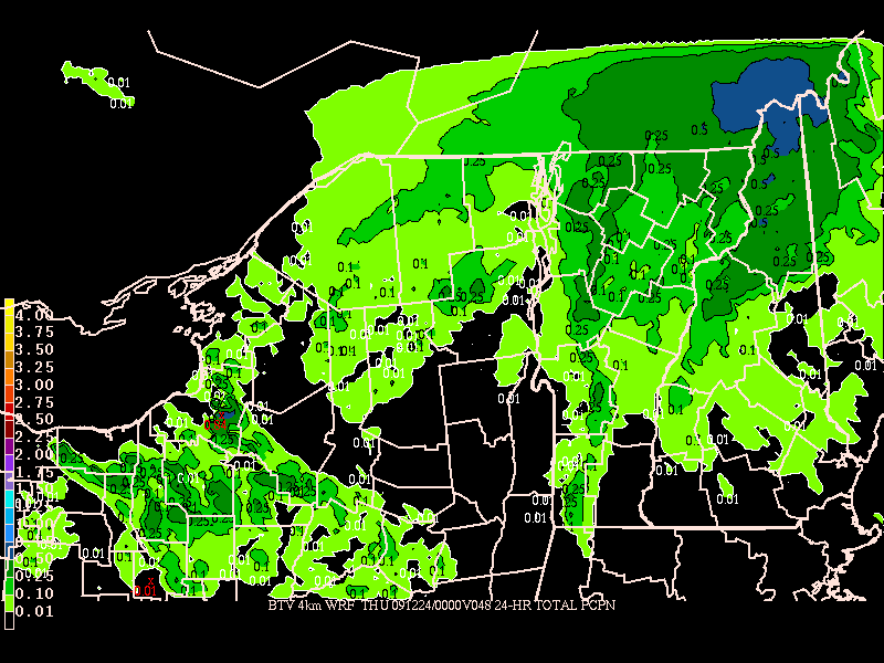
24 hr. precip ending Tuesday:

By wed. the flow will be a little wetter and a little more widespread. The ADK will see more snow, as will the rest of the greens. In this “flow pattern” the greens do the best because they are “cross barrier.” For the ADK to do best I’d like to see a more northern component. Regardless we’re looking at another 2-4 inches of snow with a few higher pockets getting into the 3-6 range.
tues-wed night accum precip:
2. Boxing Day Storm:
UPDATE
Well kids I wish I had better news. I wish I could say this system was trending in our favor but it’s not. Not that we’re going to get totally skunked across the board but it’s def. not going to be awesome. Even with a ton of model solutions out there, I just can’t see a way we don’t get a fair deal of sleet mixing with rain from this system.
Here’s the current forecast:
The low pressure system spinning in the central plains will cut itself off sometime tomorrow night. As it does that a warm front will spread precip N/NE through the midatlantic and into the NE. Upper level temps will warm above freezing. Despite immense model spread for where the upper levels will be below freezing, all generally agree that as far north as the Canadian border will see upper level temps >0c. This means that precip at the front end will not likely fall as snow. The snow growth region is very high with this system and so I see liquid precip falling. However, as the lower levels of the atmosphere will be below freezing at the start of the system up until maybe midday saturday, the bulk of this precip will freeze from around 5kft down to the ground. Thus I’d see a fair amount of sleet for the adirondacks. Vermont/NH will see more rain because of the placement of the systems.
By the time we get to sat afternoon/night we start to see even more model discrepency. some show a seconary wave of surface low pressure develop in the Philly-NYC-NJ coast region. The effect of this low, is also unclear. On one hand it could certainly pull dry air into the system shutting down precip (not bad if it’s too warm) or it could pull in cooler air and turn rain back to sleet. Personally I’d go with the dryslot route for the adk and – well – you don’t want to know for VT/NH. The effects aren’t pretty for those areas.
(SIDE NOTE: There is NO consistency with timing on this piece of crap. We could be dealing with a 24 hr event from friday night to sat night. We could be dealing with a 36 hr event or a 24 hr event from sat night to sunday night. This thing is a mess).
Anyway, as sat night turns into sunday am, a cold front will push through the region. Now if there is any precip left, it should turn back to snow. The best place for this to occur would be in N. VT. The primary and secondary lows at this time will be merging in So. Canada. and a broad cyclonic flow looks to develop. This will give us some upslope snowfall Sunday. Not loving the set up (air seems a little dry) but nevertheless there could be some accumulations. I’ll watch that closely.
NOW while this fluff is nice and necessary, the real story is what happens on Boxing day. (BTW we’re still working on the storm naming system. So far this is storm #3 and I’m thinking of giving storms female names. I’m thinking this one is “Courtney” and by way of background she played soccer, is spastic and prob has anger issues)
First the facts:
— A powerful low pressure center will develop and deepen over the four corners region and move N/E towards the central plains. On the backside of the system high winds will whip the plains with snow and blowing snow.
— The system will bowling ball right around Chicago.
— It will be cold in the NE before the system and a large snow pack exists down into the Midatlantic which any air from the south needs to pass over before it gets to the North Country.
Those are the facts. (not very different than the facts I laid out last week). Here is where the story gets complicated. My confidence is growing that we’ll be able to add the following to the facts list:
— A secondary low will develop along the NE coast somewhere sat.
— The primary low will weaken and cut off around the western great lakes.
— Warm air advancing from the south will fail to penetrate deep into the North country as it moderates over the Midatlantic snow pack, the secondary develops, and the primary weakens.
— Central PA/Central NY state will deal with ice issues
— Upslope/LES could be very nice in the days after the storm.
To understand all of this you are going to have to bear with me. I’m going to take you through ALL the model runs because I want to show all what’s “in play.”
GFS:
Last week the GFS waffled between a coastal solution and an inland cutter route for a period of time. Then around the end of the week it settled on a primary low heading into the great lakes. As I wrote last week the question would be whether a primary low develops along the coast and the track of the primary low. My perspective at that time was that the GFS was having trouble with developing a secondary low and was either losing the primary to develop a coastal or losing the secondary coastal to strengthen the primary. This was what caused the waffle. Still having some trouble in that regard as of Monday.
12z Monday run:
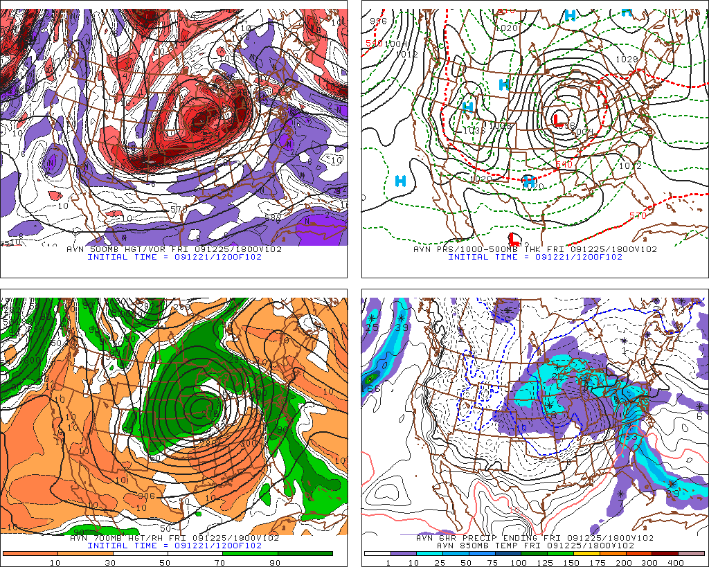
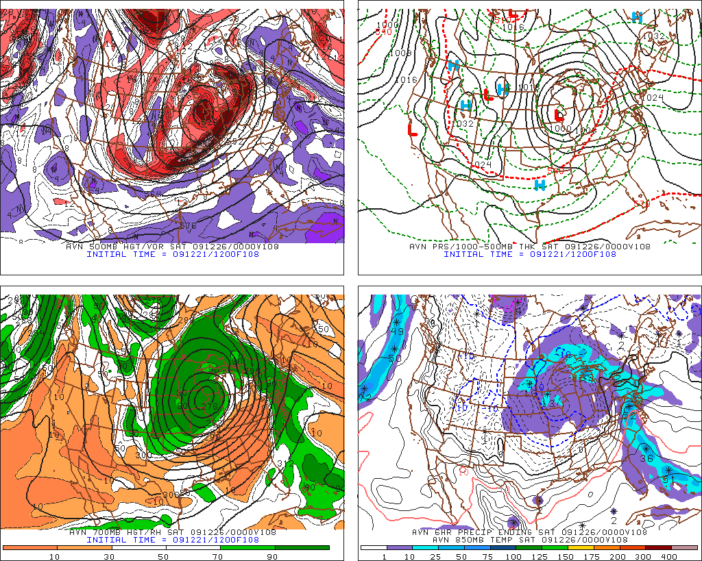
As you can see in these pictures, the primary low gets cut off by the GFS as out ahead warm precip heads into the NE. Upper levels of the atmosphere are not conducive to snow all the way to Canadian border, while cold air damming is occurring at the surface, and temps at 5k hover around freezing all the way down into central PA. The GFS on that run develops NO secondary low and delivers a rainy mess to the coast, ice disaster to central pa and s/central NYS and a mixed bag of snow, sleet to the ADK with snow to rain for vt. However I think the GFS is like a dog chasing it’s tail here.
Look at the 0Z run from today:
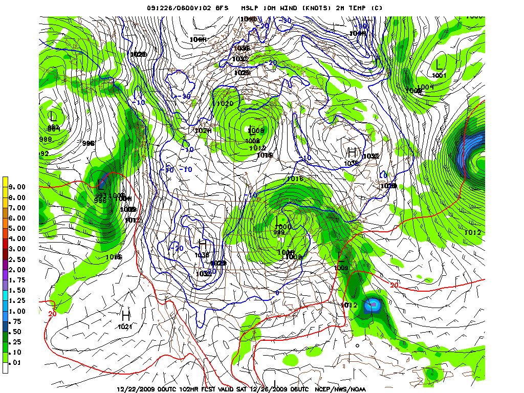
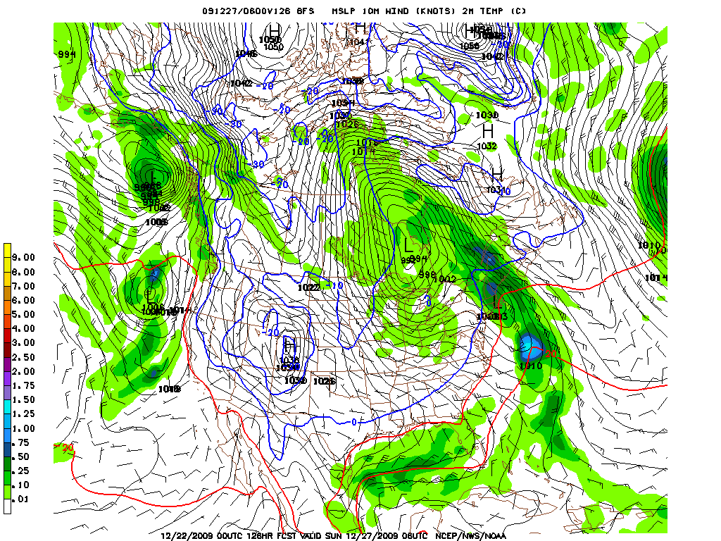
Just 12 hours later the GFS gives you a rather robust coastal secondary low that moves into the conn. river valley, pulls any warm out away from the ADK. Totally an about face from the last runs. So what do we do? Look at other models.
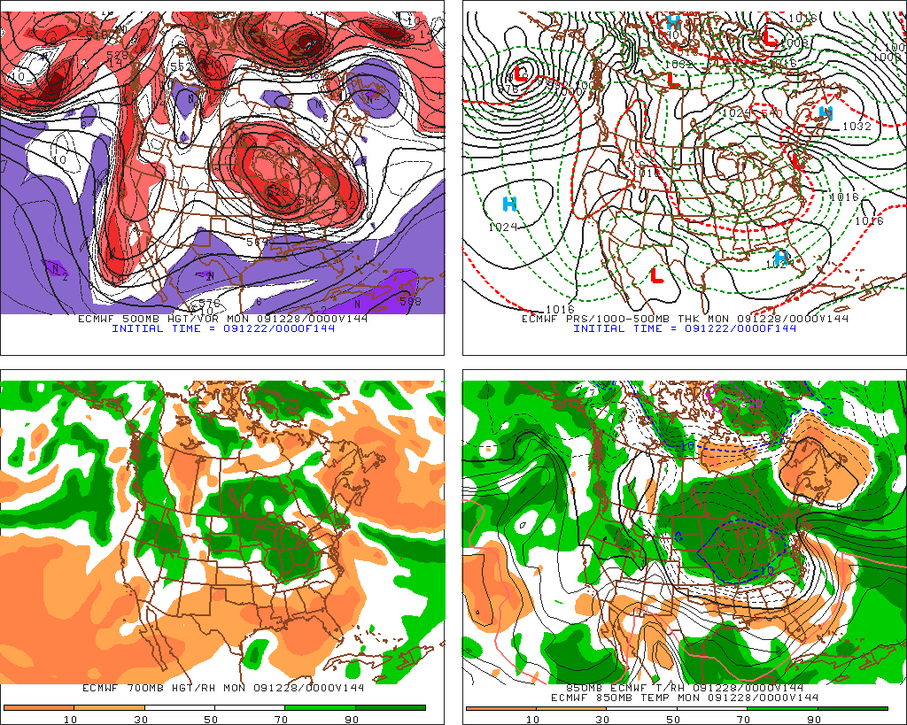
The EURO:
While not the “king” of this winter like it was last year the Euro has had a few key moments. For one it was one of the first models to hint at the power of the latest nor’easter. It even got the track kinda right.
On Monday the 0z euro showed a cut off pattern similar to the GFS. No secondary low. 5k temps at or around freezing, frontal passage, turns precip back to snow
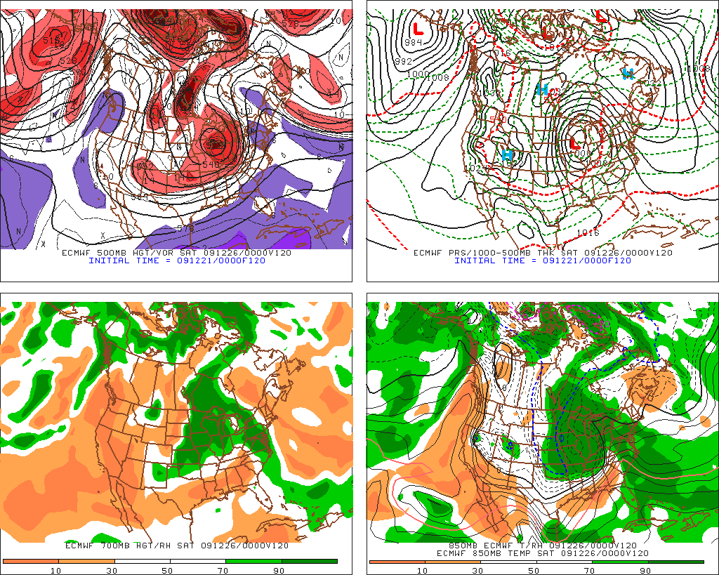
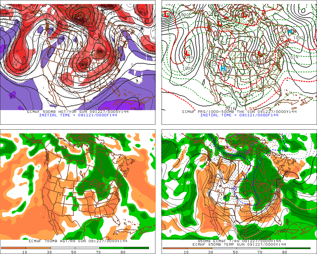
By the afternoon however the Euro had begun to come back to the idea that a secondary low would form:
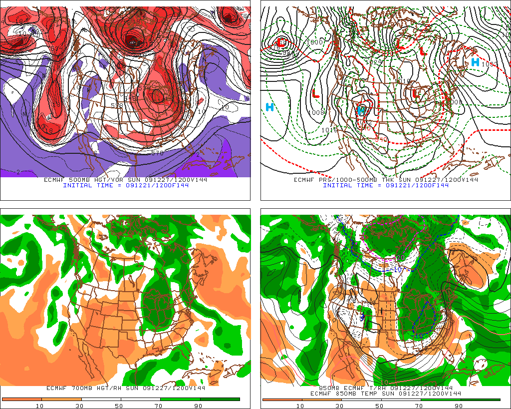
So clearly the Euro is sniffing around the same solution the GFS is. Under both of these models we’re looking at snow to sleet for the north country, then snow (light) in the adk and rain in New England.
This morning the euro had stuck with the solution of yesterday:
Tues 0z
CMC:
I like the CMC. Other people don’t. Of course some people like raw bell peppers, aspargus and chicken livers.
Anyway the CMC has been fairly consistent with showing the low in the plains become cut off, a secondary low developing and moving just inland along a baroclinic zone. The CMC would give the ADK a very nice snow event with only a little icing to start.
0z Monday:
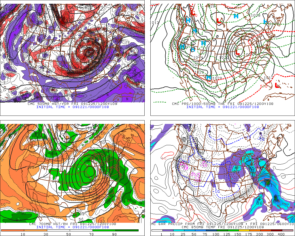
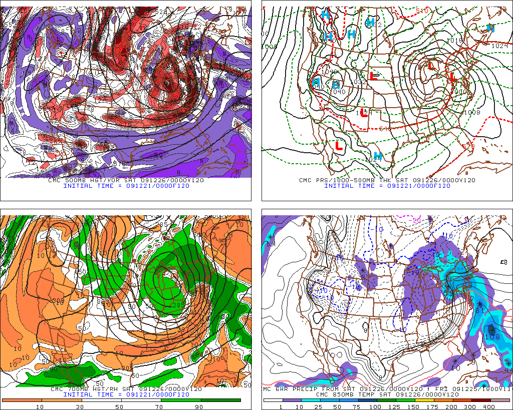
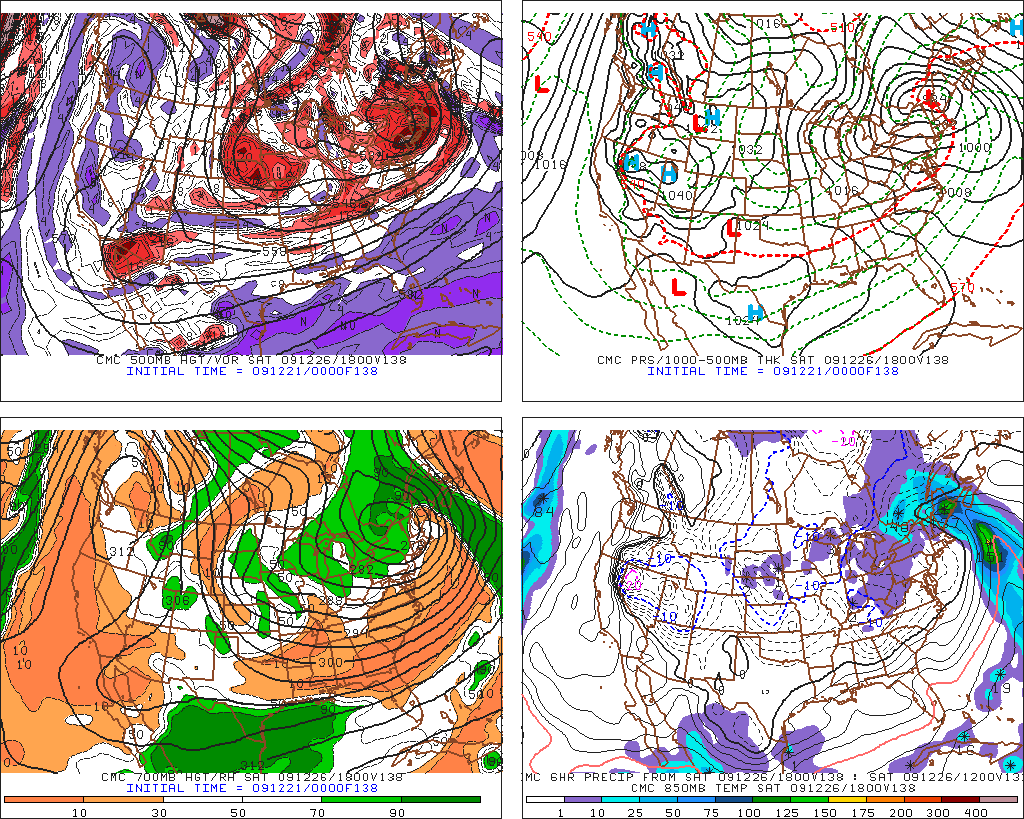
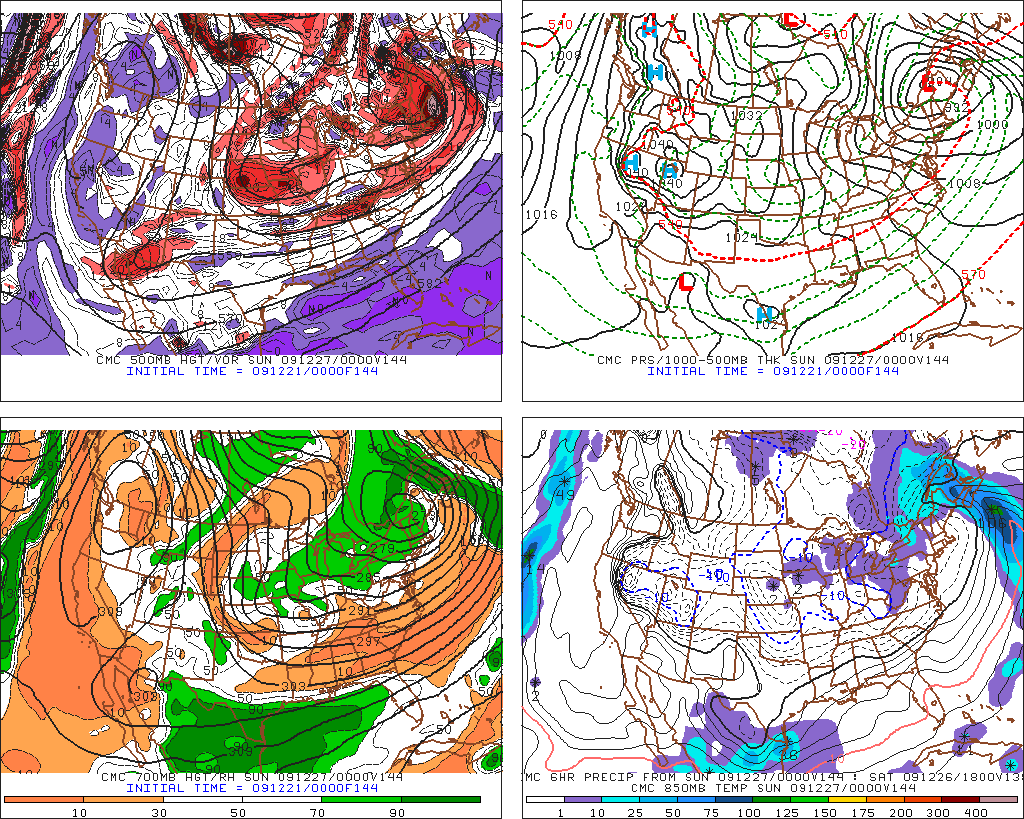
In this last picture take note of where the low ends up. I see the best thing to come from this system is the wrap-around/Upslope/LES in the wake of the event. The GFS in later runs trends towards placing the low as a vertically stacked system in roughly the same position as the CMC. This would be great. Steady light snow for a few days along the green spine and ADK coupled with a wind vector off the lakes pulling precip to the NE is a wonderful set up for us. So we have to watch that all.
12Z CMC on Monday was almost the same. (Remember how all the other models went back and forth).
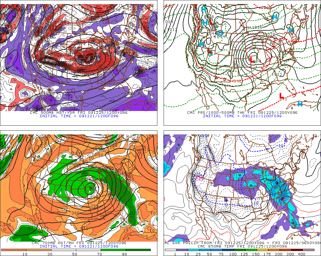
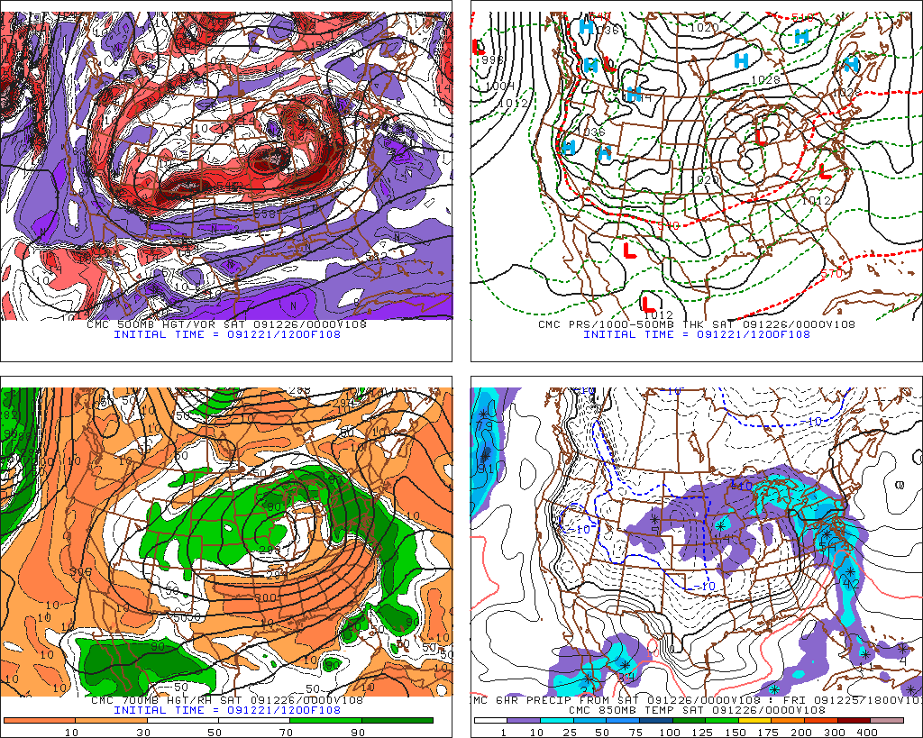
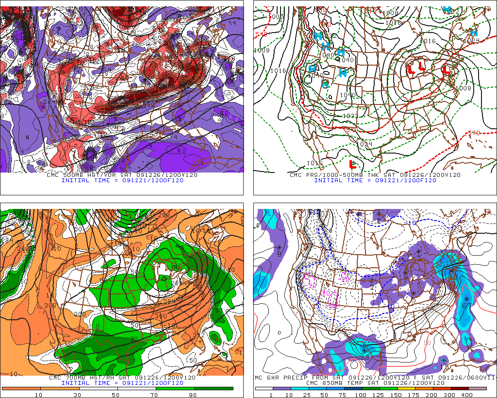
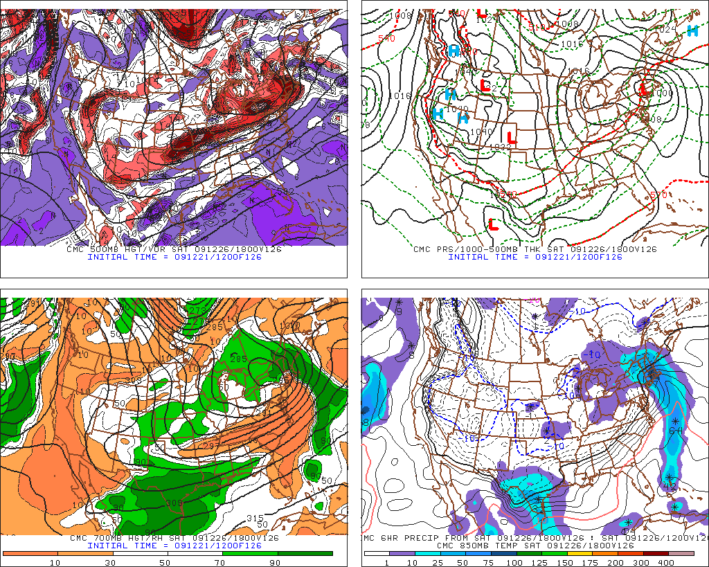
All in all it’s too soon to make any calls regarding snow amounts, ice amounts, sleet amounts and whatnot. Best thing I can say at this point is that the ‘dacks aren’t looking at all rain, a secondary could develop and help us out a lot and don’t listen to all the harbinger’s of doom talking about this being a rainy disaster for the NE. It’s far too soon and there is far too many suggestions that that isn’t the case to worry about that right now.
One thing: I have had some questions about what makes this storm dangerous from an icing potential. I’ll explain that here.
3. Long Range:
Following the passage of the boxing day system we look to be cold through to New Years with some LES snow and flurries each day as a possibility. Storm threats exist right around new years with a pattern relaxation forecasted the first week of January. (makes sense to me as we would have been in the current pattern for roughly 6 weeks and the system needs to reload before my blockbuster feb. develops).
16 Comments
Leave a Reply
|
|||
| Home |




Chris
wrote on December 22nd, 2009 at 10:29 amHey Lionel….Heading up to Saddleback tonight…whats your take on accum up in the Rangeley region out of tonight/tomorrow’s event?
I’ve seen 6+” mentioned by a few Maine TV stations but wanted to get your take.
Thanks!
Canadian hiker
wrote on December 22nd, 2009 at 10:49 amThanks LH for the update was waiting for this update. When you call for potential rain, I take for granted that it’s going to be snow at least somewhere up north here in Canada. I like how things are shaping right now. I stay positive about “Courtney”.
Greg
wrote on December 22nd, 2009 at 11:36 amyour writeups amaze me LH! thanks dude
Could Be Buggy
wrote on December 22nd, 2009 at 11:54 amMS Paint! Glad to see you are back!
Greg
wrote on December 22nd, 2009 at 12:42 pmVIVA LA LH’s MS PAINT MAPS!
bob johnson
wrote on December 22nd, 2009 at 12:24 pmYeah we need some Maine casts, this storm looks to bring much more snow to Maine than the ADK and Greens.
powhounddd
wrote on December 22nd, 2009 at 1:21 pmCourtney likes Frenchmen and she’ll be visiting us.
Doremite
wrote on December 22nd, 2009 at 6:38 pmCan you please wrap a bow around the 540dm line and slide it just below Jay Peak. Thanks.
BushWhacker
wrote on December 23rd, 2009 at 3:38 pmGreat website! I love the updates…most of it is over my head, but I love em when you tell me it is going to snow!
I'm_a_crappy_skier
wrote on December 23rd, 2009 at 9:18 pmYou simply rock!
Heading up to Whiteface Saturday. keeping a careful eye on thruway ice. Me thinks if I start late (noon) and clear Albany by 3PM I should be ok… Will make depart time descision Friday night when latest forecasts are in(central dirty jerzey).
Happy Holidays FIS!
Evan
wrote on December 24th, 2009 at 12:25 pmWhy does it always have to rain on or around Christmas? Any hope for New Years like Josh Fox is talking about? He’s already broke my heart predicting no rain for the rest of 2009 so my trust is not there.
Greg
wrote on December 24th, 2009 at 12:59 pmUghhhhhhhh…… If only nature loved her averages in the sense that the two weeks of arctic air we’ve had recently could average with this warm storm. The humanity!
W. Petrics
wrote on December 25th, 2009 at 9:33 amFor some odd reason, the NE US climatologically has a Christmas thaw. While it does snow in NE on Christmas, it is actually rare over the last 100 years. It snows on New Years day more frequently. Many old Vermonters call the 25th the regular Christmas thaw.
Doremite
wrote on December 25th, 2009 at 8:40 pmYo LH:
Merry Christmas. Thoughts on possibility of Northern VT seeing some snow on the backside of this slop?
Greg
wrote on December 26th, 2009 at 10:12 amLH was just kind enough to forsake a few minutes of boxing day merriment topost an update.
Harvey44
wrote on December 26th, 2009 at 3:55 pmLionel – thanks for the updates – today’s – and all of ’em. (Wish I could figure out how to feed the updates. I think because they are part of an older post, they don’t show up our FIS feed on Harvey Road.)
I’m constantly trying to figure out how elevation will impact the canned weather news reports that are out there. I mean I KNOW elevation helps. But not in every case, and not always to the same degree. In the Southern Adk, tree skiing bases are a precious commodity. In a storm like this one, any sleet we get is gold.
Thanks again for everything. The diligence is really appreciated.