A Day Fit for Kings
By: Ben
March 12, 2010
Unfortunately, by this time no one else had appeared in the ravine and we were beginning to get worried! Surely on such a nice day Tucks would be crawling with people!? We consulted maps, GPS, sextants, and even looked at Greg’s IPhone, but we couldn’t figure out where we had gone wrong.
Tom was really worried.
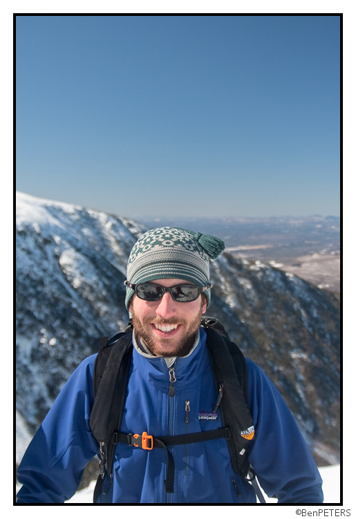
We decided to do what any responsible mountaineer would do when hopelessly lost – head up.
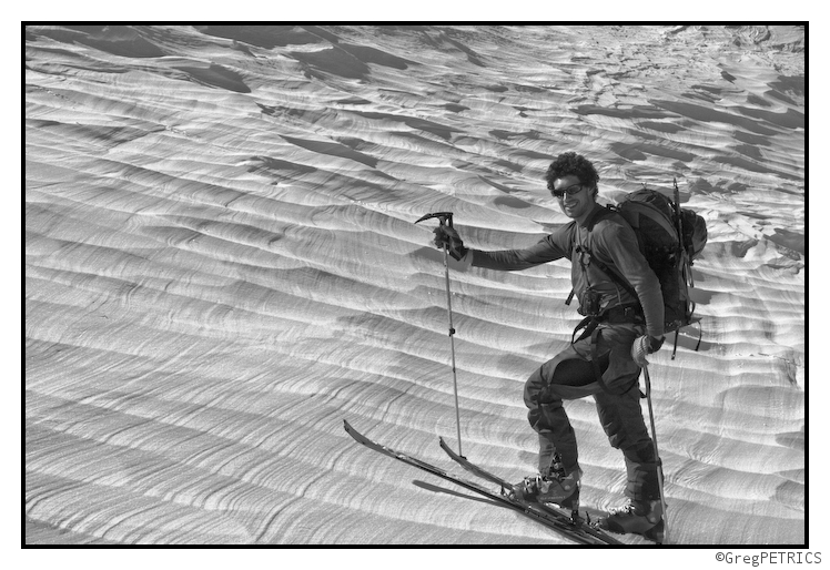
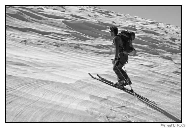
Maybe this is the Sahara? Where is this? Hellbrook?! WE’RE LOST!!
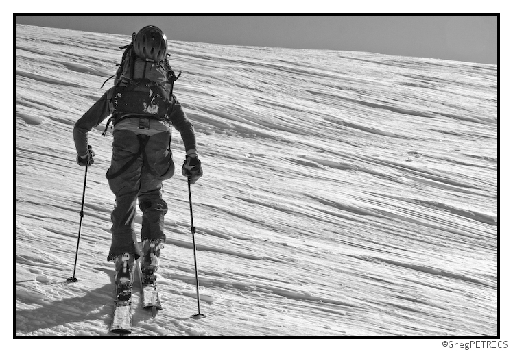
We gained the summit where we attempted to get our bearings. That should be Monroe to the south…
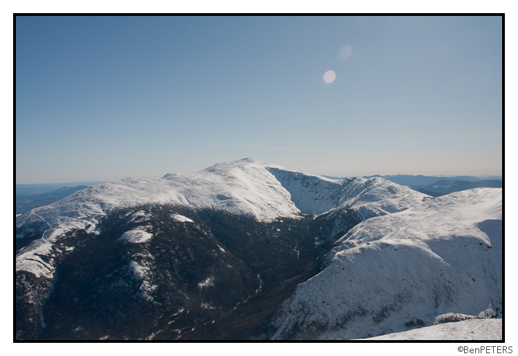
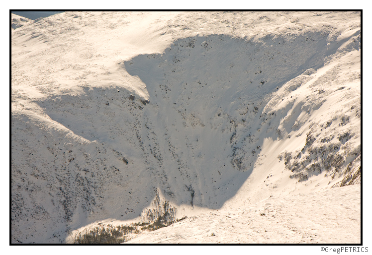
Maybe that’s Tuckerman?
Read about the author: Ben
Enjoy this TR? Read another: TR: The Great and Improbable Mother’s Day Mother Load
28 Comments




Greg
wrote on March 12th, 2010 at 7:16 amBeyond excellent Ben… incredible. Definitely worth the wait XP
Evan
wrote on March 12th, 2010 at 9:13 amPetricks-Peters Cooler? I was thinking something like Butta’s Blogg Flogger. Either way nice line.
Paul
wrote on March 12th, 2010 at 1:07 pmNot fair that you guys/gal have all the fun. Thanks for the pics. Great to view while at work.
ml242
wrote on March 12th, 2010 at 1:58 pmhey, who posted and made you guys the kings of new hampshire?
K_C
wrote on March 12th, 2010 at 2:31 pmNice line and nice pics! Too bad you had the Xtreme gaper with you – did he tumble down the bootpack and take everyone out along the way?
Ben
wrote on March 12th, 2010 at 2:34 pmYa, we really had to babysit that one. first he booted all the way up the skintrack, then he beatered down the headwall while trying to ride it switch to the road.
Most egregiously he failed to get apres-ski beers from the overly religious gas station owner who chooses not to sell beer…
Anonymous
wrote on June 23rd, 2010 at 11:53 pmI believe you mean most eGREGiously
Patrick
wrote on March 12th, 2010 at 4:19 pmNice work! Though, as you admit, it’s a little hard to believe no one’s skied that. 4500 vertical must be nearly the most continuous vertical descent one can ski in the East however–since Mt W to Pinkham is only 4300!
Greg
wrote on March 12th, 2010 at 4:24 pmMTW to the Glen House is a bit more than 4500 I believe.
Ben
wrote on March 12th, 2010 at 4:36 pmyep! Baxter Peak to Abol Bridge is 4640′ – but even if you skied off the west side of the mountain instead of the usual north/east side, the last mile or two would be pretty flat…
But ya, 4500′ of relatively good continuous skiing is pretty impressive for the EC!
Joanne
wrote on March 12th, 2010 at 9:34 pmYah, we figured last weekend that the descent was probably the longest one on the east coast… Glad you got into one of the many new lines!
christian
wrote on March 12th, 2010 at 4:54 pmman, tucks looks like crap this year…the pee pee cooler looks sick, can’t wait to falling-leaf that thing.
Greg
wrote on March 12th, 2010 at 5:03 pmYou’d gape that thing in your jester hat dude.
Sam
wrote on March 13th, 2010 at 6:43 amnot a first descent. I skied it once in the early 1980’s on skinny skis and leather tele boots. So what if I wasn’t born yet.
Allen
wrote on March 13th, 2010 at 7:05 amYou guys should come to the Himalayas, plenty of FD’s for the taking.
noel
wrote on March 13th, 2010 at 11:57 amit’s too bad I tracked out your line in the great gulFIE the day before.Nice pictures. I can see my tracks from tuesday.
Greg
wrote on March 13th, 2010 at 5:27 pmActually not. We noticed the previous party neglected to ski the pow far skiers left. What were you guys thinking going dead middle? Best snow was on the corners!
EO
wrote on March 13th, 2010 at 11:24 amDefinitely not a first descent. I think some guy over on T4T with infinitely more soul and coreness skied it first.
Ben
wrote on March 13th, 2010 at 11:27 amI thought that was a given!?
I mean, we are AT skiers, therefore we are bereft of soul. I don’t think it’s possible for us to have fun even if we tried with our heels locked up all the time.
samthamandaddy
wrote on March 13th, 2010 at 4:24 pmeXCELLENT BEN—–YOU GUYS HAVE DONE A GREAT JOB WITH THIS!!!
Jonathan Shefftz
wrote on March 13th, 2010 at 4:54 pm“4500 vertical must be nearly the most continuous vertical descent one can ski in the East”
— Close, but not quite: the max is 5100′ from Mt W summit to Dolly Copp. (A critical part of the route — allowing it to be a continuous descent — just happens to be in one of the pictures in this TR, which is why my partner brought this TR to my attention.) We skied it March 13, 2005, although I’m sure it’s been skied before and since. (Everything up there has to have been skied a zillion times — doing anything original on that mountain is pretty much impossible.) The only route I can think of that offers a greater vertical drop would be from the summit to Jackson — this is continuously skiable, but unfortunately would require a small ascent mixed in with the descent. I’ve tried to map and scout out some continuous descents to Jackson, but unfortunately they would seem to require absolutely heinous bushwhacks.
Greg
wrote on March 14th, 2010 at 3:55 pmwe almost called the website famous internet heinous bushwhackers… i’m not sure we get that part of what we do across well enough on here.
I’m fairly convinced that–even if I’ve never skied a turnbacker line (in which a friend “turnsback” because it’s too gnar)–I’ve bushwhacked a few turnbacker thickets
Anonymous
wrote on March 15th, 2010 at 11:25 amNice pics! Great ski lines everywhere. Nice to see a different aspect skied. Hmnnnn…… looks like a piece of the Auto Road showing in the,”…Monroe looking south picture” in far left? Clue!
christian
wrote on March 15th, 2010 at 5:53 pmwow
mason
wrote on March 17th, 2010 at 7:56 amChemin des Dames?
Greg
wrote on March 17th, 2010 at 7:22 pmChemin des Dodo :D
mason
wrote on March 18th, 2010 at 8:29 amWell done.
Doug
wrote on May 25th, 2013 at 10:48 amFunny stuff. Great photos as usual. Come down to seacoast NH some winter (every third February) and ski the Stratham “Alps” with us. Look out free-heeling is infectious.