A Presidential Orbit
Planet Washington needs almost no introduction. It’s busy, accessible, and a little bit out of control. I don’t know if it’s ostensibly good or bad, but I always kind of like it up there, even on its most “circusy” days. The carnival, in my opinion, is better to have on one peak in a concentrated fashion, rather than on all of them (e.g. the Blue Ridge Parkway). In addition, I like that so many different types of people can enjoy the experience of being up on such a beautiful planet who might not otherwise have the chance. I’ll be the first to admit this planet isn’t technically perfect, but what do you expect from a dog-tired presidential orbiter at the high point of his journey?
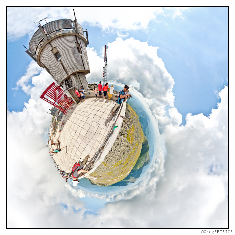
We chose the path of Crawford’s Comet back down from the depths of Planet Washington. A steady stream of travelers made their way down to Lake of the Clouds. While the many hikers streamed in to the hut, and began to get their bunks in order for a nice relaxing evening in the mountains, we were just passing through barely past the halfway mark on our journey. We weren’t on such a rigorous timetable however that we couldn’t stop for a quick dip in the watery planet.
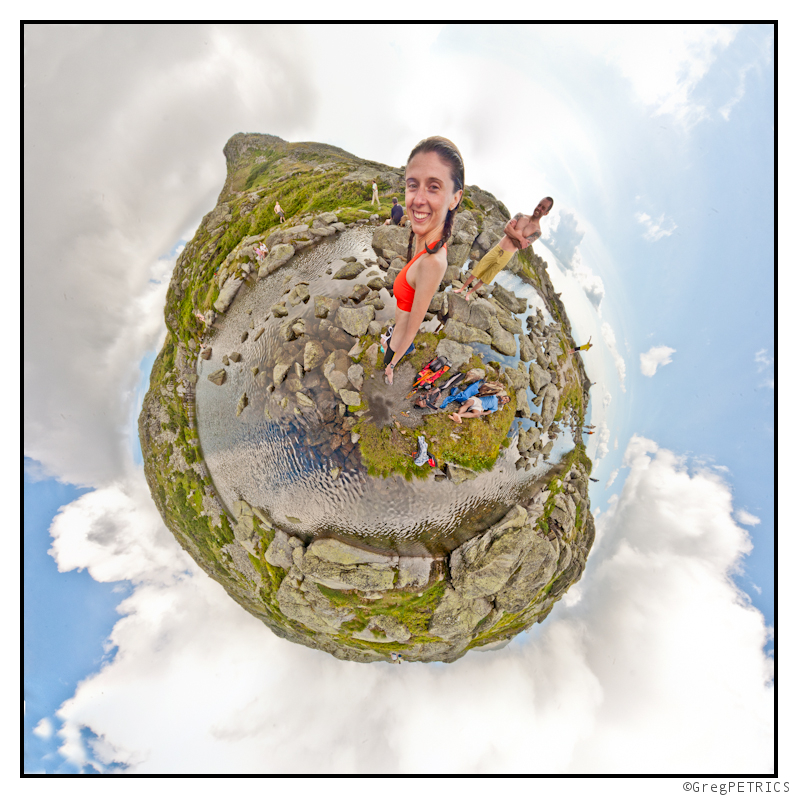
After cooling off in the crisp alpine lake, we hurried up to Planet Monroe. Despite the fact that you are past Washington, and feel that you have a mostly down hill journey, the view from atop Monroe is a stern reminder that there is still a good bit of distance to cover before touching down at Crawford Notch. You can see it for yourself stretching out at “10 o’clock” in the picture below. Christian might have cried a little when he caught site of all the distance that remained.
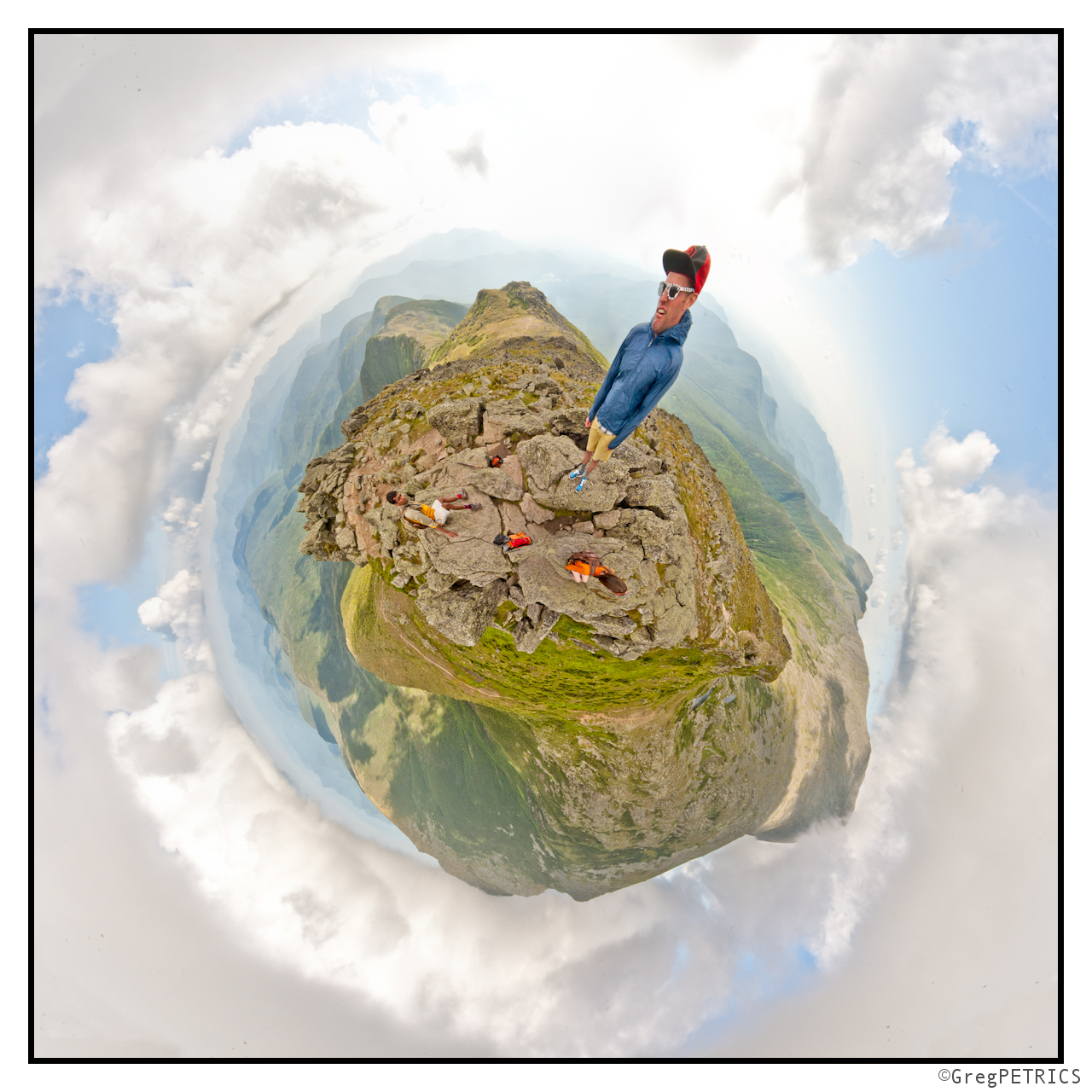
The pain in our leg muscles that we experience on Monroe suddenly turned into pain in our ankles, hips, knees, the pads of our feet and backs by the time we made it to Planet Franklin. Incidentally, I’m not actually sure if Franklin is an official peak or not (I would guess not), but we stopped for the photo anyway. We didn’t linger however because we knew that the big uphill climb (big, at least, when you’re 20ish miles, 7,500 vertical feet, and 9 hours into your trip) to Eisenhower remained…
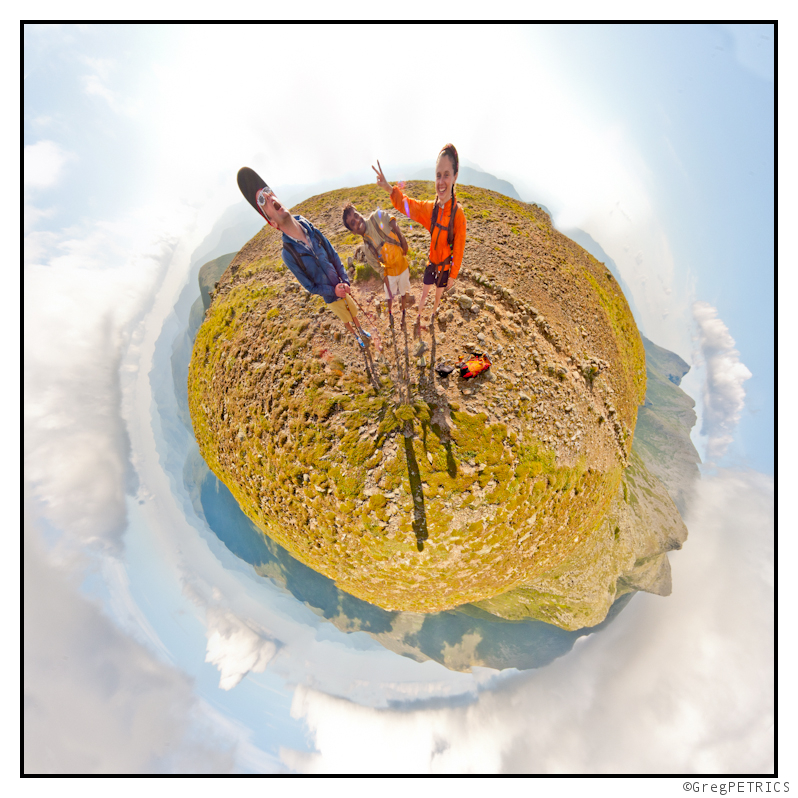
Planet Eisenhower is a cool peak in the southern portion of the Presidential. It’s the last “biggish” peak. As you come up underneath its summit push, it does seem to loom horribly high above you. The view from the top though is superb as the lesser peaks of the Southern Presidential seem to bob left and right building up to Washington. There is also a tremendous cairn marking the top. As the evening light poured in from the west, everyone in the group had their moral lifted as we took in the sights, and relished in the fact that we were almost done.
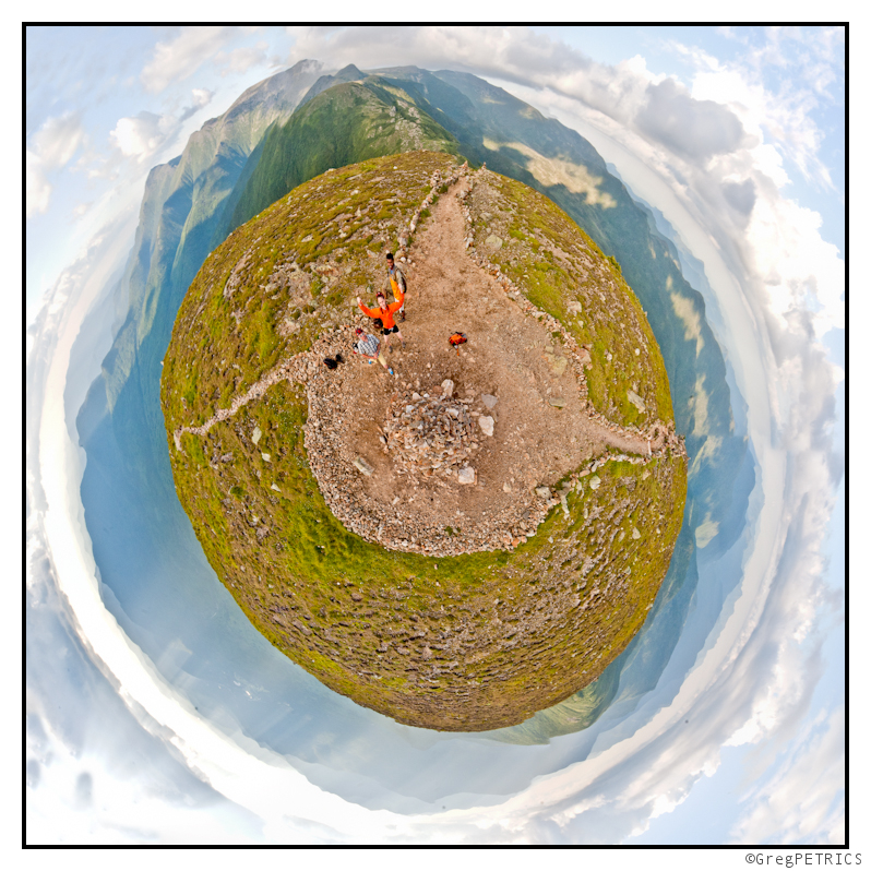
The last bit of trail between Eisenhower and Planet Pierce is rolling, and frequently dips below timberline. We trundled across the divide reasonably quickly however, and soon enough popped out onto Planet Pierce just in time for the sun to dip below the clouds that were building in from the west. Since this was the final peak, we all took a long, well-deserved break.
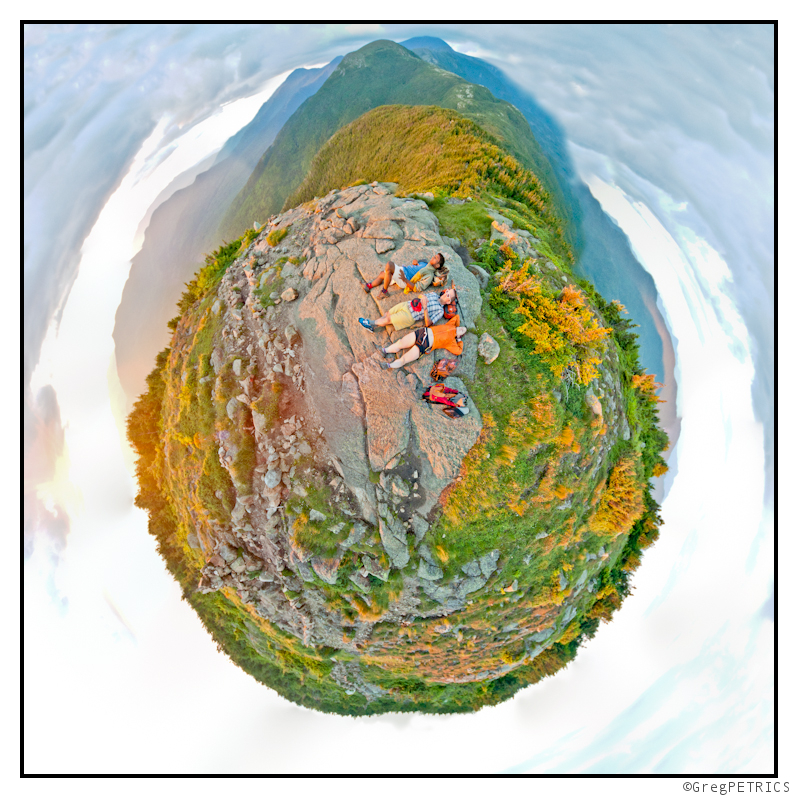
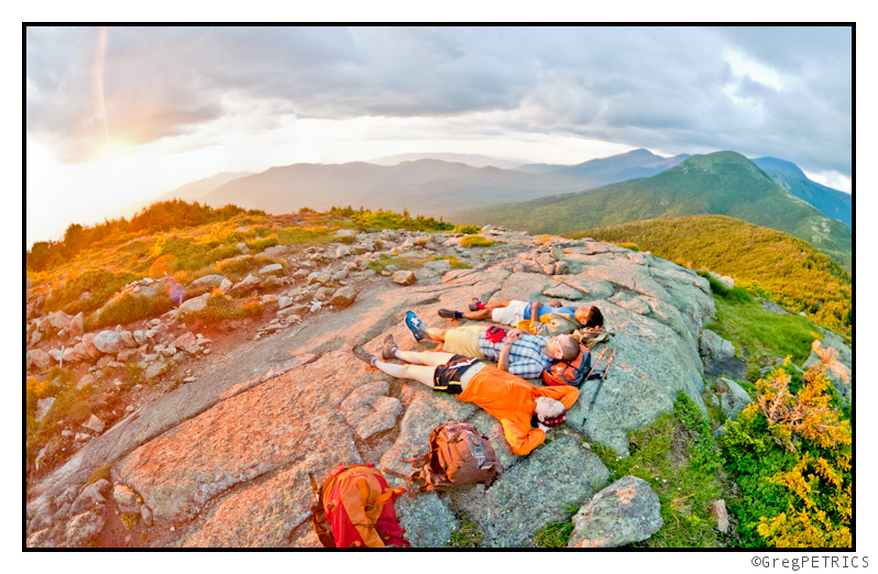
Touching down for the last time–the orbit complete–we were all satisfied to be back on terra firma. Congratulations (or at least beverages in a cooler) for safely returning from our interplanetary expedition were just a few short miles down the Crawford Path back on Planet Earth.
Read about the author: Greg
16 Comments




icelanticskier
wrote on July 11th, 2011 at 10:36 pmi shoulda gone into this one, chem free;)
now i’m really fahked……….
unreal
rog
Talbert
wrote on July 12th, 2011 at 10:12 amPlanet Superball IX, another galaxy.
https://lh5.googleusercontent.com/-kVRO5tSC0K0/ThuyEJVFbnI/AAAAAAAAAbI/_Yp70vZ0u1M/s144/planet%252520superball.JPG
Greg
wrote on July 12th, 2011 at 10:15 amgot a bigger copy josh? the link goes to a thumbnail!
Talbert
wrote on July 12th, 2011 at 10:57 amWhoops.
https://lh5.googleusercontent.com/-kVRO5tSC0K0/ThuyEJVFbnI/AAAAAAAAAbI/_Yp70vZ0u1M/s640/planet%252520superball.JPG
Thanks for the inspiration.
MadPatSki
wrote on July 12th, 2011 at 11:02 amAwesome…your planet feel almost as crowded as Sluice on that day. :P
Always have to be careful with the gravity and not falling off the face of the Planet. I hate when that happens.
surf88
wrote on July 14th, 2011 at 4:40 pmNice!!! With all the times we crossed paths I’m glad I made into a pic. On Planet Adams Im in the blue shirt at 8oclock. Clay is probaly my favorite orb Great Gulf looks really cool and extra steep in it.
Greg
wrote on July 19th, 2011 at 8:29 amsweet! I’m glad you spotted yourself. I saw your post over on surf88.wordpress.com, and tried to comment, but it didn’t show up. Any thoughts? I also noticed there is some misaligned sidebar issue in google chrome on an Apple machine…. let me know if you want a screenshot…
hope to see you in the mountains soon!
Anonymous
wrote on July 19th, 2011 at 9:30 amhuh? not sure why the comment didnt show up. Usually I get notified on comment attempts, and I didnt. The chrome/apple issue I probably wont be able to fix because I’m using a WP theme on WP site, and this is the best theme I’ve found for my blog. I’ve recently purchased a domain and server space and am working on starting a new site to move my TR’s to.
TEO
wrote on July 23rd, 2011 at 8:45 pmUh, it’s M-o-n-r-o-e, as it President James Monroe. Apparently, you’ve been wisely breakfasting at the diner in Twin Mountain, Munroe’s (Family Restaurant).
Greg
wrote on July 24th, 2011 at 8:43 pmoops! Noted and (more importantly) corrected.
Beef Wellington III
wrote on August 10th, 2011 at 9:59 pmMost excellent, Greg! Question: how did you produce these pictures? I’m guessing: a fisheye lens & photoshop.
Greg
wrote on October 2nd, 2011 at 10:23 pmSorry for bot replying sooner. These are produced as follows:
First take a 360 by 160 (YES, 160) pano by whatever means u like. I use a sigma 12mm on a full frame sensor camera held in portrait orientation.
Then stretch in GIMP or Photoshop into a square image.
Finally hit the image with a polar coordinate transformation with x=theta and y=r. Done! :D
christian
wrote on December 4th, 2013 at 11:00 amwhat an awesome day this was!
Greg
wrote on December 6th, 2013 at 7:01 amYoubetcha