“Upslope” Snow on Tap for Friday Morning
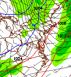
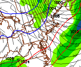
On thursday a moderatly strong low pressure system will skirt along to our north. As it does, it will push the ADK and VT into the warm sector, bringing some snows along at the front end from WAA/isentropic lifting. Once the warm front passes early thursday AM, the precip will remain as light rain. Later in the day, as the system moves out, a cold front will pass.
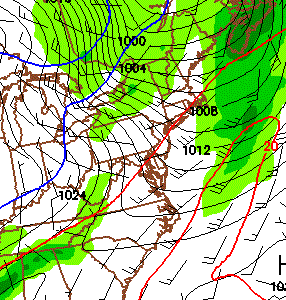
As it does it will turn winds from a southerly direction (bad) to a southwest/west and eventually NW direction. (good).
Here we are going through the morning from 6z to 9z to 12z.
Now what does that mean? Well it means we’ll see a cross barrier flow into the spine of the Greens with some low level lake enhanced moisture. (also good).
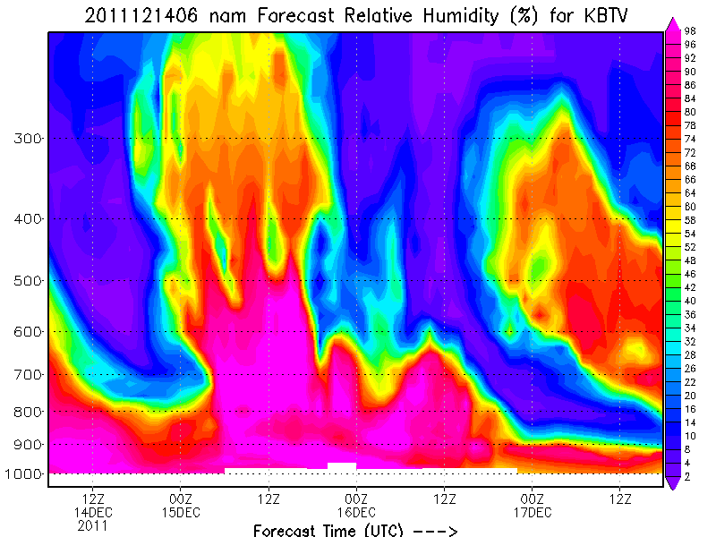
So looking at the specifics here we see that early friday morning- 6z through 14z (or about 1am to 9am) the factors look to be in play for an upslope snowfall along the Green spine.
We see decent airmass saturation from the ground to about 850/700mb in the period:
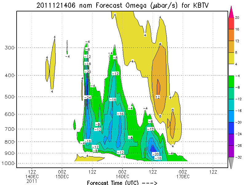
We see actually VERY nice omega values (represents upward motion in the atmosphere). We like to see big numbers around 900mb:
The only conern is the moderate temps. We’re just not going to get the best uplift and mositure in the prime snow-growth region. Ideally I’d like to see the max upward motion occur in a region of 85% RH or greater with temps between -10 and -15C. We’ll be warmer than that:
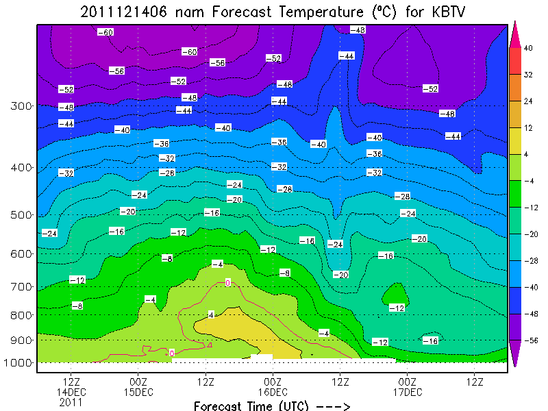
Now this doesn’t mean we will not get snow, it just means it will be a wetter and denser snow. Given the need for some base, that might not be a bad thing. All in all I’m looking forward to the first “magic” snow of the season. I’m reserving my totals estimate until the higher RES-WRF model comes into line with the event tonight.
In the meantime- in honor of my broken headlamp, and running in the dark along the SBTV rec path, here is some cool FIS night work that I suggest you read.
5 Comments
Leave a Reply
|
|||
| Home |





Anonymous
wrote on December 14th, 2011 at 10:53 amby “big values” with regard to Omega @BTV do you mean “big negative”?
cos those #s are all negative…
Anonymous
wrote on December 14th, 2011 at 10:54 amoh and thanx!!
Lionel Hutz
wrote on December 14th, 2011 at 12:32 pmyes. Big negative. The omega equation is such that upward motion results in negative numbers and downward motion results in positive numbers. Omega comes from a complex equation that estimates microbars/second so negative numbers mean the air is rising at that many microbars a second. Rough estimate is that a mircobar is about equal to a centimter.
Scott
wrote on December 14th, 2011 at 5:08 pmNice write up dude…those are some really good low level omega values from orographic ascent.
Snow growth temps suggest needle flakes and prob no more than 10:1 ratios but I bet we get some decent localized QPF. I’ll be there measuring it on Friday morning and it should be snowing nicely for the morning report at 11-12z.
Lionel Hutz
wrote on December 15th, 2011 at 1:07 pmScott-
The problem I see is duration. That moisture rich enviornment just doesn’t look so good. I think we can all agree that this:
http://www.famousinternetskiers.com/magic-monday-retrograding-storm-and-broad-cyclonic-flow-brings-snows/
was the GOLD standard for upslope events. While I see similar low level omega values, and saturation around and before 12z friday…the thing just gets DRY fast. I don’t love that.