Wasatch Weather: March Madness Begins Sunday
Actually it doesn’t. But old man Ullr (PRAISE!) doesn’t care. He’s ready now for the drama, the excitement, the passion and the heartbreak that only March can bring. So what’s he to do? How about conjur up a doozy of storm for the Wasatch. That’s what.
Starting sunday and exploding monday night into tuesday, night a deep cold northern pacific storm will swing into the beehive state and take dead aim at the Wasatch. With plenty of moisture, extremely favorable conditions for orographic enhancement and sufficient duration, this looks like it’s going to be a very impressive storm.
Below, we see the cold 500 mb outline of the system as it dives S/E out of the Pacific N/W coast heading towards Utah. 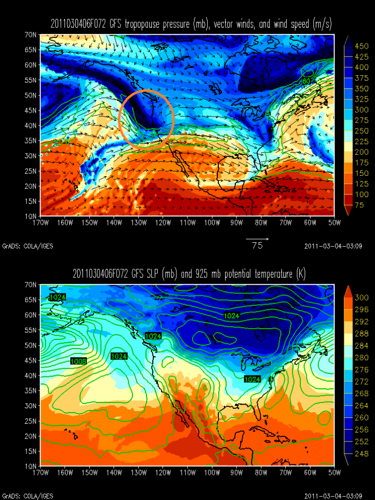
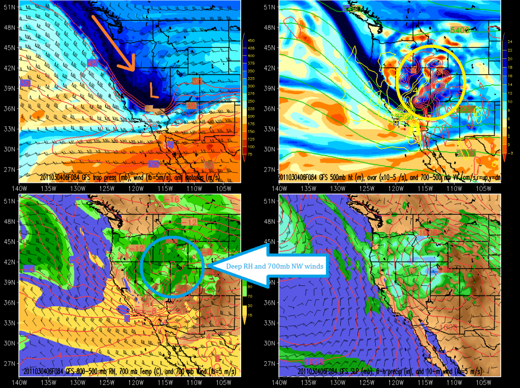
Zooming in as the storm rounds into the beehive state shows just how dead -on this will be.
In the upper left you see the track of the storm and location at the given hour. In the upper right I’ve circled the strong model predicted upward motion. Bottom left shows saturation at 700mb (wasatch elevation) and NW winds. VERY KEY.
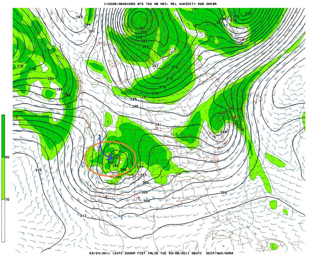
Moving on, lets look some more at the 700mb heights and moisture:
I’ve drawn in the winds in blue to underscore the fact that I think a substantial element of the forecasted heavy snow will be the result of orographic enhancement. To achieve that, we need NW winds to run smack dab ino the 3-4k vertical relief of the Wasatch and funnel up the box canyons.
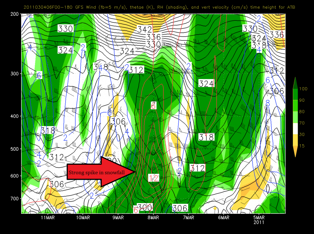
Looking at the time-height series to get a sense of the vertical motion does nothing to un-excite me.
GFS:
Red circles indicate predicted speed of upward motion. Here the max upward motion occurs with the passage of the storms cold front (look at thewind shift) and remains robust for 12 hours afterwards due to orographic lift. Awesome.
NAM:
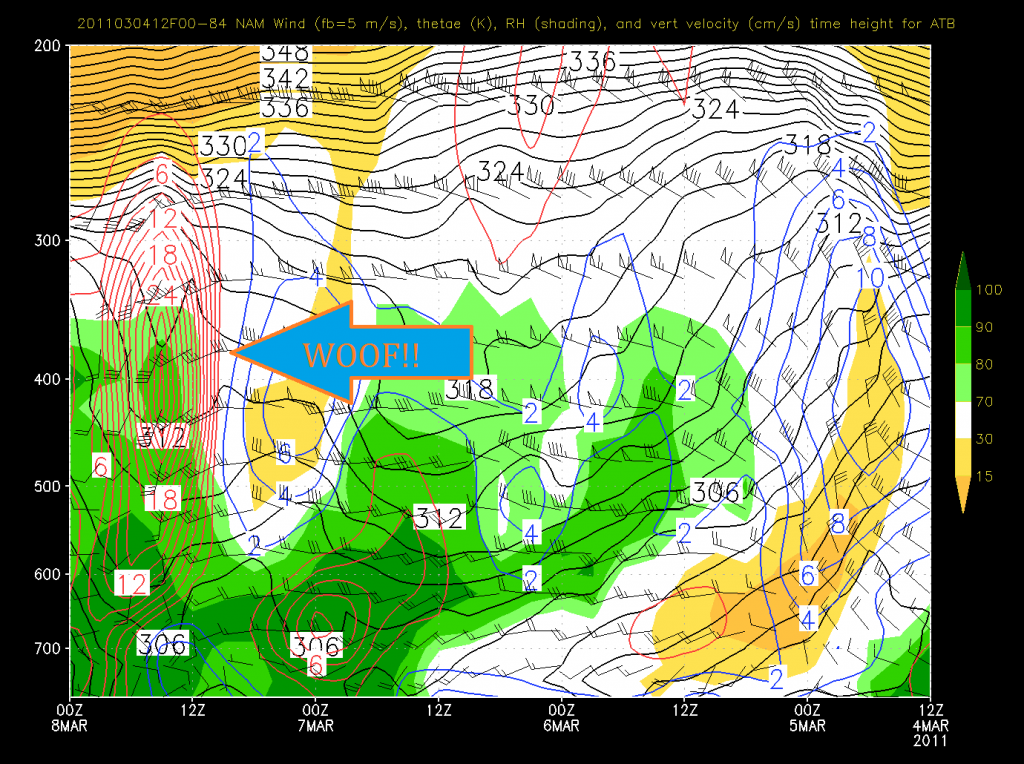
Now that’s just absurd. That much high altitude lift is not going to happen. Regardless, the NAM is clearly saying- Wax that fatties….something big is coming.
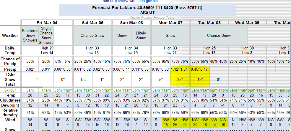
Now what does this add up too?
The NWS computer basically blew it’s load this morning answer this question:
Crazy right? Well yes. But only a little bit. Given how this storm is coming in I’d not be surprised if the high cottonwoods saw 36 inches in 24-36 hours. That’s very doable with the winds, moisture and storm track.
3 Comments
Leave a Reply
|
|||
| Home |



Porter Haney
wrote on March 4th, 2011 at 4:39 pmWOOF, wax the fatties. I love it.
The big sticks will be out in full force.
doctor_pow
wrote on March 5th, 2011 at 10:48 amSweet! I’m in town & I’ve still got one Canyons voucher left. I’m thinking Monday.
pow-pow
wrote on March 5th, 2011 at 8:14 pmis it gonna crap out…what’s goin on keeps lookin weaker and weaker