Weekend Storm: For our friends stuck down in the M.A.(Updated 2/4/10)
Look, sometimes the weather just works in strange ways. For example, by the time NBC starts its Super Bowl pre-game show (3:00 am Sunday?) Fairfax VA has a chance to eclipse Burlington, VT for yearly snowfall. Now that’s messed up! However, if you are a snow starved skier stuck down south of the Mason-Dixon line you have to thank your lucky stars and take this for what it’s worth. With the awesome TR’s i’ve been seeing which range from bushwhacking the apps to Urban DC Gnar I’ve decided you all need a good honest weather report…’cause I know down there all the mets just scream “IT’S GONNA SNOW!!!” So if you’ve stockpiled your milk, bread and eggs already then keep reading….
2/4/10 Update with shitty snowmap
The overall picture hasn’t changed that much since the first post. There has been some bouncing around of where the heavist snow will fall but not enough so that I change my thinking.
I’ve put together a classic LH ms paint crappy snowmap for you all to enjoy.
Now here’s what it means:
1. These areas, IMO at this time, are the target zone for the highest total accumulations over the next 72 hours. While areas to the south and east will see more liquid precip I belive that poor temperatures in the snow growth regions will inhibit snowfall to the south and east. I believe that these blue circles represent areas that could see 16-2o inches of snow (or more if banding sets up right) when all is said and done.
2. Areas inside two will see amts ranging from around 10-16 inches of snow. I’ll try to hone in more as we get closer but I think that’s a pretty safe and reasonable bet right now.
3. In my opinion this is the hardest to forecast. For these types of storms that move north and slide east the precip cut off is VERY sharp to the north. Like Knife edge sharp. So I’m prob. going to underdoe the precip in this region. HOWEVER- as the temperature profile at all levels of the atmosphere is more conducive to snow it is possible that these areas, while seeing less liquid equiv. precip might get as much snow according to the ruler. Overall I’m going 8-14 here. Philly…airport will measure 20. I’ll get 10. Go figure.
4. TRICKY TRICKY. Lots of moisture. Temp issues. Junk show in my opinion. I’ll get screwed here but I’ll give it an 8-14 also. Mixing might be an issue. 2/5/10 UPDATE Nix that. Going to bump area 4 up. going 10-20 here. DC looks to get slammed.
Hope Sasha and Malia have some sleds.
Well there you have it…at least until I update tomorrow am.
So here’s the deal:
– MACRO DEAL-
This year we have a three major features in play causing this MA snowmageddon.
1. NAO. Since just about thanksgiving we have seen a negative NAO predominate. For the 9,000th time this means we have lower than normal heights over the CONUS NE and higher than normal heights over Greenland. This “Greenland blocking” pattern generally locks cold air into the NE. For the NE coast to get snow we really like to see the NAO be in the negative phase as the downstream blocking in Greenland forces cold air to remain stationary as systems move out of the west and SW. Without a negative NAO the warmer air pushed ahead of these storms often results in rain for the coastal plain, SE and southern NE. So that’s +1 of the MA.
2. The AO: This has been the biggest single factor in our weather this winter. The AO has been historically negative. Since the AO correlates to the location of a polar vortex and arctic air, a negative AO leads to deep layer cold air over the CONUS. Note that it doesn’t really have a E/W correlation like the NAO does. The AO merely signals – roughly – how deep and steady of a cold air mass will be settling over the US. This year we have had incredibly sustained negative periods. Coupled with a -NAO the result has been an super strong arctic bubble of air over the NE. Basically the bubble shield you can employ in Halo 3 or the glass dome over Springfield. Shit ain’t getting in till it’s gone and everything slides around the side of the bubble. +2 for the MA as the bubble’s bottom hovers in NC/VA.
3. El Nino: We are in a moderate El Nino regime. While there is a lot of chatter on what that means for the US, I think, for the NE, the follow story is the key. An El Nino regime comes with enhanced convection/moisture in the southern parts of the Northern Hemisphere which enhances the Subtropical jet. The STJ generally slams into SO. CAL with wet air during these regimes and shoots moisture and energy across the southern 1/2 of the country. Every storm we’ve had this year has basically been born of energy which ejected from So. Cal, New Mexico or Tx.
Put all that together and the confluence of locked in cold air and juicy jet energy is the Mid-Atlantic states- specifically, VA and MD. Checkmate.
Now that you got the “Big Picture” lets take a look at the weekend system:
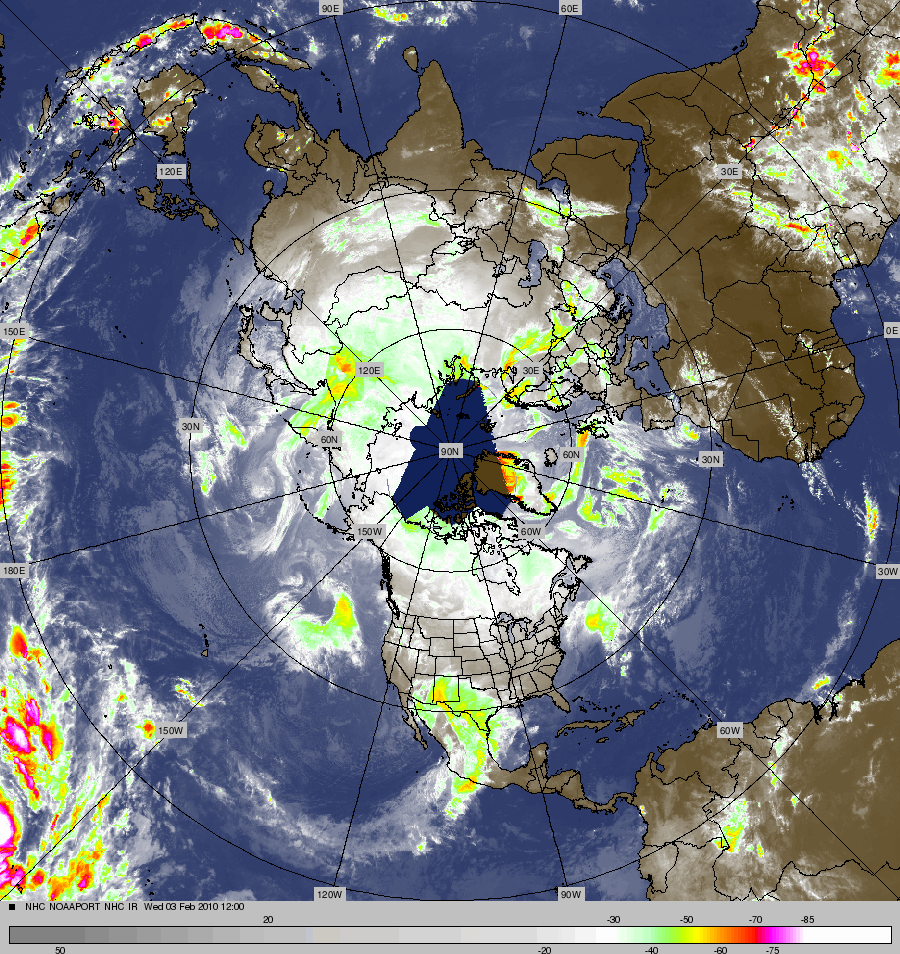
As we speak a large area of convection is developing over Texas. As you can see in this great sat. image (which I just found today so get used to seeing it a lot) the convection is developing a nice tap of subtropical moisture.
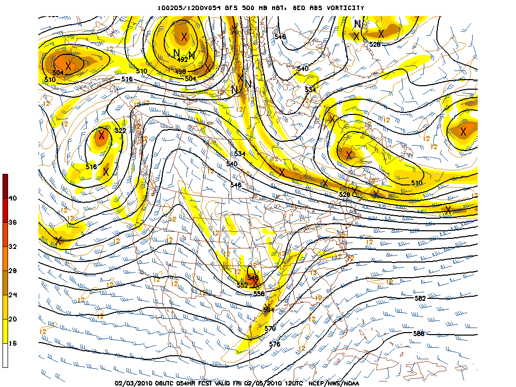
As we move into the latter half of the week, upper level energy diving out of Canada will meet up with this southern energy somewhere over the miss. river valley. The Canada energy will provide the cold air to spark a rapid intensification and cyclogensis. (This is the energy riding around the edge of the bowl).
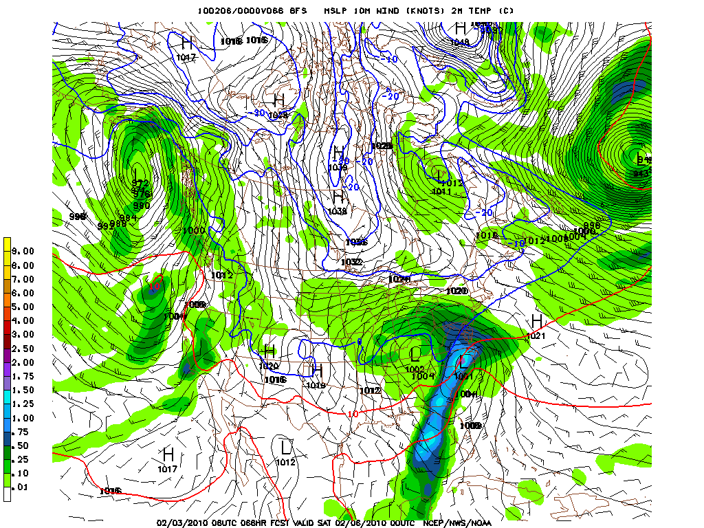
Once we reach Friday night the system will really have it’s act together.
As you can see in the GFS surface maps for Friday night the low moving out of texas has transferred energy to a surface low off the coast. As this happens deep moisture has spread north into VA and MD and the storm has begun in full force.
Overnight the storm along the coast deepens, and moderate to heavy snow continues back in MD and spreads NE into DE and SE PA. Importantly the 0c surface temp line remains south enough so that Nor. VA, most of MD and SE PA remain free of mixing issues.
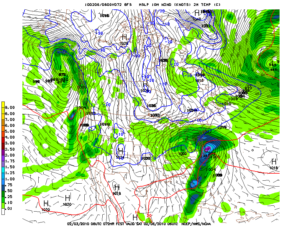
But as a word- don’t just look at the surface temp line. Look at the 850 temps too. Those show the 0c line extending more south- like to Roanoke VA. Thus given evap. cooling during snowfall and the short time the flakes have from 5k to the ground, I’d suspect this to remain all snow down to about DC.
Now by Sat. Am the storm hasn’t moved very much and moderate snow continues/redevelops in the western side…This is very common for these types of systems. Still all snow for western MD/No. VA etc…
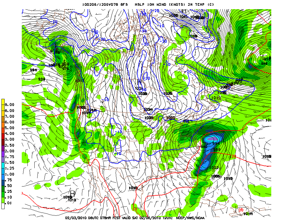
Now, normally, this far away I’d be a little more cautious with this system. However, given the “Macro” pattern above and the insane continuity of all the major models I’m pretty bullish on this system.
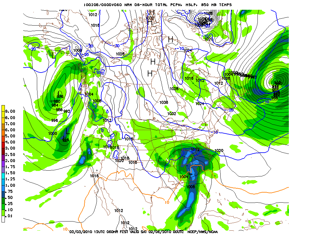
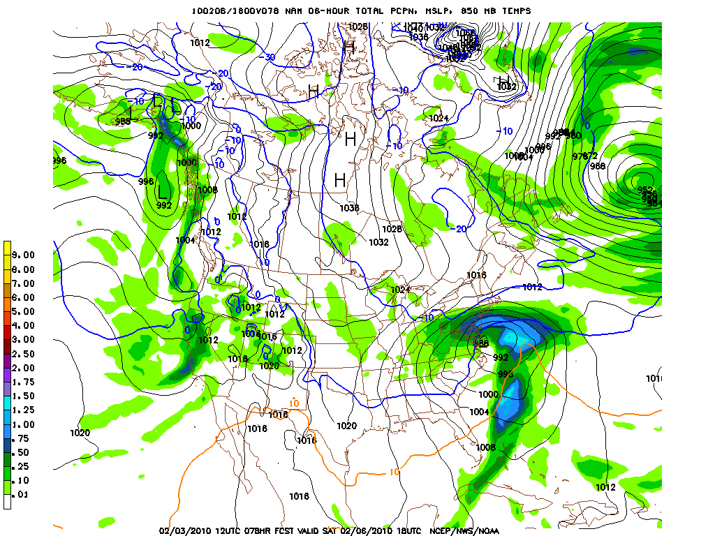
Since the NAM nailed the 12/19 system lets take a look at what it has to say:
Friday Night:
Friday overnight:
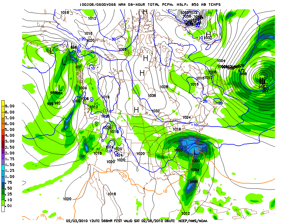
As you can see in the last two slides the NAM holds the energy back just a touch and is wetter. Since the NAM seems to have gotten the precip amts right this winter we have to lean towards it.
By Sat. AM it’s still snowing. Hard too all across the Mason-Dixon line, western MD, DE, SE. PA and Jerz.
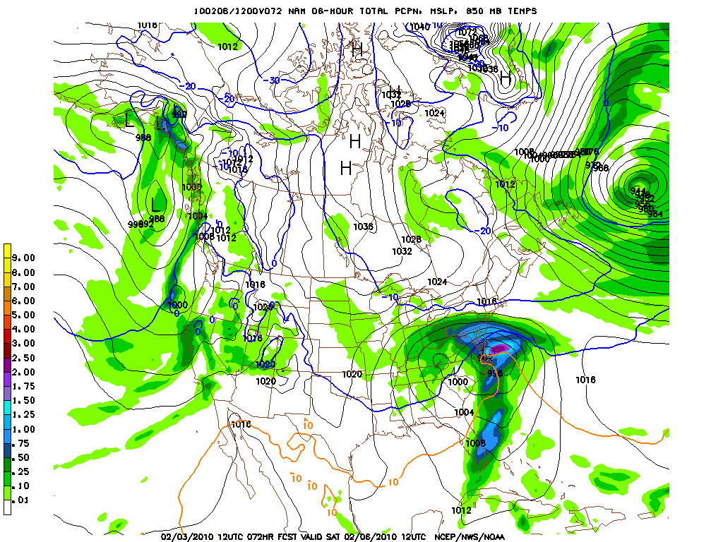
Even as we head into Sat. afternoon there is still moderate to heavy snow falling across N/E VA, MD, DE and SE. PA.
A dare even put the next slide up but I kinda have to.
This is the total QPF for the system. It’s impressive. Everything in that target zone of MD/W. VA and No. VA should fall as snow as it should in areas north of the Mason-Dixon.
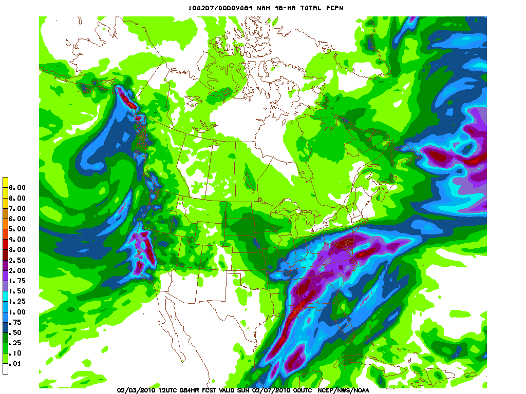
As I said before there is agreement among the major other models regarding this system. The only real difference is that the CMC takes the system a little further south. Bringing less snow to PA and more to VA. The SREF’s sort of agree with this but I’m not really sold on that solution. A lot of moisture streaming in from the south tends to nudge systems a little north and spread precip a little north. Plus the air north just isn’t that dry so we can get the precip to extend a little bit.
Regardless is semantics. Both show substantial snowfall for the MidAtlantic region with the above mentioned target zone being under the gun for a solid 12-20 inches of snow.
6 Comments
Leave a Reply
|
|||
| Home |


powhounddd
wrote on February 3rd, 2010 at 3:43 pmThat is pretty gnarly weather for those who live down there – as much as I wish we were gonna see 12-20 inches up in the north, I am stoked for all the groms, moms, and snow-lovers of all kinds who live down there and rarely get such a killer winter. I am sure all kinds of neat lines will be shredded this winter.
BTW, Mr. Hutz, where are you scoping the TRs of bushwhacks and whatnot mentioned above?
Brownman
wrote on February 3rd, 2010 at 8:15 pm…sooo… as long as the streams and catch basins hold out, the Northeast needs to pray the snowmaking equipment doesn’t breaks down… is that what you’re saying? The maintenance bills on these groomers must be getting huge!
Im_a_crappy_skier
wrote on February 4th, 2010 at 10:32 amI am doing my thingy dance!!! Lottsa love for the poke-n-oes plszzzzz! (i.e., dancing for that “nudge” north)
Dave
wrote on February 5th, 2010 at 8:06 amMaryland = MD, MA=Massachusetts :)
Lionel Hutz
wrote on February 5th, 2010 at 9:12 amA) My forecast, my abbreviations.
B) M.A. = Mid Atlantic.
Mike
wrote on February 7th, 2010 at 1:45 pmThanks for the snow band tips Lionel Hutz, helped with an excellent decision to stay south for the storm and end up at Roundtop with 20″+. Best PA ski day i’ve ever had.