So since I firmly believe we will have an active, wacky, up and down winter, I’m starting a new series called “WTF WEATHER?” I believe its safe to assume we all know what WTF means…”White Truffle Fondue”….right? Or is that just me? No really..it means what you think it means. The series will pretty much launch anytime I suspect many of you are sitting there thinking “WTF is going on with this weather and when the heck is winter/snow/sun/rainbows and unicorns coming back.” In these posts I’ll try to answer what’s going on and when it’s changing.
So if you live on the east coast I suspect you are thinking…what the hell? Why is it so warm? For example when I woke up at 5:30 this morning it was 71 degrees at PHL. This would be warm and uncomfortable in July (well not last July). So what gives? Wasn’t it a few days ago when there were frost warnings all over the place?
Well whats going on is pretty simple:

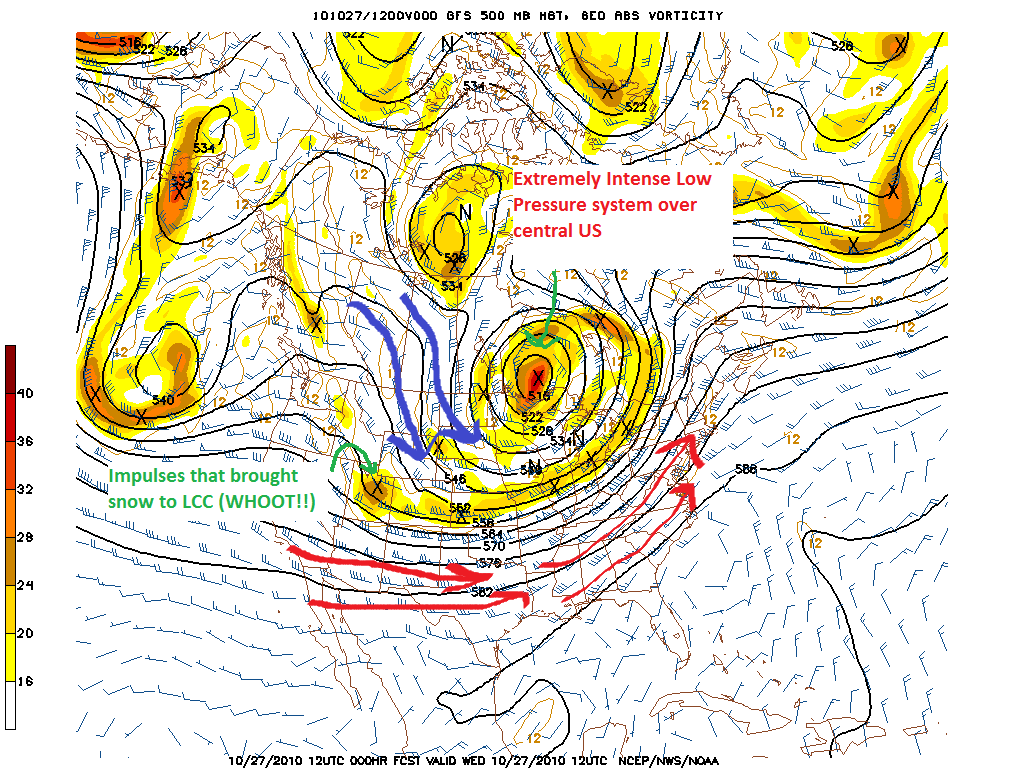
As you can see there currently is an extremely intense low pressure system centered over the Northern Plains. In swing seasons these massive storms are quite common but rarely do they get this intense. Central pressure was rated at Hurricane force. Accordingly, it is also a major factor in our wx pattern.
I’ve highlighted the the air circulating around this large low pressure system. Blue arrows represent cold northernly the flow around the western side of the low while the red represents the warm flow around the eastern side of the low.
This flow moves air in the flow direction-advection is the term. So the warm flow causes warm air to advect into the Northeast. Following the lines leads us to the source region for this air- the south. Last I checked it’s pretty warm and humid in the south. So that’s WTF up with this warm air.
Now the next question is when is this going to change?
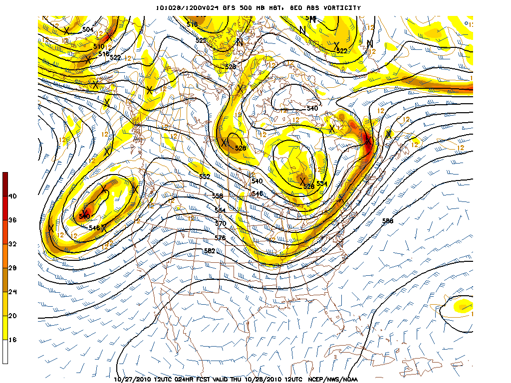
Well, the system seems like it is destined to occlude and die within the next 36 hours as it moves NE through Canada. However it will still influence atm and it will push a mild trough into the NE starting thursday.
By Thrusday AM the front will be well defined with the trailing upper level closed low to the NW.

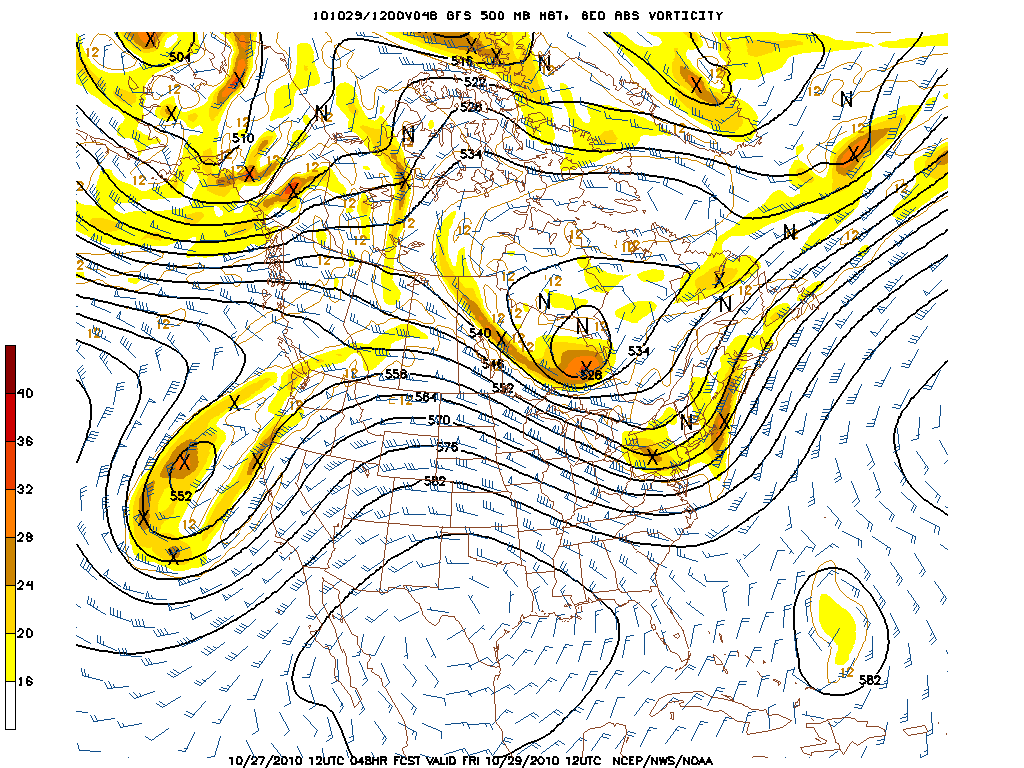
After this pushes through the upper level trough will build in.

Noticable in this image a few ripples of energy that will ride along the trough through the period. Given the temperatures these ripples will likely set off a few rounds of snow showers across the higher terrain of the ADK, Greens and Whites. The best dynamics and moisture look to be saturday night. Don’t expect too much accumulation but nevertheless I do expect some snow to fall from the sky.
4 Comments
Leave a Reply
|
|||
| Home |


Porter Haney
wrote on October 27th, 2010 at 3:31 pmL_H, how’s the weekend storms looking for the Wasatch? You going to send me a Halloween present?
Lovin’ the MS Paint weather maps.
Ben
wrote on October 27th, 2010 at 4:33 pmmmm flurries.
so much better than the past day or two!
icelanticskier
wrote on October 28th, 2010 at 8:08 am74 is predicted high in newmarket today. nice day to ride the bike to work in shorts. skiing the WROD and WSOD followed by summer cycling. new england does not suck.
rog
Keith
wrote on November 16th, 2010 at 2:38 pmWhy isn’t this gonna be snow!! WTF AJ!!!! O, yeah and don not think the Gaints are gonna make the dog fighter look good this weekend!!!